

A Quick Peak Into The North/Central Alabama Weather Situation At 3:30PM
RADAR CHECK
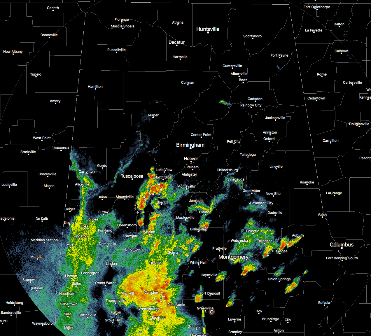
At this time, the main activity is located over the southern half of Central Alabama, with showers and storms pushing to the northeast at around 30-35 MPH. Storms have now made it up as far north as portions of Tuscaloosa, Bibb, and Shelby counties, and will soon be making their way into Jefferson county. No severe storms out there at this point, but there are a few strong cells out there with plenty of lightning, some gusty winds, and some small hail possible.
SIGNIFICANT WEATHER ADVISORY FOR EASTERN CHILTON COUNTY UNTIL 4:00PM
At 333 PM CDT, local law enforcement reported a strong thunderstorm near Clanton, moving northeast at 40 mph. Half inch hail and winds in excess of 40 mph will be possible with this storm. Locations in the path include Clanton, Lay Lake Dam and Cooper.
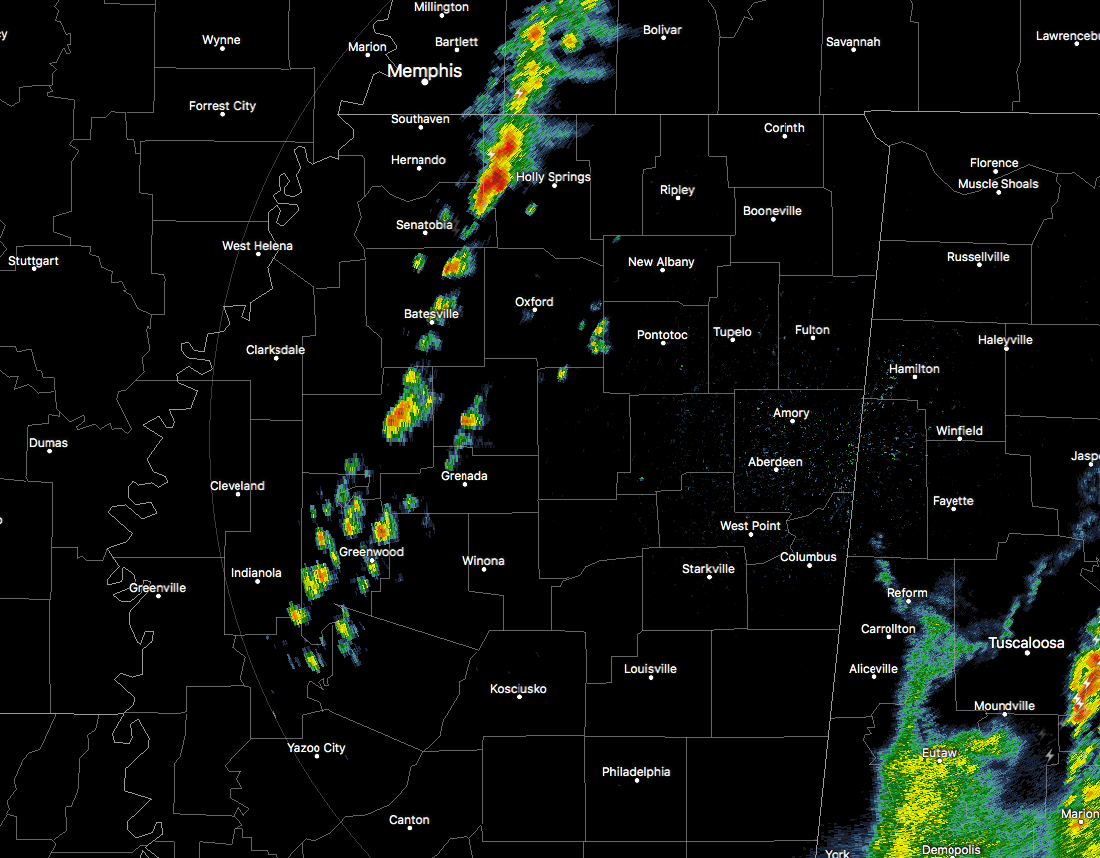
Back to our west, a line of showers and storms are pushing through the northwestern parts of Mississippi with the associated cold front. This is where the most likely threat for strong to severe storms will come from for areas mainly north of the I-20 and west of I-59. Nothing severe with this line, and the thinking is that there is enough shear but weaker than first modeled, and helicity values in the 75-150 m/s range would support strong to severe thunderstorm development. Main threat would be from wind gusts up to 60 MPH, with a much lesser threat of hail.
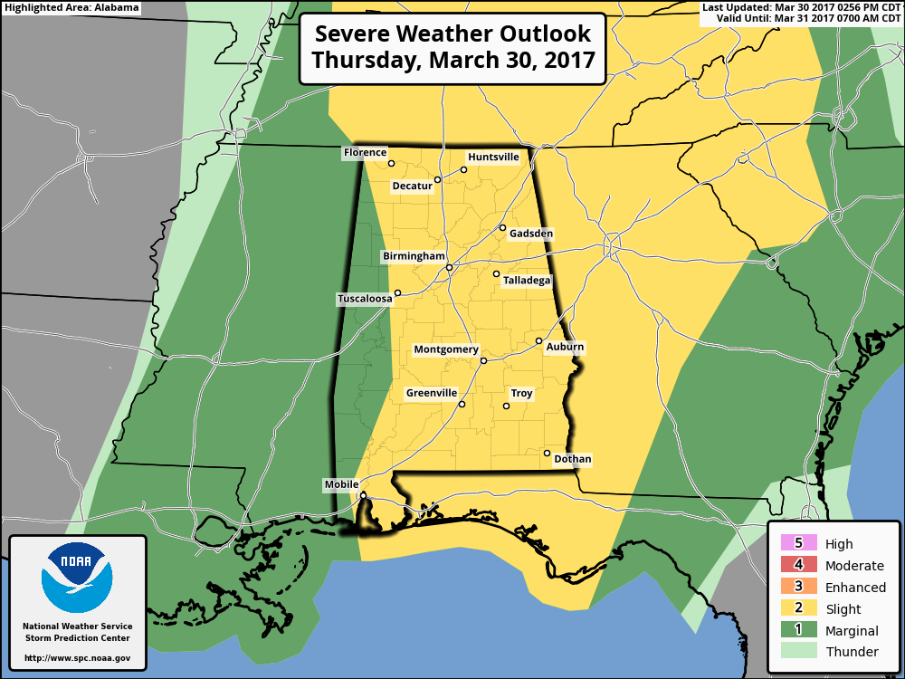
LATEST FROM SPC
The Storm Prediction Center has once again trimmed a little more off of the western edge of the slight risk area for the remainder of today and into the evening and overnight areas. Locations to the west of a line from Waterloo to Winfield to Coker to Greensboro are in a marginal risk, with the rest of the state in a slight risk for severe storms.
TIMING
Storms, of course, are in progress over the southern half of the state right now. For North Alabama, the line of storms will enter the state around 4:30-5:30PM, then progressing slowly eastward. The storms should be over by 2:00AM. The main chance of stronger storms for places like Tuscaloosa, Birmingham, Anniston, and Gadsden will come from about 7:00PM until 10:00PM.
Category: ALL POSTS, Severe Weather
About the Author (Author Profile)
Scott Martin is an operational meteorologist, professional graphic artist, musician, husband, and father. Not only is Scott a member of the National Weather Association, but he is also the Central Alabama Chapter of the NWA president. Scott is also the co-founder of Racecast Weather, which provides forecasts for many racing series across the USA. He also supplies forecasts for the BassMaster Elite Series events including the BassMaster Classic.Subscribe
If you enjoyed this article, subscribe to receive more just like it.


