

Strong Storms Affecting Parts of Talladega, Calhoun, Cleburne, & Clay Counties
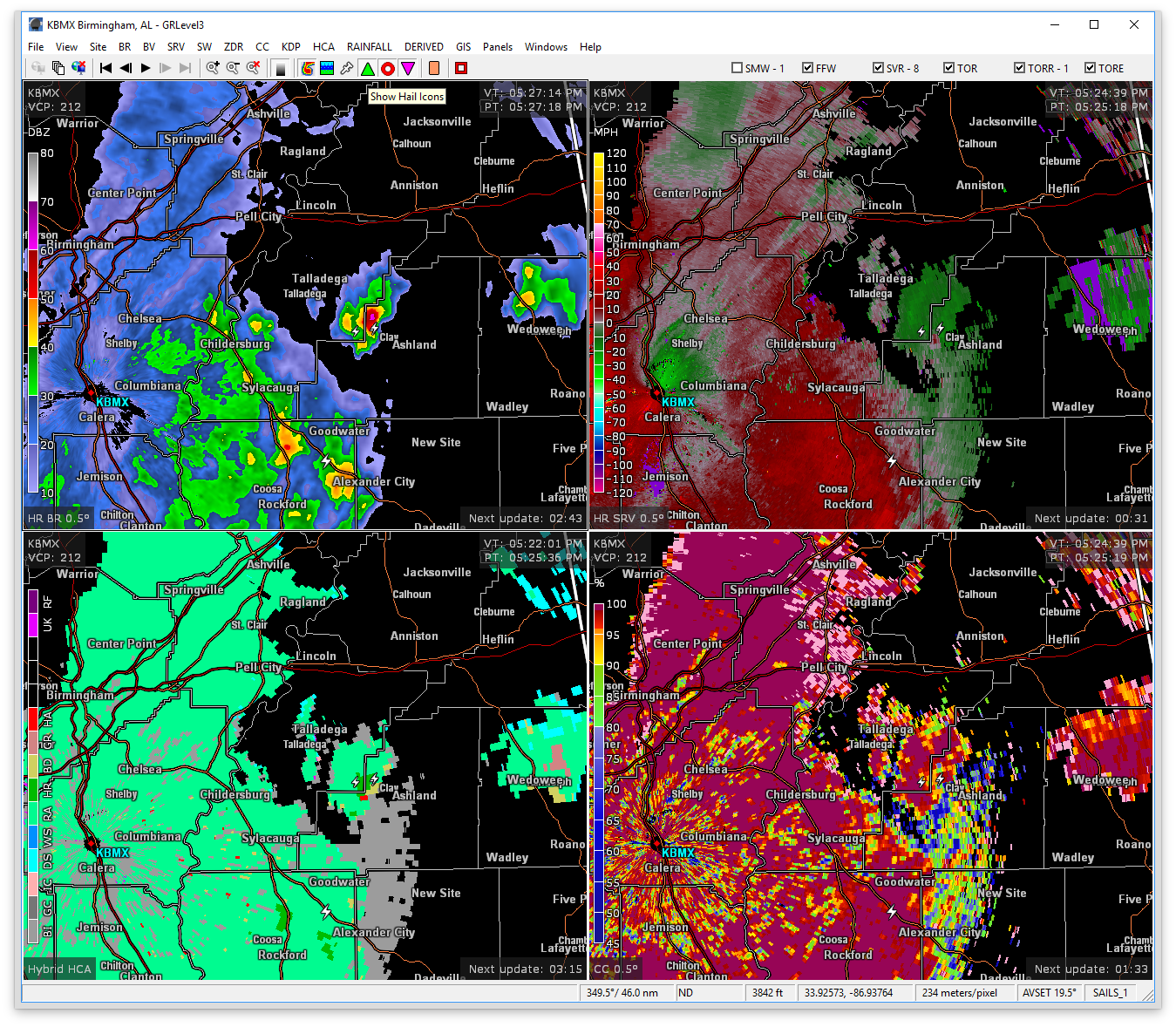
At 524 PM CDT, Doppler radar was tracking a strong thunderstorm near Waldo, or 8 miles west of Ashland, moving northeast at 35 mph. Dime size hail and wind gusts up to 50 mph will be possible with this storm.
Therefore NWS Birmingham has issued a Significant Weather Advisory until 6:30PM for parts of Talladega, Calhoun, Cleburne, and Clay counties.
Locations impacted include…
Anniston, Oxford, Jacksonville, Heflin, Cobb Town, West End-Cobb Town, Fort McClellan, Saks, Weaver, Munford, Hobson City, Waldo, Edwardsville, Anniston Regional Airport, Blue Mountain, Jacksonville State University, Grant Town, Oxford Lake, Mount Cheaha and Choccolocco.
Category: ALL POSTS, Severe Weather
About the Author (Author Profile)
Scott Martin is an operational meteorologist, professional graphic artist, musician, husband, and father. Not only is Scott a member of the National Weather Association, but he is also the Central Alabama Chapter of the NWA president. Scott is also the co-founder of Racecast Weather, which provides forecasts for many racing series across the USA. He also supplies forecasts for the BassMaster Elite Series events including the BassMaster Classic.Subscribe
If you enjoyed this article, subscribe to receive more just like it.


