

SPC Expands Moderate Risk To Include The Birmingham Metropolitan Area
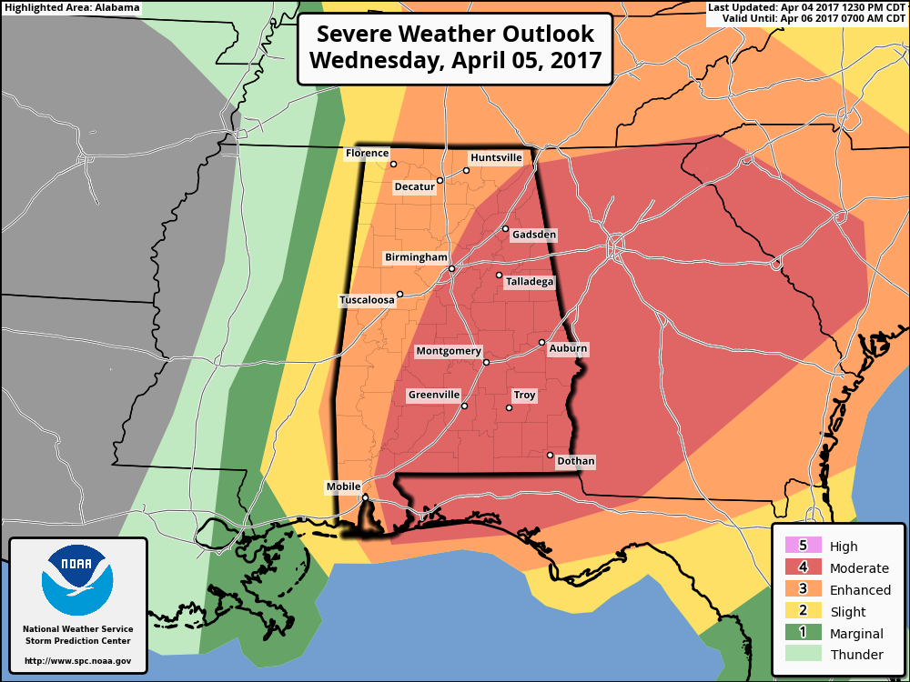
The day 2 outlook from the Storm Prediction Center has just been released, and as you can see by the graphic, the moderate risk for severe storms has been expanded to the west. It now includes all locations along and east of the I-59 corridor north of I-65, along with the Birmingham Metropolitan Area, and locations east of a line from Brent to Marion to just east of Thomasville. Most of the rest of the state is still in an enhanced risk, with the exception of a small sliver of the northwestern part of the state.
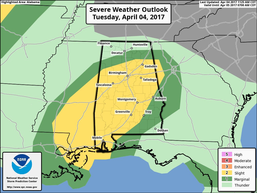
As far as the day 1 outlook which would include the overnight tonight until the 7AM tomorrow time frame, still is pretty much the same, with much of Central Alabama in a slight risk for severe storms. These storms will develop sometime after the 3AM hour and will quickly multiply across the area during the early and mid morning hours.
These graphics from the SPC coincide with each other, as the day 2 takes over when the day 1 expires at 7AM on Wednesday. Be sure to have your smartphone charged and fresh batteries in your flash lights, radios, and your NOAA Weather Radio. Know where your safe place is in your home, and be sure everyone know where it is. Already have helmets and hard sole shoes in there for everyone, and have a portable airhorn in case you need help.
Category: Alabama's Weather, ALL POSTS
About the Author (Author Profile)
Scott Martin is an operational meteorologist, professional graphic artist, musician, husband, and father. Not only is Scott a member of the National Weather Association, but he is also the Central Alabama Chapter of the NWA president. Scott is also the co-founder of Racecast Weather, which provides forecasts for many racing series across the USA. He also supplies forecasts for the BassMaster Elite Series events including the BassMaster Classic.Subscribe
If you enjoyed this article, subscribe to receive more just like it.


