

A Quick Radar Check Of North/Central Alabama at 2:45PM
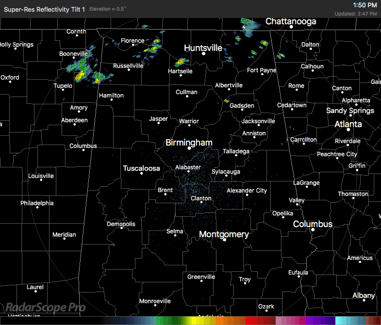
All of the shower activity is currently located in the northern counties of the state and continuing to push off to the northeast. One nice cluster of showers is currently located over portions of Franklin, Colbert, and Lauderdale counties. A few more stray showers are over in the eastern parts of the state, in Marshall and Dekalb counties. Nothing strong out there across Alabama, just some much needed rain.
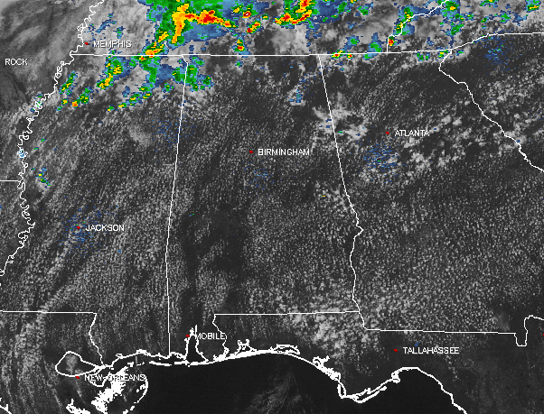
Most of the shower and thunderstorm activity has stayed pretty much in Tennessee today, especially along a surface boundary stretching from the northeastern part to the state back to the southwest and into Northern Mississippi. The northwest corner of Alabama will be the most likely place for any shower and storm activity throughout the remainder of the afternoon.
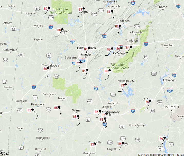
It is really warm out there as well, with temperatures ranging throughout the 80s today. The warm spot is currently Eufaula at 89 degrees, with the cool spot being Albertville at 81 degrees.
Category: Alabama's Weather, ALL POSTS
About the Author (Author Profile)
Scott Martin is an operational meteorologist, professional graphic artist, musician, husband, and father. Not only is Scott a member of the National Weather Association, but he is also the Central Alabama Chapter of the NWA president. Scott is also the co-founder of Racecast Weather, which provides forecasts for many racing series across the USA. He also supplies forecasts for the BassMaster Elite Series events including the BassMaster Classic.Subscribe
If you enjoyed this article, subscribe to receive more just like it.


