

Potentially Tornadic Storm in Northeast Mississippi
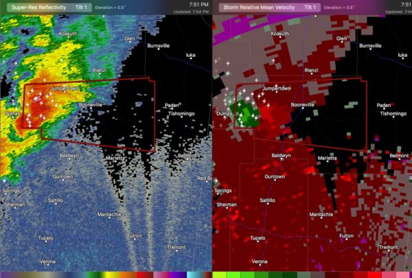
We are watching a severe thunderstorm north of Tupelo tonight and shows radar indications of producing a possible tornado.
The storm is just west of Booneville MS in Prentiss County.
It is moving ESE and will pass near or just south of Booneville between 8-820 p.m.
If it holds together, it may threaten Franklin or Colbert Counties in Alabama between 9 and 9:30 p.m.
Category: ALL POSTS, Severe Weather
About the Author (Author Profile)
Bill Murray is the President of The Weather Factory. He is the site's official weather historian and a weekend forecaster. He also anchors the site's severe weather coverage. Bill Murray is the proud holder of National Weather Association Digital Seal #0001 @wxhistorianSubscribe
If you enjoyed this article, subscribe to receive more just like it.


