

Tornado Will Reach Western Colbert or Franklin Counties by 3:15 p.m.
UPDATE AT 256 PM
NWS Memphis has upgraded the tornado warning with a TORNADO OBSERVED tag. Tornado is near Burton. It is moving more east than northeast. It will reach northwestern Franklin and southwestern Colbert County around 315 p.m. Be in safe shelter in western Colbert and Franklin Counties well before this VERY dangerous storm arrives. Leave mobile homes NOW for safer structures!!!
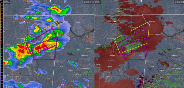
UPDATE 252 PM
Tornado on the ground near Thrasher in Prentiss County MS!!
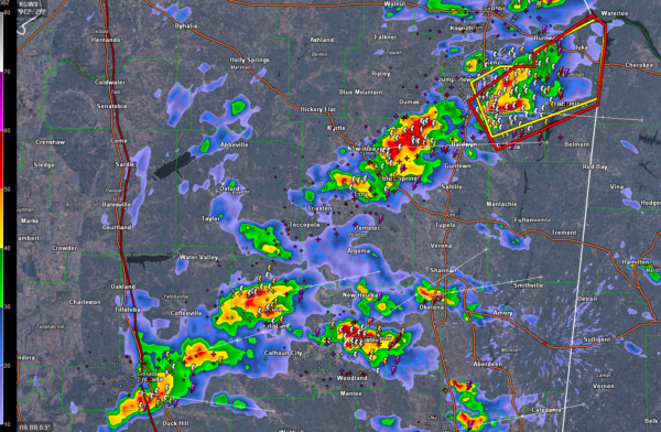
UPDATE 245PM
A severe thunderstorm warning was just issued for Chickasaw, Itawamba, Le and Monroe Counties in NE Mississippi. Severe storm near Houston will move near Okolona. This storm may eventually affect Marion County.
ORIGINAL POST
Our line of storms has developed and intensified as advertised over Mississippi.
At 2:45 p.m., a strong storm was over Booneville MS in Prentiss County. A severe thunderstorm warning was just issued for Prentiss and Tishomingo Counties. That storms is organized and isolated and taking on supercellular characteristics.
That storm just got a tornado warning. It is turning right and will impact Colbert and/or Franklin County by 3:15-3:30.
Other strong storms were near New Albany, Houston and north of Yazoo City.
Other storms are increasing to the northwest of Columbus MS.
Storms should be into Marion and Lamar Counties within the hour as well.
Category: ALL POSTS, Severe Weather
About the Author (Author Profile)
Bill Murray is the President of The Weather Factory. He is the site's official weather historian and a weekend forecaster. He also anchors the site's severe weather coverage. Bill Murray is the proud holder of National Weather Association Digital Seal #0001 @wxhistorianSubscribe
If you enjoyed this article, subscribe to receive more just like it.


