

Heads Up Winston County, Walker County
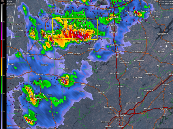
The storm riding the Lawrence/Winston County line is very organized and shows rotation. It has a hook echo as well.
It definitely has hail in it, over the line in Lawrence County. That hail could be 1 inch in diameter.
In fact, the MEHS algorithm is outputting hail potential between 1.75 and 2 inches.
A severe thunderstorm warning is in effect for Lawrence County, but several of the storms have exhibited right turning tendencies today and this storm will skirt the county line moving toward Grayson.
Damaging wind and hail are possible and we can’t rule out a tornado.
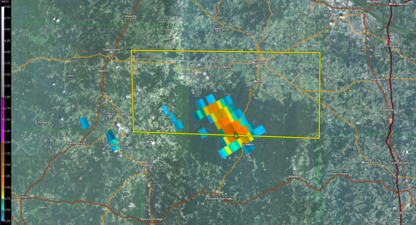
WALKER COUNTY
A strong storm is near Carbon Hill. It is moving east at 25 mph. Hail is likely, possibly to one inch, as well as strong gusty winds, torrential rains and deadly lightning.
BE IN SAFE SHELTER AS THESE DANGEROUS STORMS APPROACH
Category: ALL POSTS, Archived Warnings
About the Author (Author Profile)
Bill Murray is the President of The Weather Factory. He is the site's official weather historian and a weekend forecaster. He also anchors the site's severe weather coverage. Bill Murray is the proud holder of National Weather Association Digital Seal #0001 @wxhistorianSubscribe
If you enjoyed this article, subscribe to receive more just like it.


