

Tornado Warning Canceled For Parts Of Pickens County
…THE TORNADO WARNING FOR EAST CENTRAL PICKENS COUNTY IS CANCELLED… The storm which prompted the warning has weakened below severe limits, and no longer appears capable of producing a tornado. Therefore the warning has been cancelled. A severe thunderstorm watch remains in effect until 500 AM CDT for west central Alabama.
Tornado Warning Continues For Parts Of Pickens County Until 12:45AM
Apr 27th @ 12:07 am
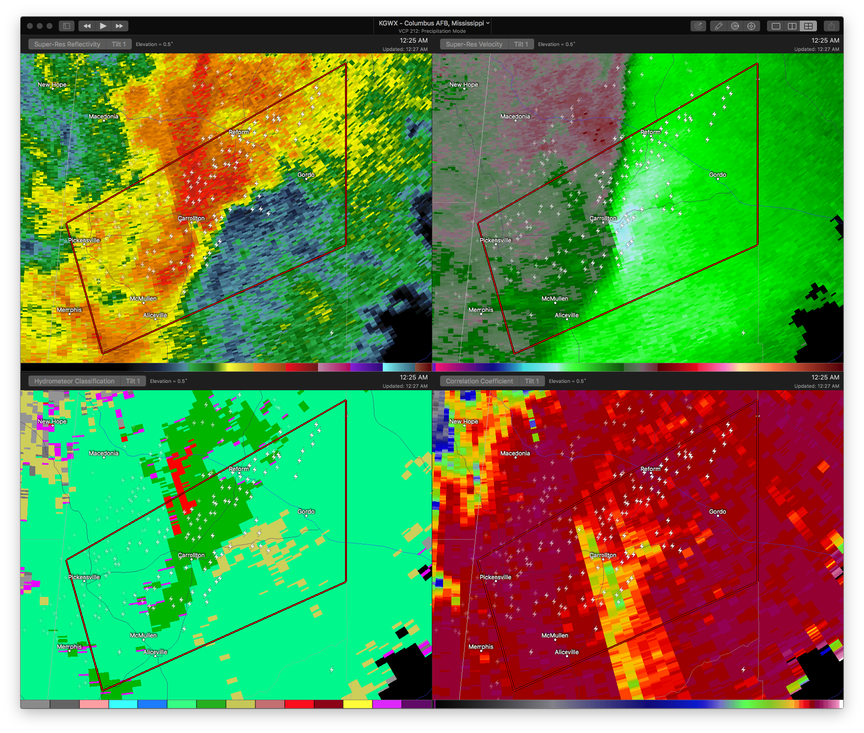

…A TORNADO WARNING REMAINS IN EFFECT UNTIL 1245 AM CDT FOR EAST CENTRAL PICKENS COUNTY… At 1227 AM CDT, a severe thunderstorm capable of producing a tornado was located over Carrollton, moving northeast at 45 mph.
HAZARD…Tornado.
SOURCE…Radar indicated rotation.
IMPACT…Flying debris will be dangerous to those caught without shelter. Mobile homes will be damaged or destroyed. Damage to roofs, windows, and vehicles will occur. Tree damage is likely. Locations impacted include… Gordo, Reform, Carrollton, Owens, Kirk, Dillburg and Lubbub.
Tornado Warning Issued For Parts Of Pickens County Until 12:45AM
Apr 27th @ 12:07 am
UPDATE 1224
Dangerous storm near Carrollton is moving northeast toward Gordo and Reform. Tornado warning continues for Pickens County.
Be in safe shelter from Carrollton to Gordo and Reform.
UPDATE 1217
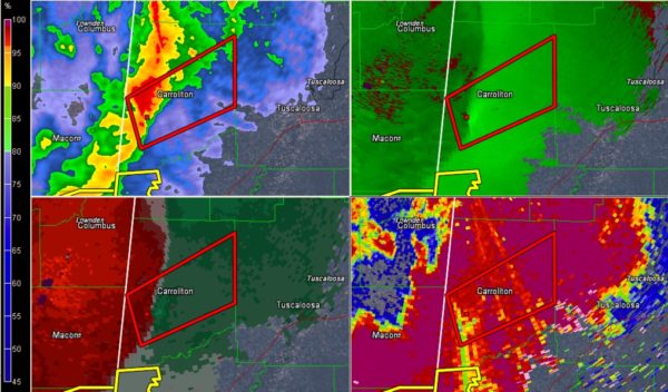
At 12:13, there appeared to be a brief tornado debris signature wit the storm approaching Carrollton.
Be in safe shelter now in the warning in Pickens County.
There is a very suspicious looking signature in Pickens County between Memphis and Pickensville and moving toward Carrollton.
Could be possible tornado.
Be in safe shelter now up towards Carrollton!!

The National Weather Service in Birmingham has issued a
* Tornado Warning for…
Central Pickens County in west central Alabama…
* Until 1245 AM CDT
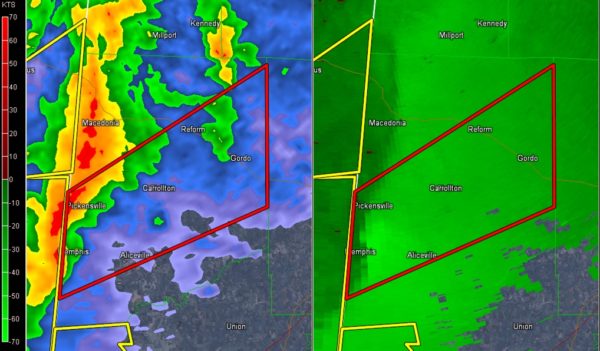
* At 1207 AM CDT, a severe thunderstorm capable of producing a tornado was located near Bevill Lock And Dam, or near Pickensville, moving northeast at 45 mph.
HAZARD…Tornado.
SOURCE…Radar indicated rotation.
IMPACT…Flying debris will be dangerous to those caught without shelter. Mobile homes will be damaged or destroyed.
Damage to roofs, windows, and vehicles will occur. Tree damage is likely.
* Locations impacted include…
Aliceville, Gordo, Reform, Carrollton, Pickensville, McMullen, Garden, Bevill Lock And Dam, Gainesville Lake Boat Ramp And
Campground, Dillburg, North Pickens Airport, George Downer Airport, Owens, Kirk and Lubbub.
Category: ALL POSTS, Archived Warnings
About the Author (Author Profile)
Subscribe
If you enjoyed this article, subscribe to receive more just like it.


