

Strong Storm Affecting Franklin & Lawrence Counties
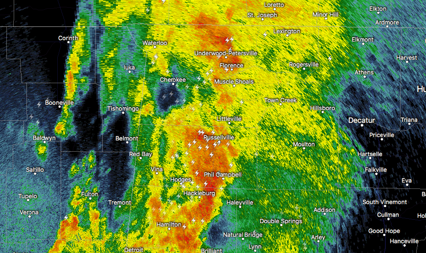
At 1237 AM CDT, Doppler radar was tracking a strong thunderstorm near Hackleburg, or 9 miles west of Haleyville, moving northeast at 80 mph. Wind gusts up to 50 mph and frequent lightning will be possible with this storm.
Therefore a SIGNIFICANT WEATHER ADVISORY has been issued for eastern Franklin and southwestern Lawrence counties until 1:15 AM CDT.
Locations impacted include…
Russellville, Phil Campbell, Mt Hope, Tharptown, Duketon, Rockwood, Landersville, Newburg, Pleasant Ridge and Isbell.
Frequent cloud to ground lightning is occurring with this storm. Lightning can strike several miles away from a thunderstorm. Seek a safe shelter inside a building or vehicle.
Category: ALL POSTS, Archived Warnings
About the Author (Author Profile)
Scott Martin is an operational meteorologist, professional graphic artist, musician, husband, and father. Not only is Scott a member of the National Weather Association, but he is also the Central Alabama Chapter of the NWA president. Scott is also the co-founder of Racecast Weather, which provides forecasts for many racing series across the USA. He also supplies forecasts for the BassMaster Elite Series events including the BassMaster Classic.Subscribe
If you enjoyed this article, subscribe to receive more just like it.


