

Quite Warm Already At This “A Little Bit Later Than Midday” Update
MIDDAY CHECK ON CENTRAL ALABAMA’S WEATHER
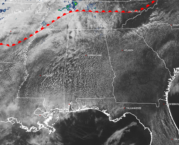
It’s a mix of sun and clouds in the skies across Central Alabama at this “A Little Bit Later Than Noon” update, with most of the area dry at the moment. There is a small area of precipitation showing on radar in Chilton County, but not sure if it is even reaching the ground. If it is, it is very light in nature and very brief, as it moves quickly to the northeast.
Throughout the rest of the day, skies will remain partly to mostly cloudy, and there is a small risk for a few isolated afternoon showers and storms to develop with the heating of the day. Temperatures will be pretty warm out there today, with afternoon highs reaching the mid to upper 80s across Central Alabama, with a few southern locations in the area possibly touching 90 degrees. The odds of any one location in the area receiving any rain is around 1 in 10.
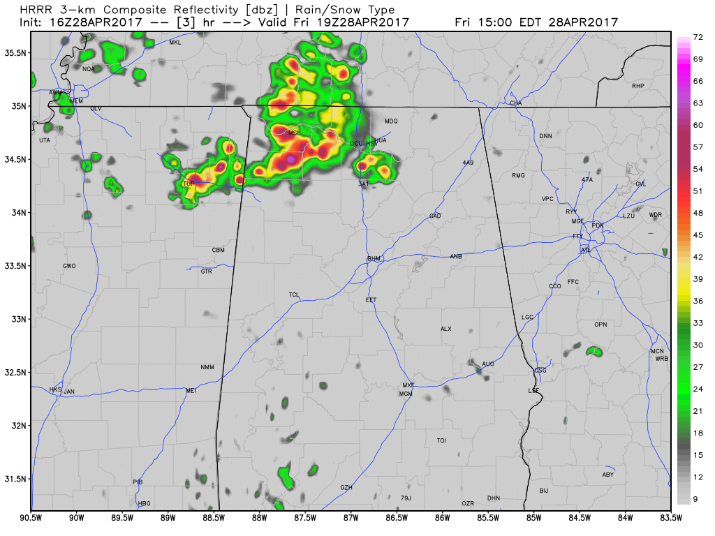
We will have to mention that in the northwestern parts of the state, the latest HRRR is showing a mass of showers and storms developing this afternoon, and these could affect the northwestern locations in Central Alabama, especially portions of Marion and Winston counties. These storms could become strong and may become locally severe as they move off to the northeast into Tennessee. NWS Huntsville is hinting on their chat that conditions may be conducive for supercell development, with damaging winds and large hail as the main threats. We’ll keep an eye on that and give updates if needed.
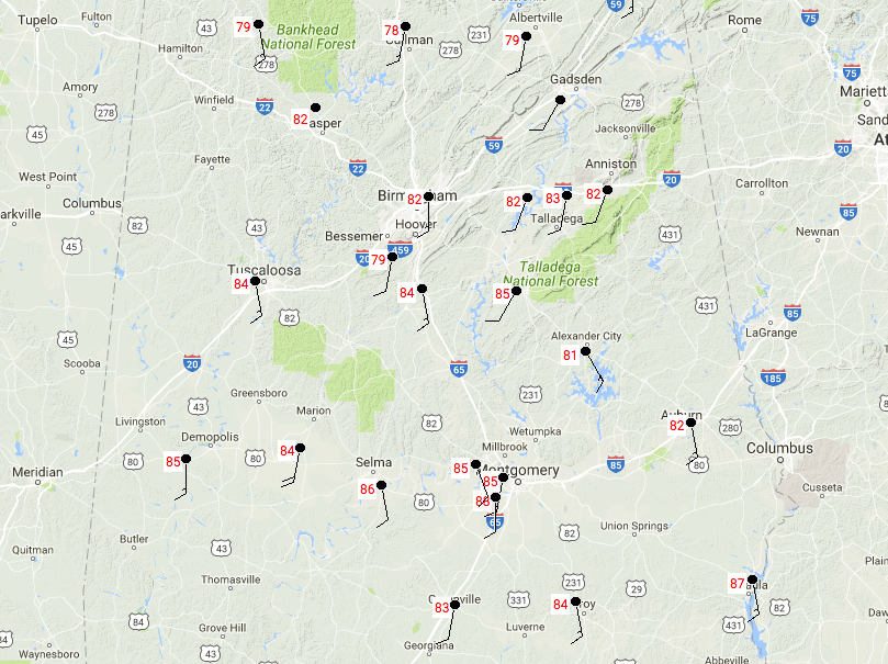
TEMPERATURES AT 12:50PM
Temperatures are mainly in the 80s at this point on the last Friday of April, with a few locations in the northern parts of the area in the upper 70s. The warm spot is currently Eufaula at 87 degrees, while the cool spot is Cullman at 78 degrees.
IS SATURDAY A REPEAT OF TODAY?
The answer to that questions is yes, but maybe a few degrees warmer. With moisture levels being a little higher tomorrow, we will have a little better chance of widely scattered showers and storms. Once again, most will stay dry, but the odds of any one location receiving rain will be around 1 in 5. Otherwise, a mix of sun and clouds in the sky, and afternoon highs will be in the upper 80s to the lower 90s.
If you would like to see what the weather holds for Ft. Morgan over to Panama City Beach, click here to see the Beach Forecast Center page. Save Up To 25% on Spring Break Beach Vacations on the Alabama Gulf Coast with Brett/Robinson! The Beach Forecast is partially underwritten by the support of Brett/Robinson Vacation Rentals in Gulf Shores and Orange Beach. Click here to see Brett/Robinson’s best beach offers now!
ON THIS DAY IN WEATHER HISTORY – April 28, 1990
Thunderstorms produced severe weather in the southeastern U.S. during the day. Severe thunderstorms spawned four tornadoes, including one which injured four persons at Inman SC. There were also more than one hundred reports of large hail and damaging winds, with better than half of those reports in Georgia. Strong thunderstorm winds injured four people at Sadler’s Creek SC. Also, twenty-nine cities in the northeastern U.S. reported record high temperatures for the date as readings soared into the 80s and lower 90s. Highs of 88 degrees at Binghamton NY, 94 degrees at Buffalo NY, 89 degrees at Erie PA, 90 degrees at Newark NJ, 93 degrees at Rochester NY and 92 degrees at Syracuse NY, were records for the month of April.
Category: Alabama's Weather, ALL POSTS
About the Author (Author Profile)
Scott Martin is an operational meteorologist, professional graphic artist, musician, husband, and father. Not only is Scott a member of the National Weather Association, but he is also the Central Alabama Chapter of the NWA president. Scott is also the co-founder of Racecast Weather, which provides forecasts for many racing series across the USA. He also supplies forecasts for the BassMaster Elite Series events including the BassMaster Classic.Subscribe
If you enjoyed this article, subscribe to receive more just like it.


