

It Ain’t Over ‘Til It’s Over
So said Yogi Berra.
All day long, the HRRR model has seemed out to lunch. It has been late with the storms’ arrival and all over the board. It predicted that storms would form over Mississippi and move into Alabama during the early evening. When it didn’t look like that was going to happen, we began to think, “HRRR, go home, you’re drunk.”
But now it might be getting vindicated.
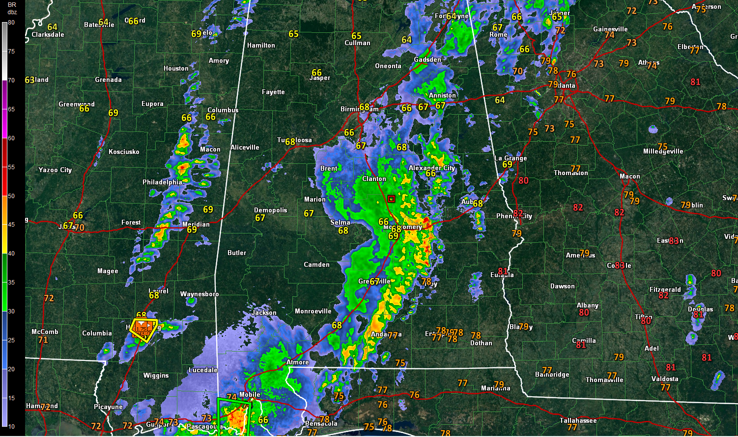
Showers and storms are forming over eastern Mississippi tonight. The storm over Hattiesburg has gone severe. It will be tracking up I-59 toward Meridian. Golfball sized hail was just reported with it. This storm could eventually affect Sumter County in West Alabama.
There is lots of lightning now from south of Starkville to rest of Shuqualak.
The storms in Oktibbeha, Winston and Noxubee Counties will be into Lamar and Marion, Lamar, Pickens and Sumter Counties before 930 p.m.
Some showers are forming over Tuscaloosa and Fayette Counties as well.
Three factors are helping the storms. The front is along I-55 in Mississippi and it has strong forcing associated with it.
The airmass over Mississippi had a chance to recover slightly this afternoon. CAPE values are between 500-1,000 joules/kg.
Finally, the 850 mb jet, up at about 5,000 feet is now increasing over eastern Mississippi and western Alabama. It is around 70 knots over the Hatttiesburg storm. This will help the showers and storms to increase and some of them to become severe this evening.
We will see if this can extend into Alabama.
Hold the phone.
Category: Alabama's Weather, ALL POSTS
About the Author (Author Profile)
Bill Murray is the President of The Weather Factory. He is the site's official weather historian and a weekend forecaster. He also anchors the site's severe weather coverage. Bill Murray is the proud holder of National Weather Association Digital Seal #0001 @wxhistorianSubscribe
If you enjoyed this article, subscribe to receive more just like it.


