

Mainly Cloudy Skies Across Central Alabama With A Few Storms
We have several showers and a few storms out there at this later-than-midday check of Central Alabama’s weather. I apologize for this blog post for being later than usual, but trying to find a place with working WiFi when the local major internet provider is down is nearly impossible. Fortunately, I have finally found a place… my Mother-In-Law’s.
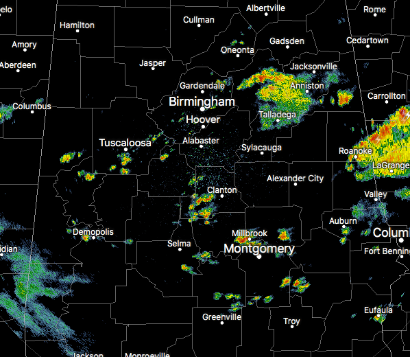
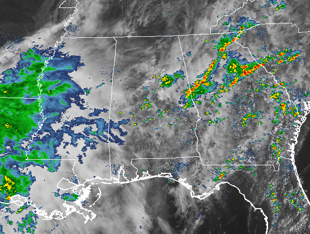
Rain is current affected parts of south-central to the eastern parts of the area at this point. Nothing that could be considered strong, but some do have some heavy downpours at the moment. Other scattered showers have popped up over the western parts of the area as well.
Back to our west, we have a big shield of rain stretching from western Mississippi, into southern Arkansas, much of Louisiana, and back into eastern Texas. Currently there are no severe watches or warnings in effect.
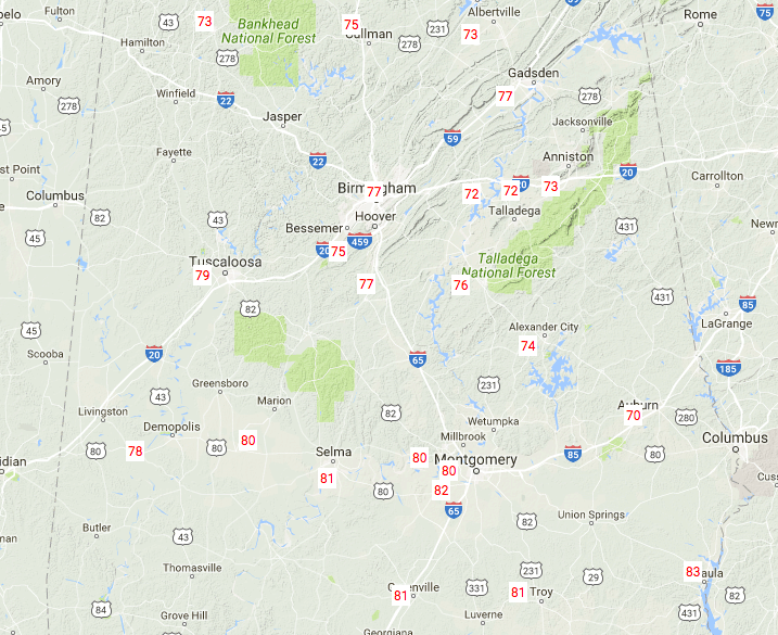
Temperatures at 12:50PM are currently ranging from the lower 70s in the northern parts of the area, to the lower 80s in the south. Eufaula is currently the warm spot at 83 degrees, with Haleyville as the cool spot at 73 degrees.
For the rest of your Monday, skies will continue to be mostly cloudy, and rain chances will be on the rise as a cold front will be moving into the area and stalling out in the southern parts of Central Alabama. Rain and storms will be likely across almost all of the area tonight, with the best chances coming south of the I-20 corridor. Highs will top out in the upper 70s to the mid 80s, with lows in the upper 50s to the mid 60s.
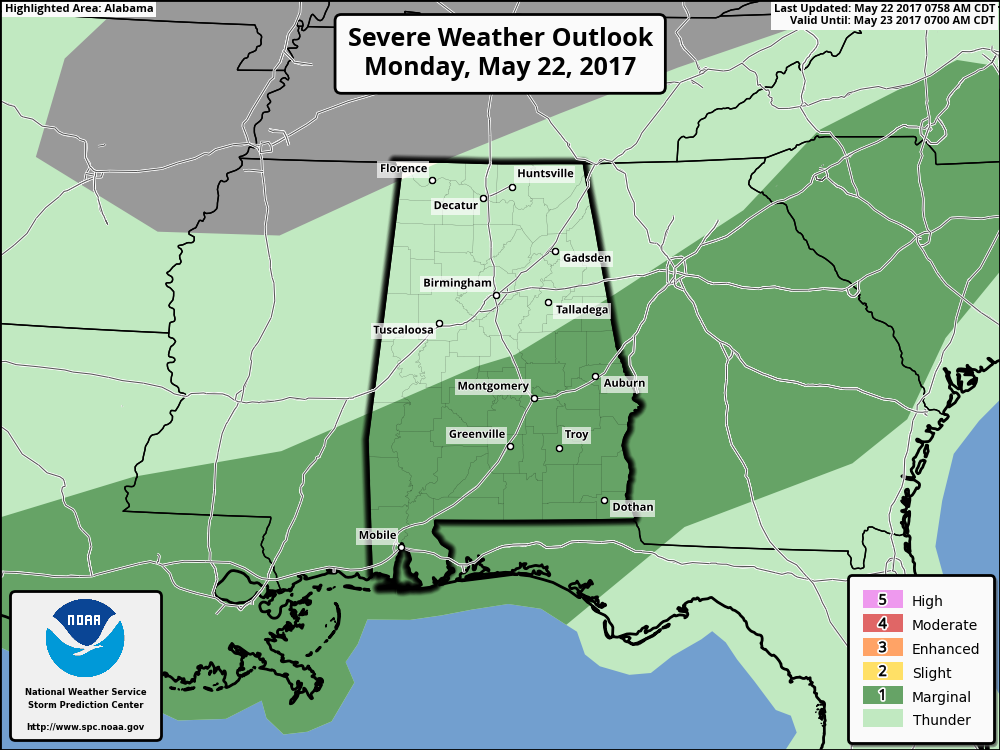
SPC has much of the southern parts of Central Alabama in a marginal risk for severe storms for the rest of the day and into the morning hours on Tuesday, mainly for gusty winds and some hail.
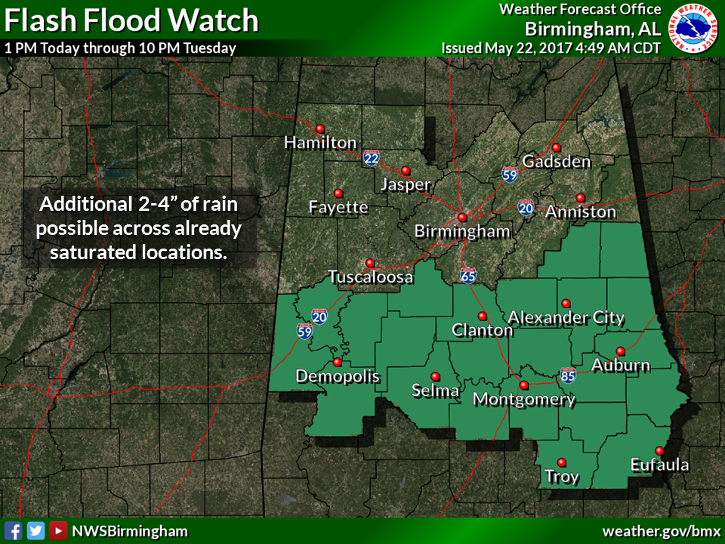
A Flash Flood Watch is in effect for the southern parts of the area until 10PM Tuesday night. Additional rain amounts of 2 to 4 inches are possible in the watch area through Wednesday night, with 1-2 inches for the counties north of the watch.
For the day on Tuesday, we could possible have a break in the rain during the morning through the afternoon hours, but we’ll have more rain arriving during the evening ahead of a surface cold front and a deep upper trough. Skies will be mostly cloudy, and highs will be in the mid to the upper 70s throughout the area.
The SEC Baseball Tournament returns to the Hoover Met this week, May 23–28. Come see some of the best college players in the country as they compete for the championship. Also, for the first time ever, you can take advantage of the Hoover Metropolitan Complex which will feature a free, indoor Fan Fest – ferris wheel, sports bar and much more! Tickets start at only $9!
BEACHBOUND: For a detailed look at the weather from Fort Morgan over to Panama City Beach, Click here to see the Beach Forecast Center page. The Beach Forecast is partially underwritten by the support of Brett/Robinson Vacation Rentals in Gulf Shores and Orange Beach. Click here to see Brett/Robinson’s best beach offers now!
ON THIS DATE IN WEATHER HISTORY
1987 – A powerful tornado virtually wiped the small southwest Texas community of Saragosa off the map. The twister destroyed eighty- five percent of the structures in the town killing thirty persons and injuring 121 others in the town of population 183. The tornado hurled trucks and autos through adobe and wood- frame homes, with some vehicles blown 500 feet.
Category: Alabama's Weather, ALL POSTS
About the Author (Author Profile)
Scott Martin is an operational meteorologist, professional graphic artist, musician, husband, and father. Not only is Scott a member of the National Weather Association, but he is also the Central Alabama Chapter of the NWA president. Scott is also the co-founder of Racecast Weather, which provides forecasts for many racing series across the USA. He also supplies forecasts for the BassMaster Elite Series events including the BassMaster Classic.Subscribe
If you enjoyed this article, subscribe to receive more just like it.


