

A Quick Update On Our Weather Situation At 9:15AM
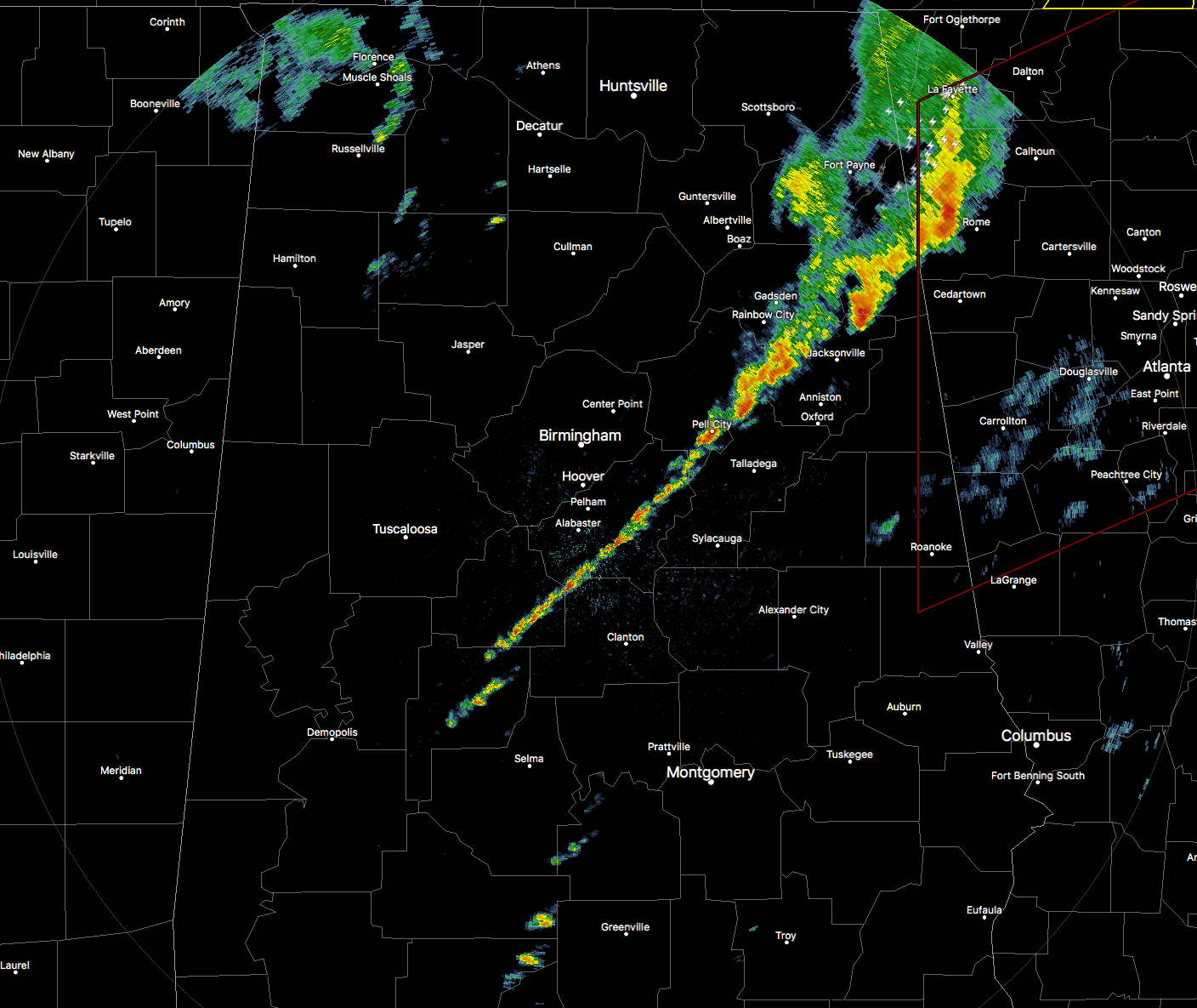
RADAR CHECK
We have a line of showers and storms pushing through Central Alabama, mainly on the eastern side of the area. This line is associated with a shortwave that is pushing through the area.
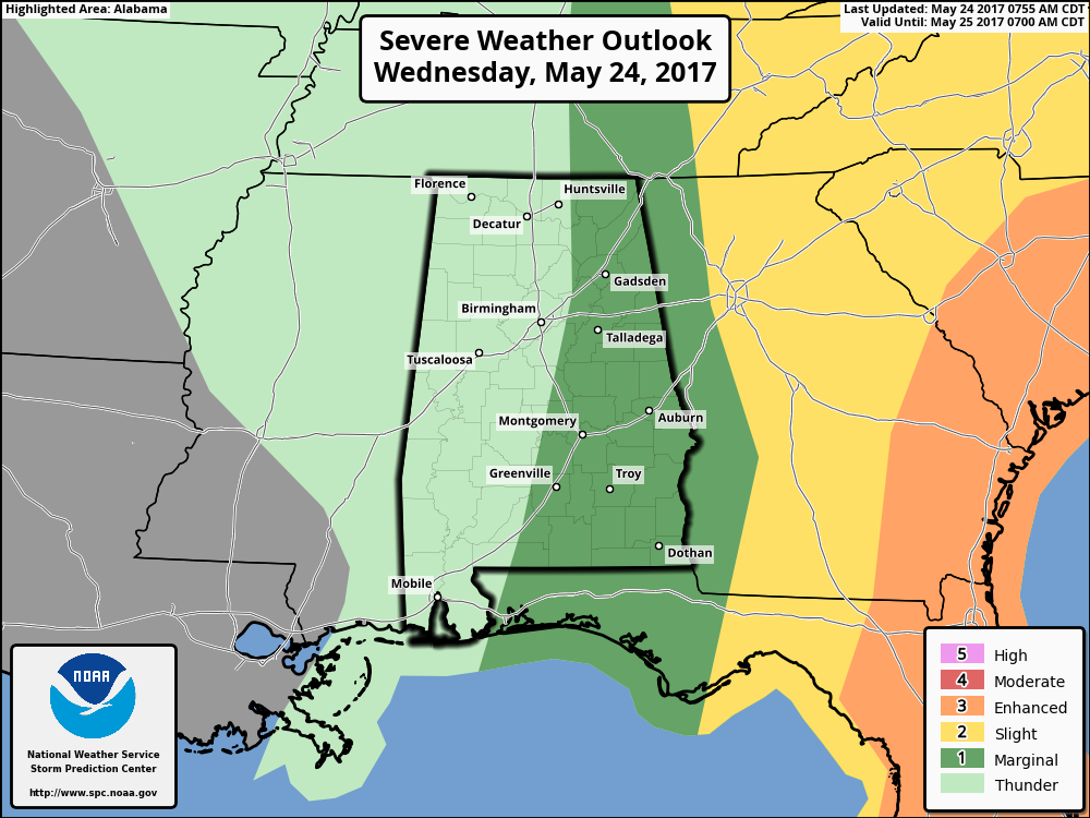
MARGINAL RISK FOR SEVERE STORMS IN EAST ALABAMA
We currently have a Marginal Risk for severe storms for the eastern half of the state for today, mainly for this first wave of storms. The main threat with this line will be from damaging wind gusts. The threat for an isolated tornado is really low, but not at zero, so we just need to keep our eyes on this line as it progresses eastward. The good news is that the better dynamics will be to our east in Georgia, where there is a Slight Risk for severe storms.
These should move completely out of the area by 2-3PM, but we’ll have more showers and storms pushing in from the west that will be associated with the upper low. Severe weather is not expected with the low, but scattered showers and storms will be possible throughout the remainder of the day and into the overnight hours.
Category: Alabama's Weather, ALL POSTS
About the Author (Author Profile)
Scott Martin is an operational meteorologist, professional graphic artist, musician, husband, and father. Not only is Scott a member of the National Weather Association, but he is also the Central Alabama Chapter of the NWA president. Scott is also the co-founder of Racecast Weather, which provides forecasts for many racing series across the USA. He also supplies forecasts for the BassMaster Elite Series events including the BassMaster Classic.Subscribe
If you enjoyed this article, subscribe to receive more just like it.


