

Strong Storms Affecting Talladega, Cleburne, Coosa, & Clay Counties
SIGNIFICANT WEATHER ADVISORY FOR SOUTHEASTERN TALLADEGA, SOUTHWESTERN CLEBURNE, NORTHERN COOSA AND CLAY COUNTIES UNTIL 11:45AM CDT
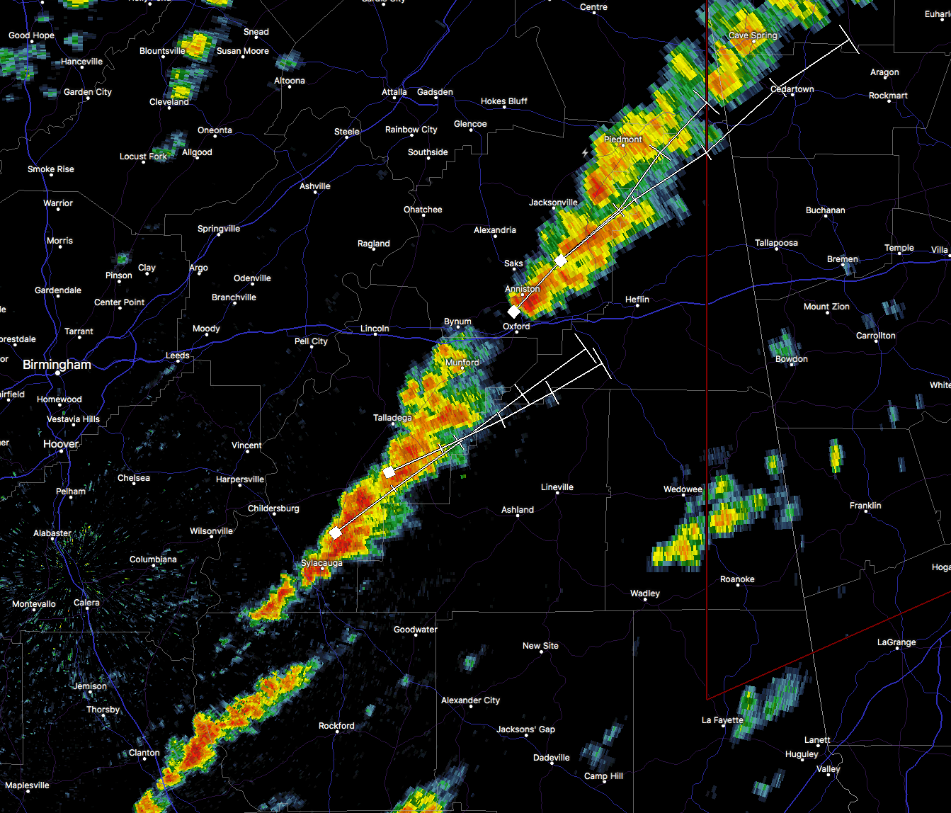
At 10:52 AM CDT, Doppler radar was tracking strong thunderstorms along a line extending from near Waldo to near Sylacauga. Movement was northeast at 30 mph. Winds in excess of 40 mph will be possible with these storms.
Locations impacted include…
Talladega, Sylacauga, Lineville, Ashland, Goodwater, Stewartville, Waldo, Winterboro, Sycamore, Parkdale, Mount Cheaha, Strickland Crossroads, Cleveland Crossroads, Gantts Quarry, Camp Mac, Ironaton, Millerville, Mignon, Gunthertown and Sylacauga Municipal Airport.
Torrential rainfall is also occurring with these storms, and may lead to localized flooding. Do not drive your vehicle through flooded roadways.
Category: Alabama's Weather, ALL POSTS
About the Author (Author Profile)
Scott Martin is an operational meteorologist, professional graphic artist, musician, husband, and father. Not only is Scott a member of the National Weather Association, but he is also the Central Alabama Chapter of the NWA president. Scott is also the co-founder of Racecast Weather, which provides forecasts for many racing series across the USA. He also supplies forecasts for the BassMaster Elite Series events including the BassMaster Classic.Subscribe
If you enjoyed this article, subscribe to receive more just like it.


