

Severe Thunderstorm Warning Continues For Parts Of Jackson, Madison, Franklin (TN), And Lincoln (TN) Counties Until 10:30PM

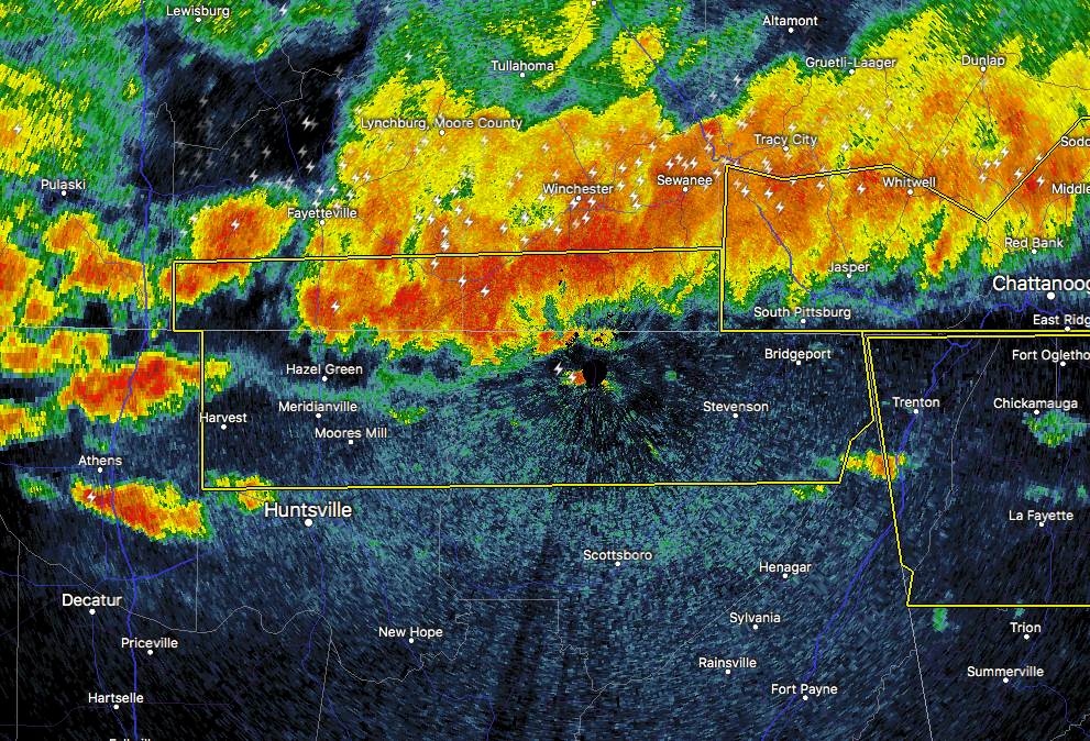
…A SEVERE THUNDERSTORM WARNING REMAINS IN EFFECT UNTIL 1030 PM CDT FOR NORTHERN JACKSON…NORTHERN MADISON…SOUTHERN LINCOLN AND SOUTHERN FRANKLIN COUNTIES… At 1013 PM CDT, severe thunderstorms were located along a line extending from near Stevenson to near Harvest, moving south at 20 mph.
HAZARD…60 mph wind gusts and quarter size hail.
SOURCE…Radar indicated.
IMPACT…Hail damage to vehicles is expected. Expect wind damage to roofs, siding, and trees. Locations impacted include… Northern Huntsville, Bridgeport, Moores Mill, Meridianville, Hazel Green, South Pittsburg, Stevenson, Huntland, Skyline and Harvest.
Severe Thunderstorm Warning Issued For Parts Of Jackson, Madison, Franklin (TN), And Lincoln (TN) Counties Until 10:30PM
May 27th @ 9:56 pm

The National Weather Service in Huntsville Alabama has issued a
* Severe Thunderstorm Warning for…
Northern Jackson County in northeastern Alabama…
Northern Madison County in north central Alabama…
Southern Lincoln County in Middle Tennessee…
Southern Franklin County in Middle Tennessee…
* Until 1030 PM CDT
* At 955 PM CDT, severe thunderstorms were located along a line extending from 9 miles south of Sewanee to 6 miles northeast of
Ardmore, moving southeast at 25 mph.
HAZARD…60 mph wind gusts and quarter size hail.
SOURCE…Radar indicated.
IMPACT…Hail damage to vehicles is expected. Expect wind damage to roofs, siding, and trees.
* Locations impacted include…
Northern Huntsville, Bridgeport, Moores Mill, Meridianville, Hazel
Green, South Pittsburg, Stevenson, Huntland, Skyline and Harvest.
Category: ALL POSTS, Archived Warnings
About the Author (Author Profile)
Subscribe
If you enjoyed this article, subscribe to receive more just like it.


