

Severe Thunderstorm Warning Continues For Parts Of Colbert, Franklin, And Lauderdale Counties Until 1:15AM

…A SEVERE THUNDERSTORM WARNING REMAINS IN EFFECT UNTIL 115 AM CDT FOR LAUDERDALE…WESTERN COLBERT AND NORTHWESTERN FRANKLIN COUNTIES… At 1250 AM CDT, severe thunderstorms were located along a line extending from 8 miles northeast of Cherokee to near Sandy Springs, moving southeast at 45 mph.
HAZARD…70 mph wind gusts and quarter size hail.
SOURCE…Radar indicated.
IMPACT…Hail damage to vehicles is expected. Expect considerable tree damage. Wind damage is also likely to mobile homes, roofs, and outbuildings. Locations impacted include… Florence, Red Bay, J P Coleman State Park, Cherokee, St. Florian, Underwood-Petersville, Waterloo, Posey Loop, Oakland and Barton.
Severe Thunderstorm Warning Issued For Parts Of Colbert, Franklin, And Lauderdale Counties Until 1:15AM
May 28th @ 12:33 am

The National Weather Service in Huntsville Alabama has issued a
* Severe Thunderstorm Warning for…
Lauderdale County in northwestern Alabama…
Western Colbert County in northwestern Alabama…
Northwestern Franklin County in northwestern Alabama…
* Until 115 AM CDT
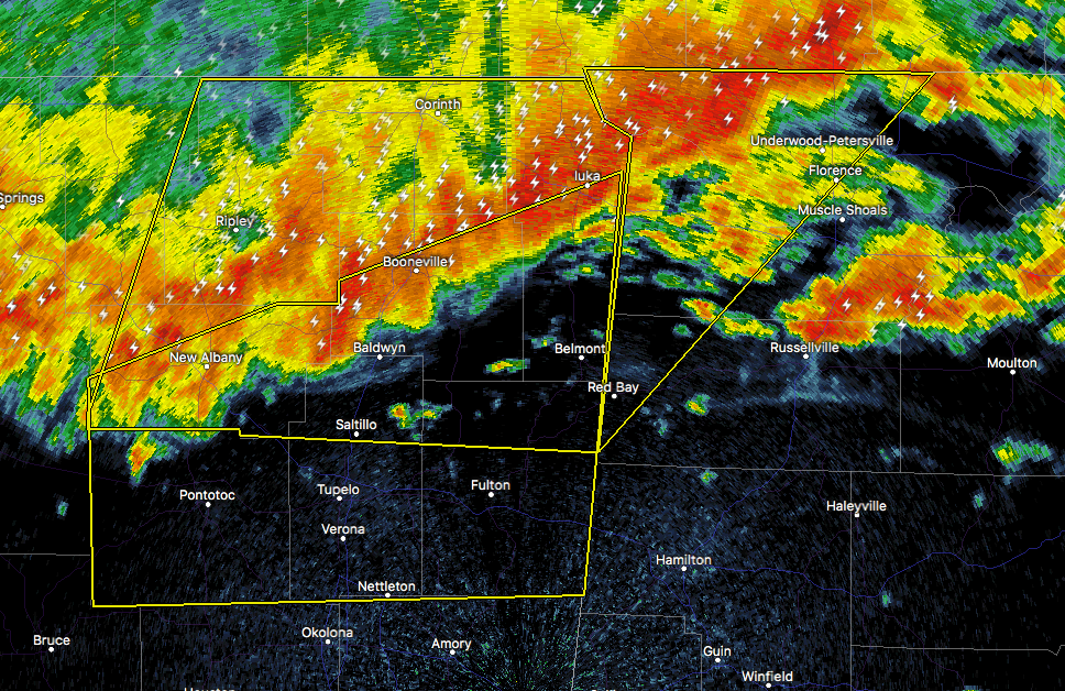
* At 1232 AM CDT, severe thunderstorms were located along a line extending from near Walnut Grove to near Baldwyn, moving southeast at 45 mph.
HAZARD…60 to 70 mph wind gusts and quarter size hail.
SOURCE…Radar indicated.
IMPACT…Hail damage to vehicles is expected. Expect considerable tree damage. Wind damage is also likely to mobile homes, roofs, and outbuildings.
* Locations impacted include…
Florence, Red Bay, J P Coleman State Park, Cherokee, St. Florian, Underwood-Petersville, Waterloo, Posey Loop, Oakland and Barton.
Category: ALL POSTS, Archived Warnings
About the Author (Author Profile)
Subscribe
If you enjoyed this article, subscribe to receive more just like it.


