

Watch Canceled; Severe Weather Threat Continues for Later Today, Tonight and Monday
The Severe thunderstorm watch for Central Alabama was canceled just before 5 a.m. this morning as the severe storms moved into Georgia.
A thin line of storms trailing from the main storm complex is weakening as it pushes into the Montgomery area.
A large area of moderate rain was pushing across Northwest Alabama that will affect mainly areas north of I-20 this morning.
The day should be mainly rain free after this precipitation moves across the area. Any storm that does manage to form during the afternoon could pack a punch though with damaging winds and hail possible.
Here is the day one severe weather outlook from the SPC: 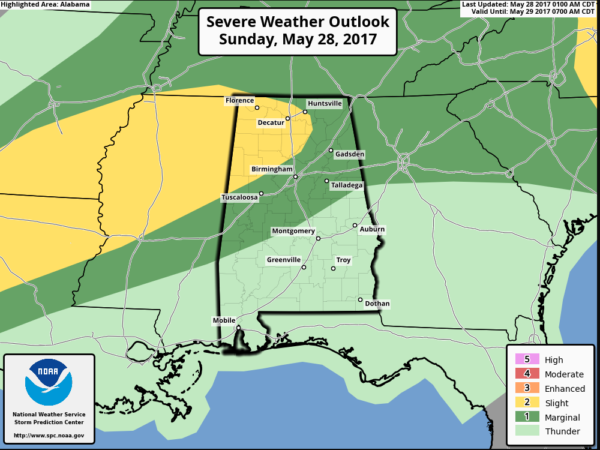
More storms are possible overnight tonight ahead of a stalling cold front. That front will bring more storms on Monday. Some of those could be severe as well. So keep a weather eye to the sky through the long holiday weekend and stay with AlabamaWX.com for the latest updates.
Category: Alabama's Weather, ALL POSTS
About the Author (Author Profile)
Bill Murray is the President of The Weather Factory. He is the site's official weather historian and a weekend forecaster. He also anchors the site's severe weather coverage. Bill Murray is the proud holder of National Weather Association Digital Seal #0001 @wxhistorianSubscribe
If you enjoyed this article, subscribe to receive more just like it.


