

Muggy June Weekend
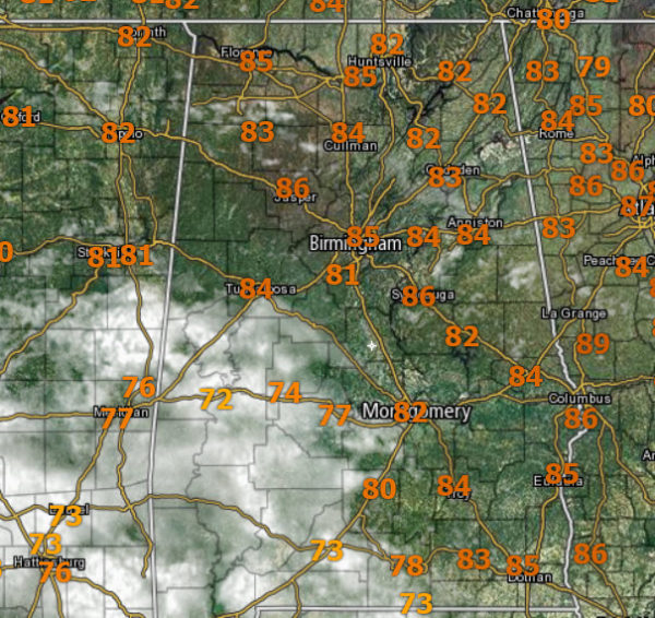
Scattered showers and thunderstorms remain in the forecast this weekend. Each day the greatest coverage of these will come during the peak heating of the day, afternoon and evening hours, but with this air mass in place, a shower can occur at just about anytime. Not everyone will see the rain, and when it is not raining, expect a mix of sun and clouds with a highs in the mid 80s and that is what we are seeing this afternoon.
The scattered nature of the daily activity, there is no way of knowing when and where rain will occur, just be prepared to dodge some rain along the way, and of course head indoors if thunder and lightning make their presence known.
RADAR CHECK: Numerous showers and storms are lifting northeast across our southwestern communities late this morning. Locations through out Greene, Hale, Perry, and Dallas counties are seeing rain and storms.
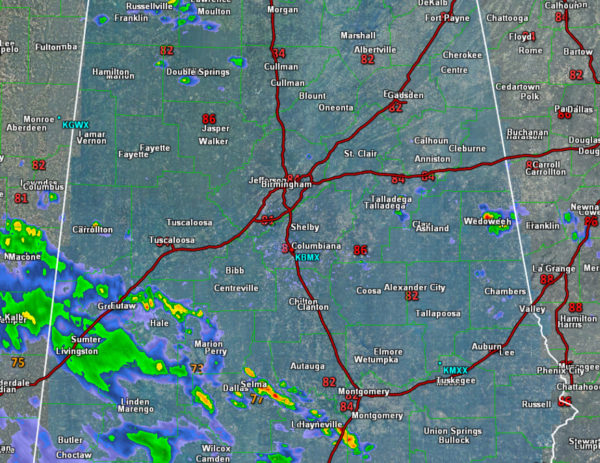
In other locations through North/Central Alabama, showers and storms are beginning to blossom on the radar. As we see each day, these will continue through the rest of the afternoon and evening hours before most of it begins to wind down after sunsets. Brief tropical downpours are likely and once again, the main concern will come from dangerous cloud to ground lightning.
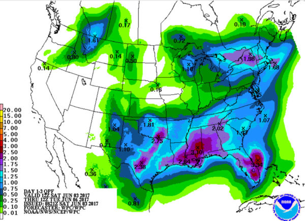
Little change in the forecast as we head into the new work week as the pattern persist, but changes are ahead. Rainfall over the next few days through early Wednesday will be in the range of 1 to 2 inches for many locations which will continue to help keep drought conditions from returning.
Category: Alabama's Weather, ALL POSTS
About the Author (Author Profile)
Macon, Georgia Television Chief Meteorologist, Birmingham native, and long time Contributor on AlabamaWX. Stormchaser. I did not choose Weather, it chose Me. College Football Fanatic. @Ryan_StinnetSubscribe
If you enjoyed this article, subscribe to receive more just like it.


