

Showers Becoming More Numerous
Showers have developed late this morning in the rather humid air mass over the Southeast US and along the Gulf Coast. As you can see from the regional radar composite, showers with embedded thunderstorms were occurring from just west of New Orleans along the Gulf Coast to just west of Jacksonville. Additionally more scattered showers and embedded thunderstorms were occurring over South Georgia and South Alabama.
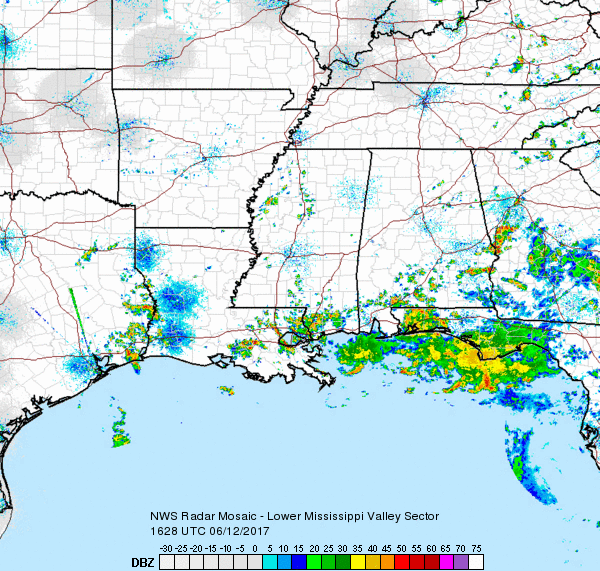
What is probably somewhat noteworthy to weather enthusiasts is the motion of the radar echoes. Motion on the small storms was rather hard to establish, but the large cluster of storms stretching from just southwest of Columbus, GA, to near the southern side of Atlanta was moving westward. Yes, that’s right, westward. The reason for this somewhat unusual motions is the weak upper level disturbance that was still being analyzed this morning over Louisiana and the western Gulf of Mexico. This weak low has set up an easterly flow, albeit weak, over the Southeast US.
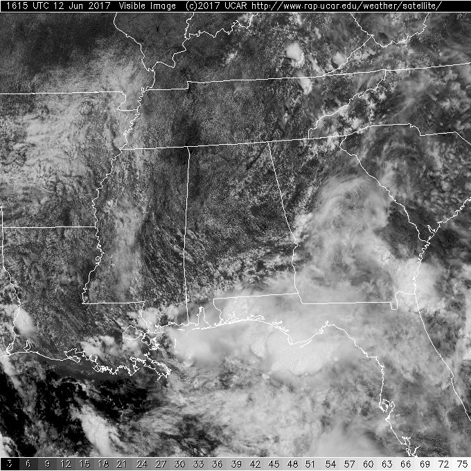
Satellite image just before noon also showed an extensive cumulus field over the norther two-thirds of Alabama, so additional showers are likely to develop in the heat and humidity of the afternoon.
-Brian-
Category: Alabama's Weather, ALL POSTS
About the Author (Author Profile)
Brian Peters is one of the television meteorologists at ABC3340 in Birmingham and a retired NWS Warning Coordination Meteorologist. He handles the weekend Weather Xtreme Videos and forecast discussion and is the Webmaster for the popular WeatherBrains podcast.Subscribe
If you enjoyed this article, subscribe to receive more just like it.


