

A Quick Look At Our Weather Situation At 12:00PM
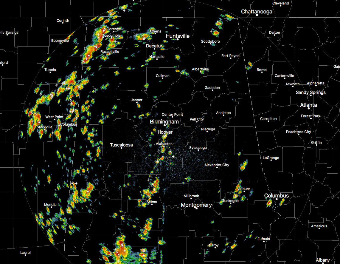
Well there is a big difference from the 10AM radar image to the noon image. Showers and storms have really popped up during the last couple of hours mainly over the western half of the state, but there are a few down in the southeastern parts as well. None of these are severe at the moment, but some of the storms just across the Mississippi state line are putting down some heavy rainfall.
The line of storms has progressed to the south and now extends from North-Central Tennessee, back through the northwestern tip of Alabama and through North Mississippi, before dissipating in Arkansas. There are no warnings at this point, but some of the embedded cells in this line are pretty strong, especially in the northeastern corner of Mississippi, that will soon be moving into Lauderdale and Colbert counties in Northwest Alabama.
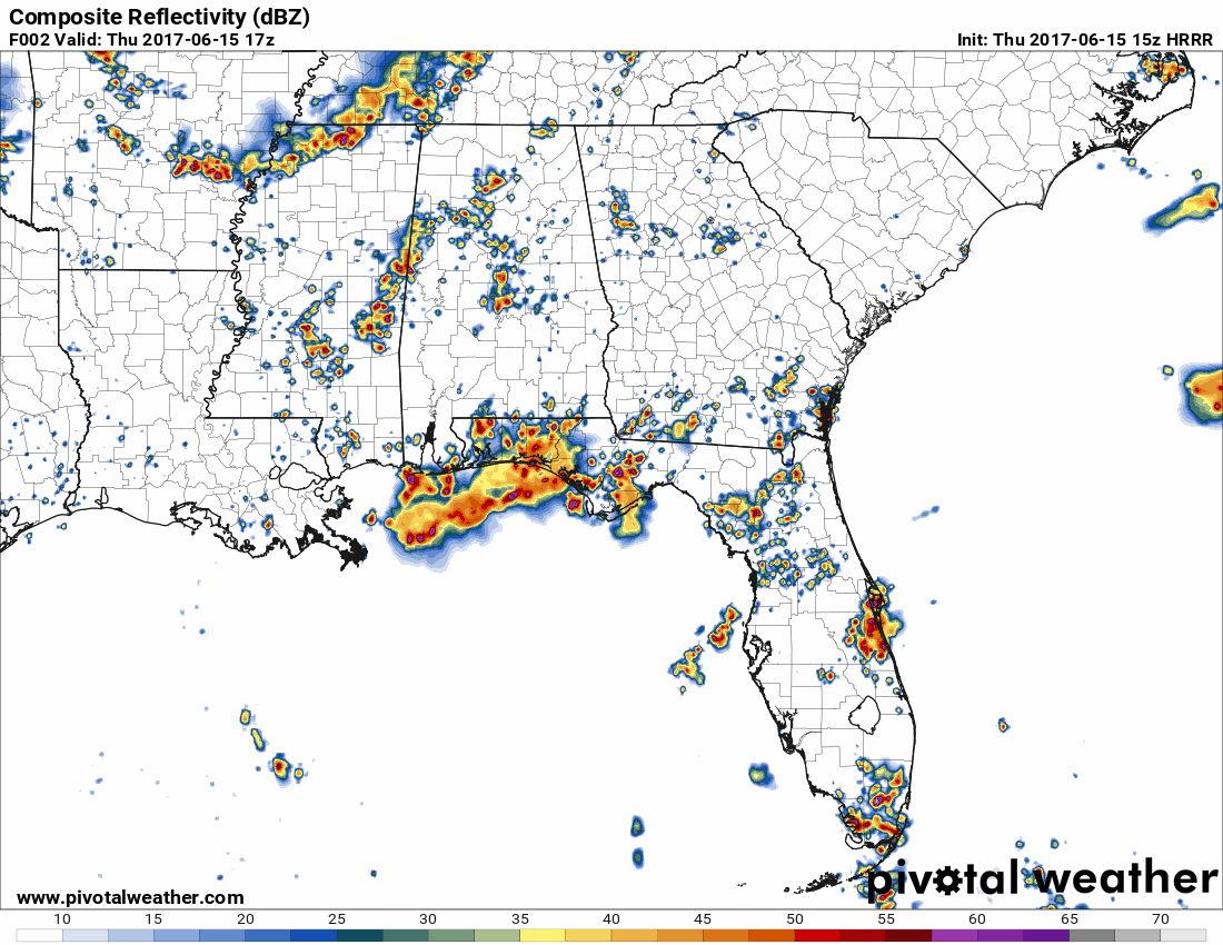
The animated image shows what the latest run of the HRRR is expecting for Alabama throughout the rest of the afternoon and into tonight at midnight. It has picked up on the idea of the MCS now holding together as it moves through Central Alabama until it breaks apart around 6-7PM, but numerous showers and thunderstorms will be possible until everything start to die down around 10PM.
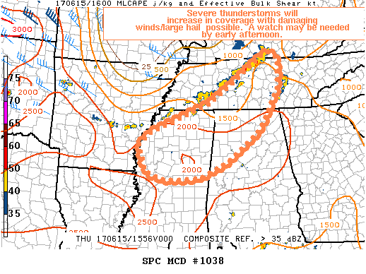
The latest mesoscale discussion has come out from the SPC, and severe thunderstorms are expected to increase in coverage through this afternoon with a risk for damaging winds and large hail. Trends will be monitored for the possibility of a Severe Thunderstorm Watch.
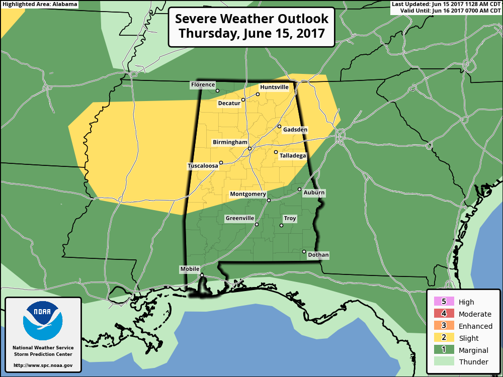
Latest update from the SPC has nearly the entire state under some risk of severe storms today and through tonight, with the northern half of the state in a Slight Risk, and almost the remainder of the state in a Marginal Risk. There will be no tornado threat with today’s storms, but the main threat will be from damaging straight-line thunderstorm winds.
With that being said, straight-line winds can do as much damage as a tornado, so please stay weather aware throughout the day. If a Severe Thunderstorm Warning is issued for your location, take it seriously. We’ll have updates on the blog throughout the day.
Category: Alabama's Weather, ALL POSTS
About the Author (Author Profile)
Scott Martin is an operational meteorologist, professional graphic artist, musician, husband, and father. Not only is Scott a member of the National Weather Association, but he is also the Central Alabama Chapter of the NWA president. Scott is also the co-founder of Racecast Weather, which provides forecasts for many racing series across the USA. He also supplies forecasts for the BassMaster Elite Series events including the BassMaster Classic.Subscribe
If you enjoyed this article, subscribe to receive more just like it.


