

Steamy Saturday Afternoon
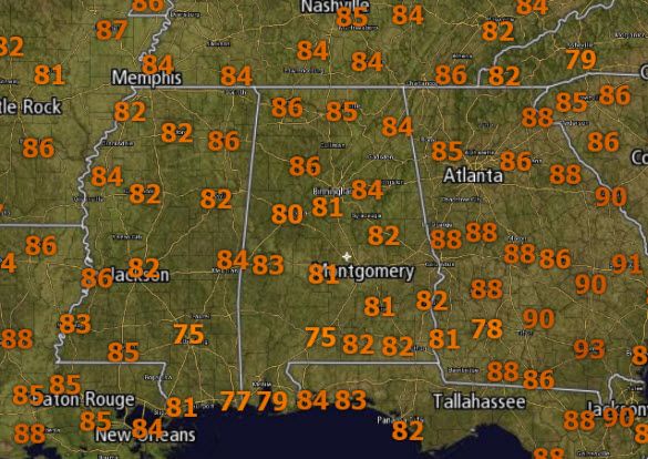
A mix of sun and clouds today, along with high dew points, means it is a rather humid afternoon across North/Central Alabama.
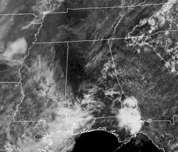
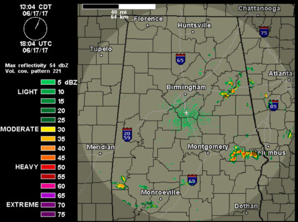
Temperatures are well into the 80s across the area, and of course we are watching the radar as showers and storms are developing.
There is no way of knowing exactly where they will pop up in advance, but an early afternoon radar check shows a few storms mainly over East Alabama impacting Calhoun, Cleburne, and Clay counties. Expect isolated to scattered storms to be possible at just about anywhere with most of the activity winding down after sunset.
TO OUR NORTH: A low pressure system and frontal boundary are going to be responsible for storms as an “enhanced risk” of severe thunderstorms is forecast through tonight as severe thunderstorms are expected late this afternoon into tonight, mainly from the central Plains across the middle Mississippi Valley into southern Lower Michigan, with damaging gusts and hail likely. This frontal boundary will continue to sink towards the south and impact our weather in the days ahead.
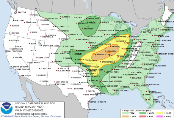
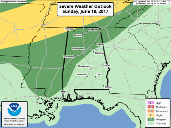
FOR FATHER’S DAY: The very warm and humid air mass will remain in place and with an approaching frontal boundary from the north tomorrow, rain chances over the state will be increasing, and in fact the SPC has much of north and west Alabama in a “marginal risk” for severe storms as some damaging wind gusts will be possible with stronger storms.
Still no washout, and most of the day expect a mix of sun and clouds, with afternoon highs in the upper 80s and lower 90s.
Category: Alabama's Weather, ALL POSTS
About the Author (Author Profile)
Macon, Georgia Television Chief Meteorologist, Birmingham native, and long time Contributor on AlabamaWX. Stormchaser. I did not choose Weather, it chose Me. College Football Fanatic. @Ryan_StinnetSubscribe
If you enjoyed this article, subscribe to receive more just like it.


