

A Few Quick Notes on PTC2
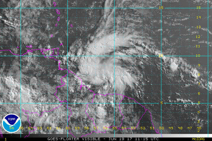
Potential Tropical Cyclone 2 is very far to the south, just off the coast of Guyana. An Air Force plane just found the center barely offshore. The minimum pressure was 1010 mb, which is relatively high. And the maximum surface winds observed on the SFMR have been 41 mph in the far northeastern quadrant, about 130 miles from the center fix. There are no strong winds anywhere close to the center.
Will this be enough to have the NHC call it a Tropical Storm on the 4 p.m. advisory? Or will it be classified as a depression? We will be waiting to see!
 which is 30 knots, or just below tropical storm force.
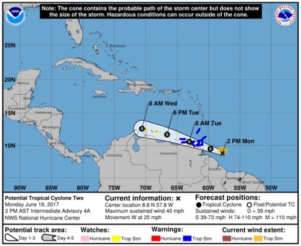
It does seem to be on enough of a northwesterly track to me to clear the coast of Venezuela. The forecast tack carries is very close to the dual island nation of Trinidad and Tobago.
Given all of that, the system might get a name in the next couple of hours.
Here is the official track from the NHC showing it becoming a tropical storm then paralleling the Venezuelan coast.
The morning run of the GFS eventually downgrades it back to an open wave over the Caribbean. The European is even less impressed.
We should have word between 3:30 and 4 p.m.
About the Author (Author Profile)
Bill Murray is the President of The Weather Factory. He is the site's official weather historian and a weekend forecaster. He also anchors the site's severe weather coverage. Bill Murray is the proud holder of National Weather Association Digital Seal #0001 @wxhistorianSubscribe
If you enjoyed this article, subscribe to receive more just like it.


