

A Quick Check On Our Weather At 2:00PM
RADAR CHECK
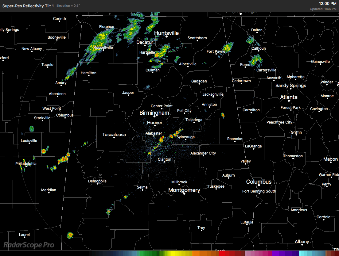
Here is the latest radar taken at 1:46PM, and we are seeing a line of showers and thunderstorms starting to form just ahead of the cold front that is moving through portions of Central Alabama. The line currently stretches from Geraldine, back to the southwest to Warrior to Northport, and will continue to push to the east with a southward jog to it with the movement of the cold front.
The front is expected to stall out over the southern parts of Central Alabama later this evening and into the overnight hours, and should be around the I-85 corridor around the morning time on Tuesday.
As far as a severe weather threat with this, there could be a few storms that could get strong to marginally severe range with the main threat coming from wet microburst winds. Looking at the radar as of now, along with the latest HRRR model run, I don’t believe that severe weather will be a problem in Central Alabama.
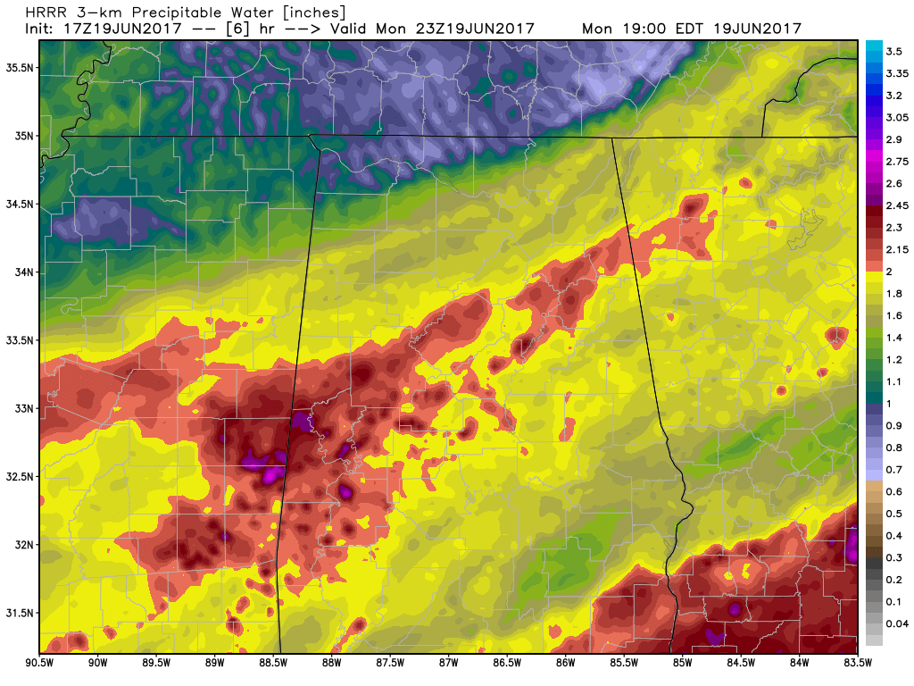
HRRR Precipitable Water values valid at 6PM tonight.
I think that the larger issue will be where the front stalls and if enough rain falls to cause any localized flooding. Precipitable water values are above 2 inches across much of the area, and with dewpoints well into the 70s, heavy rainfall is almost a guarantee.
Just stay weather aware in Central Alabama in case a weather warning is issued for your location. We’ll keep you posted on the AlabamaWx Weather Blog.
Category: Alabama's Weather, ALL POSTS
About the Author (Author Profile)
Scott Martin is an operational meteorologist, professional graphic artist, musician, husband, and father. Not only is Scott a member of the National Weather Association, but he is also the Central Alabama Chapter of the NWA president. Scott is also the co-founder of Racecast Weather, which provides forecasts for many racing series across the USA. He also supplies forecasts for the BassMaster Elite Series events including the BassMaster Classic.Subscribe
If you enjoyed this article, subscribe to receive more just like it.


