

Hello Bret!
The NHC has name the system approaching the southeastern Caribbean as a tropical storm this afternoon. It is officially named Bret now.
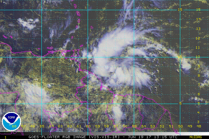
The Air Force Reserve plane had to work hard, but it did find tropical storm force winds about 25 miles northeast of the center of the circulation. This well defined circulation has allowed them to classify the system as Tropical Storm Bret.
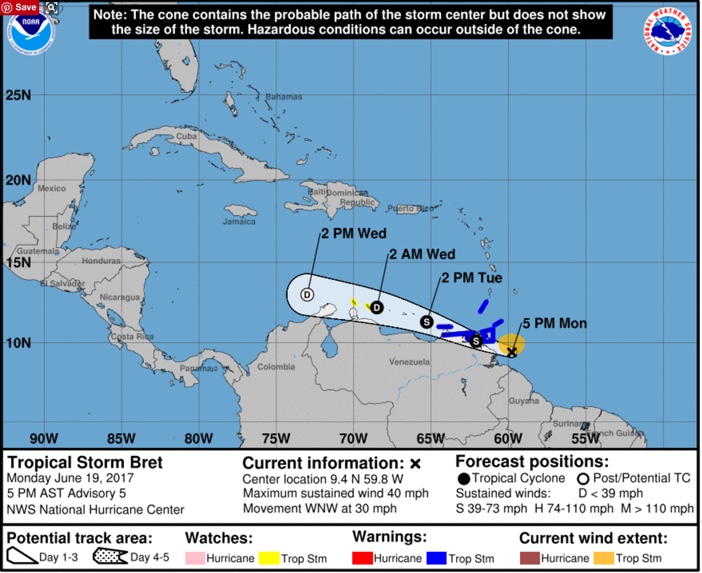
Top winds are now 40 mph. The system will begin interacting soon with the land mass of Venezuela however, and Bret should begin to weaken.
The system is moving very fast, over 30 mph, to the west northwest. The official forecast dissipates Bret in three days over the Caribbean due to interaction with land and increasing wind shear. In fact, if Bret takes a track further south, it may never make it back out to sea.
…HURRICANE HUNTER AIRCRAFT FIND THE DISTURBANCE HAS BECOME A
TROPICAL STORM…
SUMMARY OF 500 PM AST…2100 UTC…INFORMATION
———————————————-
LOCATION…9.4N 59.8W
ABOUT 125 MI…200 KM SE OF TRINIDAD
ABOUT 225 MI…365 KM SE OF GRENADA
MAXIMUM SUSTAINED WINDS…40 MPH…65 KM/H
PRESENT MOVEMENT…WNW OR 290 DEGREES AT 30 MPH…48 KM/H
MINIMUM CENTRAL PRESSURE…1007 MB…29.74 INCHES
WATCHES AND WARNINGS
——————–
CHANGES WITH THIS ADVISORY:
None.
SUMMARY OF WATCHES AND WARNINGS IN EFFECT:
A Tropical Storm Warning is in effect for…
* Trinidad
* Tobago
* Grenada
* Venezuela from Pedernales to Cumana including Isla de Margarita
A Tropical Storm Watch is in effect for…
* Bonaire
* Curacao
* Aruba
A Tropical Storm Warning means that tropical storm conditions are
expected somewhere within the warning area, in this case within 24
hours.
A Tropical Storm Watch means that tropical storm conditions are
possible within the watch area, generally within 48 hours.
For storm information specific to your area, please monitor
products issued by your national meteorological service.
DISCUSSION AND 48-HOUR OUTLOOK
——————————
At 500 PM AST (2100 UTC), the center of Tropical Storm Bret was
located by an Air Force Hurricane Hunter aircraft to be near
latitude 9.4 North, longitude 59.8 West. Bret is moving toward the
west-northwest near 30 mph (48 km/h) and is expected to continue at
a slightly slower speed over the next 48 hours. On the forecast
track, the tropical storm is expected to move near or over Trinidad
and the eastern coast of Venezuela tonight and early Tuesday.
Maximum sustained winds are near 40 mph (65 km/h) with higher gusts.
Little change in strength is forecast during the next 48 hours.
Tropical-storm-force winds extend outward up to 80 miles (130 km)
from the center, mainly north of the center.
The estimated minimum central pressure is 1007 mb (29.74 inches).
HAZARDS AFFECTING LAND
———————-
WIND: Tropical storm conditions are expected to first reach
portions of the warning area tonight, making outside preparations
difficult or dangerous.
RAINFALL: The disturbance is expected to produce total rain
accumulations of 2 to 4 inches over the Windward Islands and the
eastern coast of Venezuela tonight and Tuesday.
NEXT ADVISORY
————-
Next intermediate advisory at 800 PM AST.
Next complete advisory at 1100 PM AST.
$$
Forecaster Landsea
About the Author (Author Profile)
Bill Murray is the President of The Weather Factory. He is the site's official weather historian and a weekend forecaster. He also anchors the site's severe weather coverage. Bill Murray is the proud holder of National Weather Association Digital Seal #0001 @wxhistorianSubscribe
If you enjoyed this article, subscribe to receive more just like it.


