

A Quick Update On Our Weather At 1:20PM

The main line of storms that are involved with Tropical Depression Cindy has made its way into the northwestern parts of the state at this time, and we have a Severe Thunderstorm Warning in effect for parts of Marion and Fayette counties for the threat of strong winds and for the possibility of a brief spin-up tornado. A Tornado Warning was just issued for parts of Franklin and Lawrence counties until 1:45PM for a cell near Phil Campbell.
This line of storms is currently stretching from Lexington in Lauderdale County back to the south-southwest through Phil Campbell and Winfield through Macedonia and Pickensville before crossing over into Mississippi.
We have a broken line of convective development out ahead of the line that is moving through parts of Walker and Tuscaloosa counties and back to the southwest through Greene, Hale, and Sumter counties. Nothing too impressive with these at this point, but heavy downpours can be expected, as these will continue to build and move to the northeast. Rainfall can be expected within the next 30 minutes to 1 hour in the Birmingham Metropolitan Area.
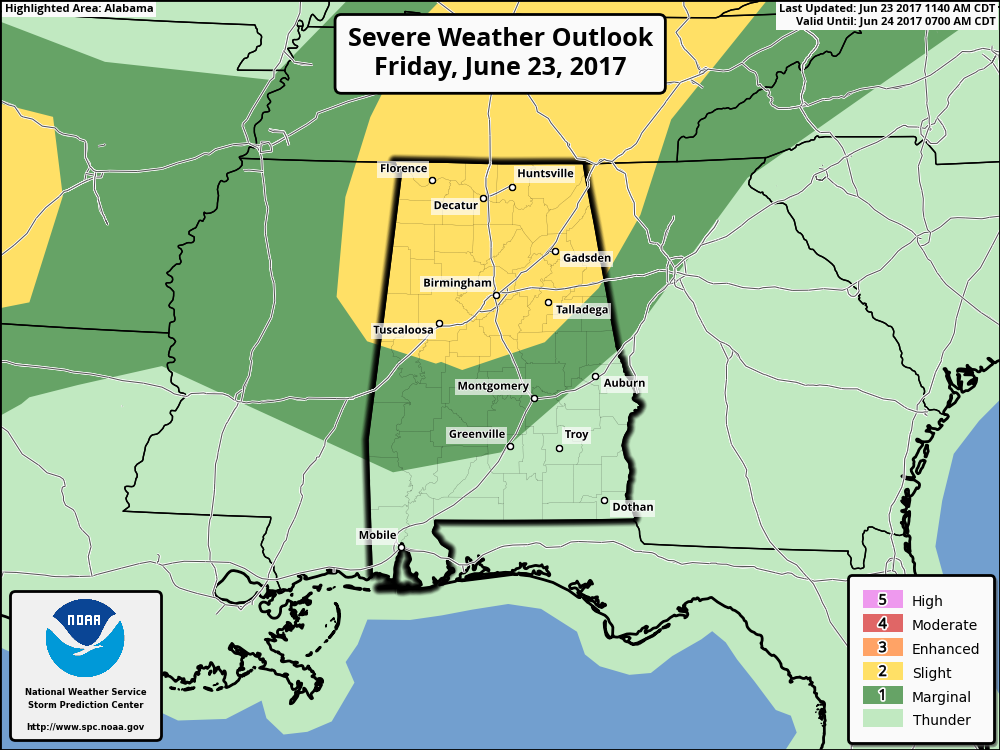
Much of North and Central Alabama continue to be in a Slight Risk for severe storms, with the rest of Central Alabama in a Marginal Risk. All of north and the northern half of Central Alabama remains in a Tornado Watch until 8PM tonight.
Category: Alabama's Weather, ALL POSTS
About the Author (Author Profile)
Scott Martin is an operational meteorologist, professional graphic artist, musician, husband, and father. Not only is Scott a member of the National Weather Association, but he is also the Central Alabama Chapter of the NWA president. Scott is also the co-founder of Racecast Weather, which provides forecasts for many racing series across the USA. He also supplies forecasts for the BassMaster Elite Series events including the BassMaster Classic.Subscribe
If you enjoyed this article, subscribe to receive more just like it.


