

One More Wet One!!
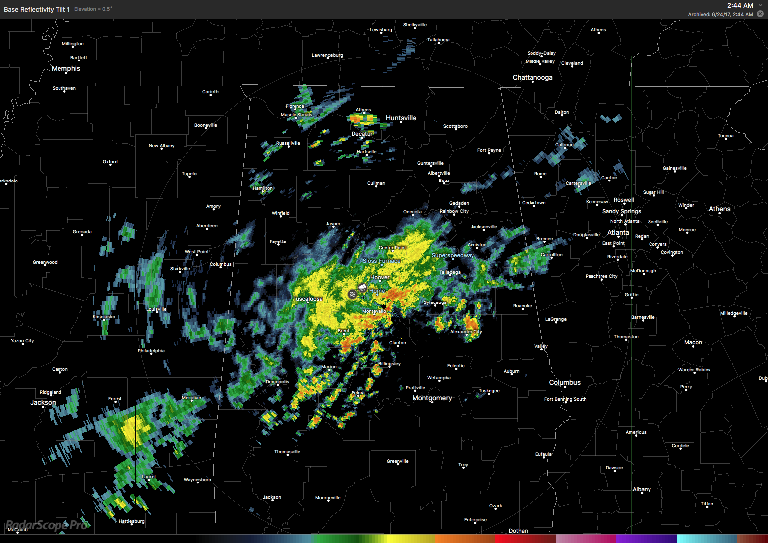
Another rather large area of rain moved through Central Alabama early this morning adding more rain to our already soggy conditions. I recorded 1.65″ between midnight and 5:30 am while the Birmingham Shuttlesworth International Airport saw only 41 hundredths of an inch and the Shelby County Airport reported 78 hundredths of an inch. This was the radar image at 2:30 am.
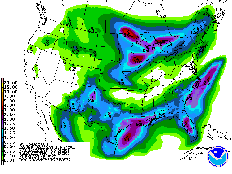
So hang in there as only one more wet day is forecast for Central Alabama as we finally dispense with the wicked witch of the Gulf, Cindy! Current radar showed three patches of moderate to heavy rain occurring in Central and North Alabama. The day is forecast to continue with showers and embedded thunderstorms off and on but a front is forecast to move through the Southeast US as an upper trough settles into the eastern US along with a high pressure center at the surface that settles into the Middle Mississippi River Valley. Look for some patchy sunshine today with highs getting out of the 70s and into the middle and upper 80s. One of the benefits of all the clouds and rain were several days of lowered temperatures including 79 on the 21st and 75 on the 20th. Flash flood watches remain for much of today across Southeast Louisiana, extreme southern Mississippi, and Southwest Alabama as well a North Georgia.
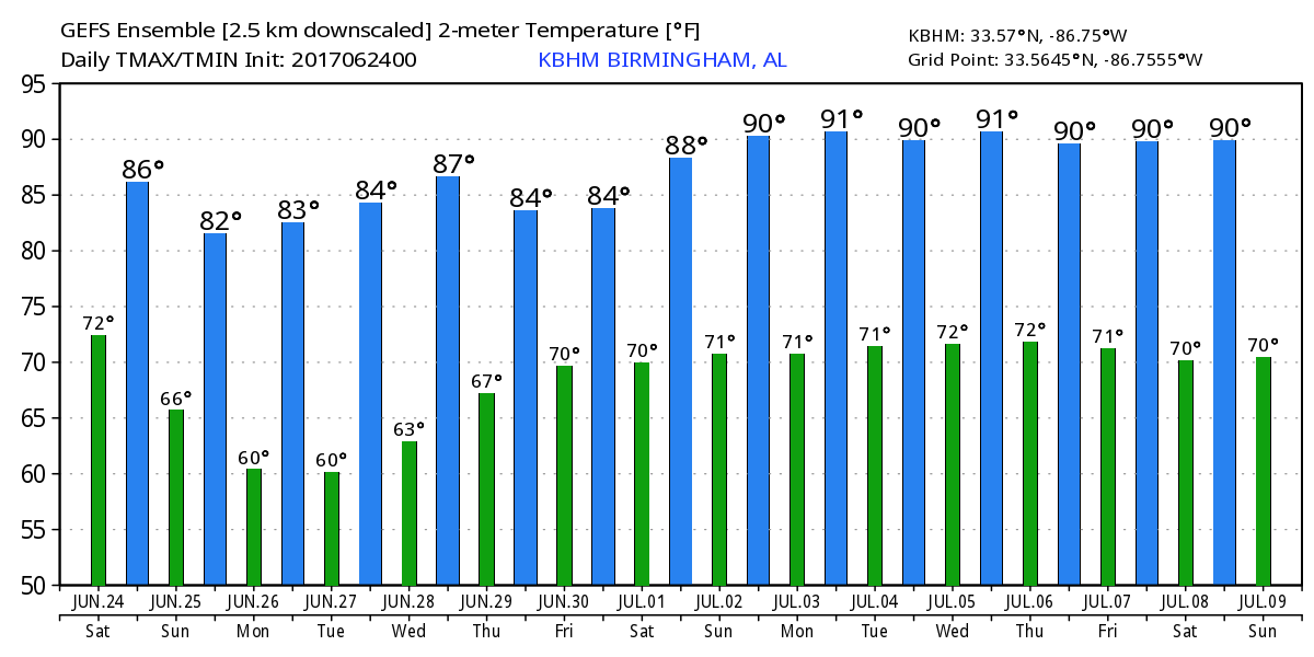
The upper trough will remain over the eastern US Monday and Tuesday keeping the drier air in place with dew points in the 50s. That should feel pretty good after several days with dew points in the 70s across Central Alabama. Highs should be kept down a tad, too, with the northwesterly flow aloft as daily readings Monday and Tuesday should be in the middle 80s.
By Wednesday the surface high will slide east of us as it moves into the Carolinas. This will bring the surface wind around to the south and we begin to see moisture levels rise as dew points edge upward into the lower 60s. I think we stay dry on Wednesday but highs will be in the upper 80s. By Thursday, with a good surface flow coming around to the south and dew points in the upper 60s, we’ll have to mention the potential for diurnally driven showers and thunderstorms with afternoon heating. Highs should remain in the middle and upper 80s and depend a great deal on just how much sun any one spot gets. This puts the rainfall through Thursday pretty light outside of the rainfall today which should be heaviest across South Alabama with one and a half inches while North and Central Alabama should stay at or below one half inch.
Afternoon showers remain likely into Friday, but a strong upper trough moving across the Great Lakes Region Saturday will drag a cold front into Southeast US on Saturday ramping up the possibility for showers and thunderstorms into the weekend. The front will likely stall out and dissipate across Central Alabama on Sunday keeping the risk for showers alive. Highs will be in the upper 80s over the weekend.
The weather at the beach will remain unsettled this weekend with a flash flood watch through 1 am Sunday. The pattern should be settling into one that involves daily chances for a passing afternoon shower Monday and into the week ahead. Highs are expected to be in the middle 80s. Click here to see the AlabamaWx Beach Forecast Center page. The Beach Forecast is partially underwritten by the support of Brett/Robinson Vacation Rentals in Gulf Shores and Orange Beach. Click here to see Brett/Robinson’s Own Your Summer specials now!
Looking into voodoo country, the GFS is pretty bullish on keeping a broad trough over the eastern US. That keeps us out of the heat. But the upper ridge builds back into the picture from the west by July 6th and stays there through July 9th. For Central and North Alabama, July 4th looks mild with highs in the upper 80s and afternoon and early evening showers.
I expect to have the next Weather Xtreme Video posted here first thing on Sunday morning. Check back often for notes and updates on the Alabama weather scene. Have a great day, stay dry just one more day, and Godspeed.
-Brian-
Category: Alabama's Weather, ALL POSTS
About the Author (Author Profile)
Brian Peters is one of the television meteorologists at ABC3340 in Birmingham and a retired NWS Warning Coordination Meteorologist. He handles the weekend Weather Xtreme Videos and forecast discussion and is the Webmaster for the popular WeatherBrains podcast.Subscribe
If you enjoyed this article, subscribe to receive more just like it.


