

Warm & Muggy At Midday With Storms Firing Up
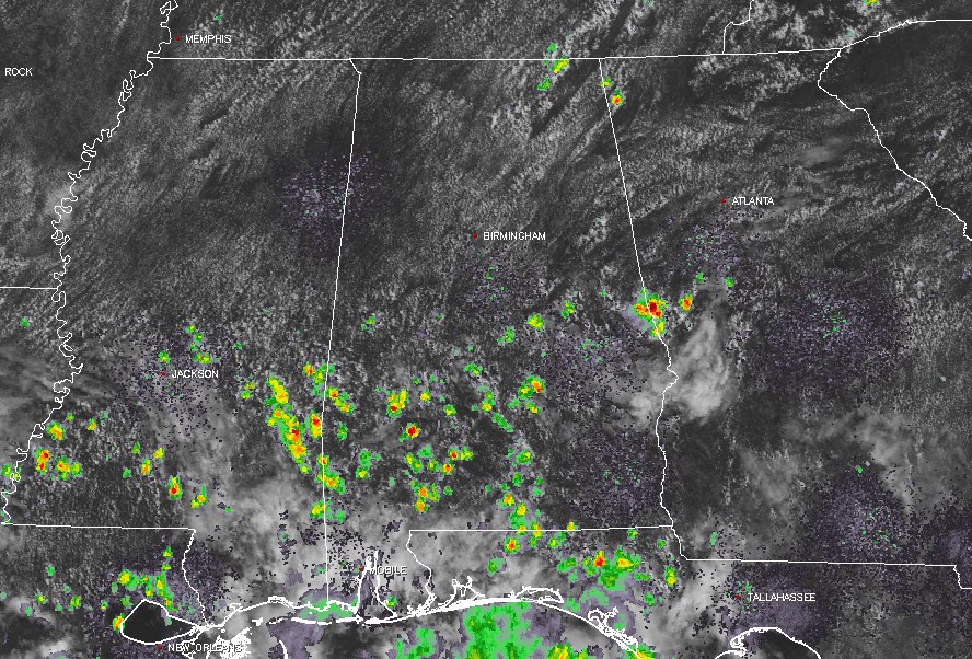
Radar Check At 11:40AM
Showers and thunderstorms have fired up as usual at this time across the southern parts of Central Alabama, with the most impressive storm showing over the AL/GA state line at Chambers County over Huguley and Valley. A few small showers are showing up in Jackson County. All of these are very slow movers, so rainfall totals could be higher.
With radar currently down in both Birmingham and Columbus, Mississippi, we are currently having to rely on other radars from around the area. So pinpoint accuracy will not be as well as usual at this point. BMX radar will be back up later this afternoon, but no word on GWX.
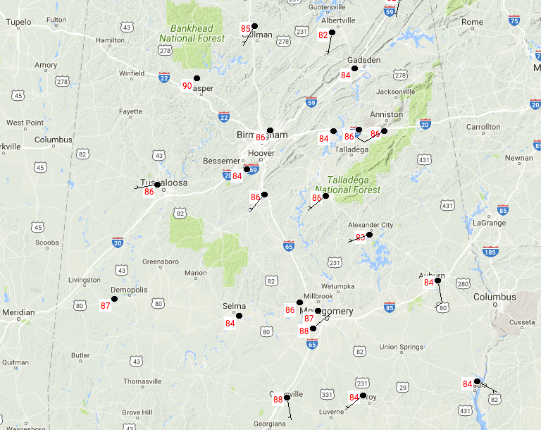
Temperatures At 11:40AM Across Central Alabama
It’s pretty hot out there already as we start our run-up to the midday hour, with temperatures ranging from the middle 80s to the upper 80s. Montgomery is currently the warm spot at 88 degrees, while the cool spot is Alexander City at 83 degrees.
Weather For The Rest Of The Day
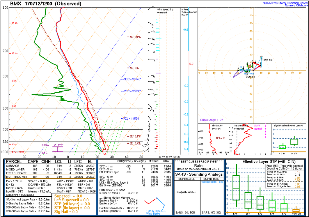
The latest sounding from NWS Birmingham shows that the convective temperature is 89 degrees, and I believe that communities near the Birmingham area may have a tough time reaching that for the high due to all of the rain that fell and soaked the already saturated ground. If Birmingham is able to reach 89 degrees, development over the Magic City will be possible.
With that being said, there is a possibility that these areas could remain dry, but the rest of the area will have the standard 30% chance of afternoon showers and storms. Highs will be in the upper 80s to the lower 90s. Any rain lingering around this evening should diminish, but a few rogue showers could hang on into the late night and overnight hours. Lows will be in the lower to middle 70s.
Thursday’s Weather
It’s the “wash and repeat” summertime forecast for Central Alabama… Skies will start off mostly clear but will begin to cloud up some due to convective heating. We’ll have our standard risk of scattered afternoon and early evening showers and storms. It will be hot and muggy, and afternoon highs will be in the lower to mid 90s. With any summertime storms, lightning will be a major issue. Please use common sense when a thunderstorm approaches… When thunder roars, go indoors.
Road Trippin’ to The Beach
For a detailed look at the weather from Fort Morgan over to Panama City Beach, click here to see the AlabamaWx Beach Forecast Center page. The Beach Forecast is partially underwritten by the support of Brett/Robinson Vacation Rentals in Gulf Shores and Orange Beach. Click here to see Brett/Robinson’s Own Your Summer specials now!
A Look At The Tropics
Remnants of Tropical Depression 4 will be moving near southern Florida by Thursday, but strengthening is unexpected, and all it should do is just enhance the risk for thunderstorms across the peninsula. The rest of the Atlantic Basin is pretty quiet with no development expected throughout the next 5 days.
Today In Weather History
July 12, 1951 – The Kaw River flood occurred. The month of June that year was the wettest of record for the state of Kansas, and during the four days preceding the flood much of eastern Kansas and western Missouri received more than ten inches of rain. Flooding in the Midwest claimed 41 lives, left 200 thousand persons homeless, and caused a billion dollars property damage. Kansas City was hardest hit. The central industrial district sustained 870 million dollars property damage.
WeatherBrains
Don’t forget you can listen to our weekly 90 minute netcast anytime on the web, or on iTunes. This is the show all about weather featuring many familiar voices, including our meteorologists here at ABC 33/40. you can watch it live here on Monday nights at 8:30PM CDT.
Category: Alabama's Weather, ALL POSTS
About the Author (Author Profile)
Scott Martin is an operational meteorologist, professional graphic artist, musician, husband, and father. Not only is Scott a member of the National Weather Association, but he is also the Central Alabama Chapter of the NWA president. Scott is also the co-founder of Racecast Weather, which provides forecasts for many racing series across the USA. He also supplies forecasts for the BassMaster Elite Series events including the BassMaster Classic.Subscribe
If you enjoyed this article, subscribe to receive more just like it.


