

8:15PM Check On Our Weather Situation
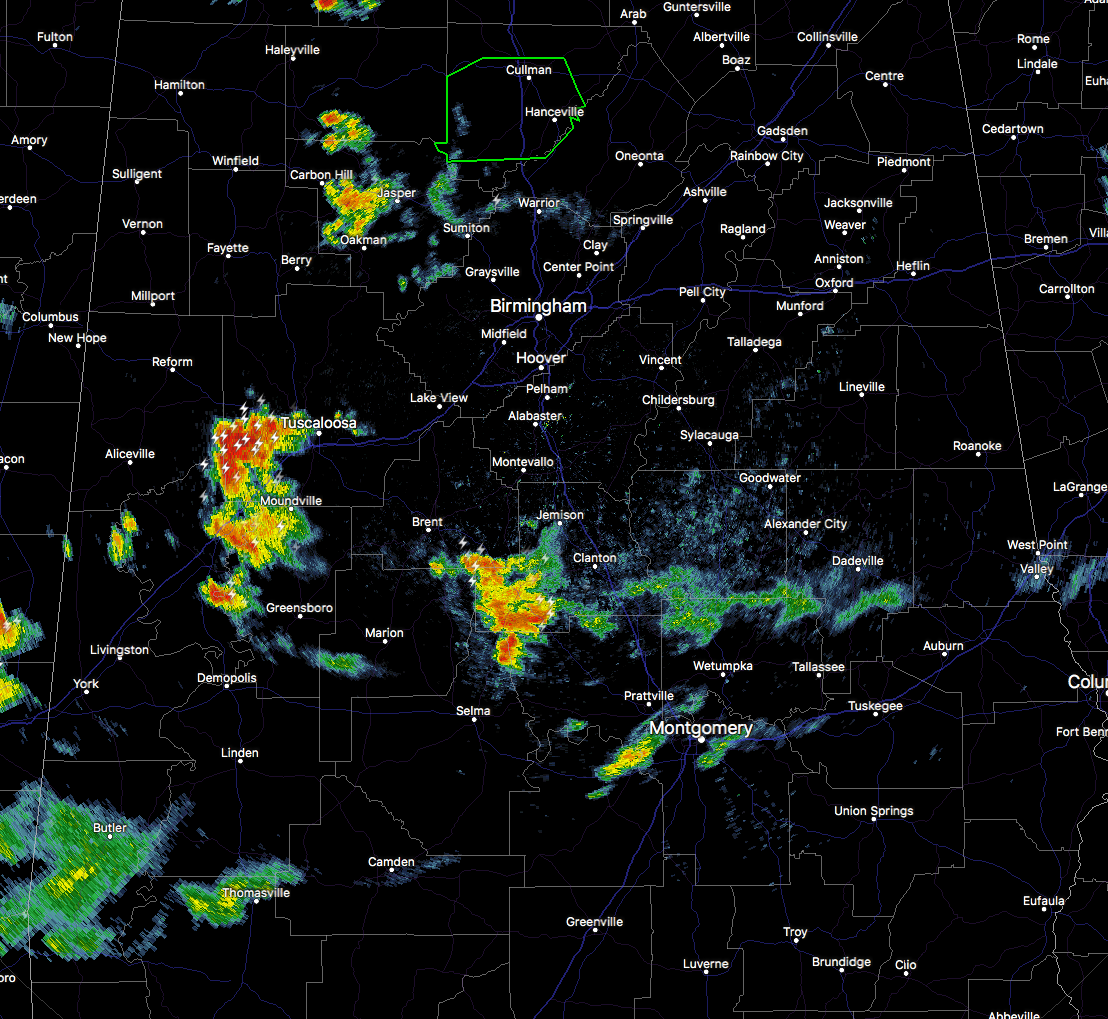
As we have reached dusk across Central Alabama, shower and storm activity is starting to dissipate quickly. We still have one hefty thunderstorm out there over parts of Tuscaloosa, Pickens, Greene, and Hale counties, that is producing torrential rainfall and dangerous cloud-to-ground lightning. Wind gusts up to 40 MPH and pea size hail could be possible as well with this storm. This is the strongest storm on the radar at this point, and it’s moving to the west at 20 MPH.
A Flash Flood Warning continues in effect for much of Cullman County until 9:30 PM, but the good news is that nearly all of the shower activity has moved out of the county and dissipated somewhat.
There are other showers and storms out there, but none are strong at this point. If you see lightning and/or hear thunder with any of these storms, please use common sense and seek shelter. Apparently, two people in Alabama have been struck by lightning today. No word as of yet on the extent of their injuries.
Category: Alabama's Weather, ALL POSTS
About the Author (Author Profile)
Scott Martin is an operational meteorologist, professional graphic artist, musician, husband, and father. Not only is Scott a member of the National Weather Association, but he is also the Central Alabama Chapter of the NWA president. Scott is also the co-founder of Racecast Weather, which provides forecasts for many racing series across the USA. He also supplies forecasts for the BassMaster Elite Series events including the BassMaster Classic.Subscribe
If you enjoyed this article, subscribe to receive more just like it.


