

Hot And Humid At Midday In Central Alabama, Code Orange Air Quality Alert
Is It Warm Enough For You As We Approach The Midday Hour?
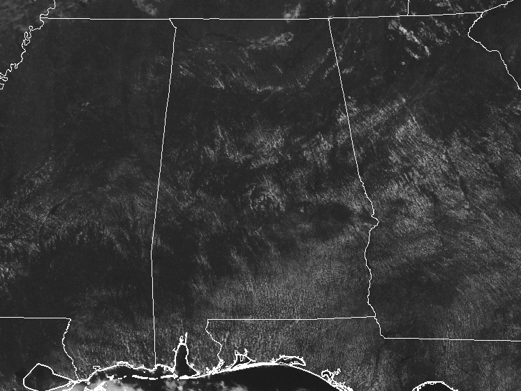
So you can tell that ridging has taken over our weather pattern in Central Alabama. Skies are mainly clear at the 11 o’clock hour, and radar is quiet and should stay that way for nearly everyone in Central Alabama throughout the remainder of the day.
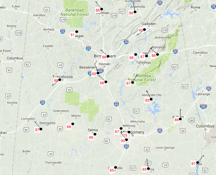
Temperatures are much warmer out there than it was just 24 hours ago. All of Central Alabama are up in the 85-90 degree range with nearly maximum sunshine making it to the surface. We do note that there is a 75 degree reading close to Montgomery, but I believe that is bad data at this point, and it’s actually closer to 88 degrees.
Weather For The Rest Of The Day
It will be a mainly sunny and hot day across Central Alabama, with a very small risk of an isolated shower or storm developing with the heating of the day. The odds of any one spot receiving any rain today will be around 1 in 10. Afternoon highs will be in the lower to mid 90s, and heat index values in the 95-100 degree range. It will be a beautiful but muggy throughout the evening and overnight hours, with lows in the lower to middle 70s.

Code Orange Air Quality Alert For Birmingham
The Alabama Department of Environmental Management has issued a CODE ORANGE Air Quality Alert for Jefferson and Shelby counties, including the Birmingham Metropolitan Area, for Wednesday. Ozone levels near the surface will reach levels that will be unhealthy for sensitive groups.
Thursday’s Weather
Pretty close to the same forecast as today, with the exception that it will be a little warmer. Skies will start off mostly clear but will become partly cloudy with the heating of the day. There will be a very small risk of an isolated afternoon shower or storm for much of the area, with a slightly larger risk for scattered showers and storms in the extreme southeastern parts of Central Alabama. Highs will top out in the middle to the upper 90s for much of the area, and heat index values will be in the 98-105 degree range. Use common sense with the heat.
Road Trippin’ to The Beach
For a detailed look at the weather from Fort Morgan over to Panama City Beach, click here to see the AlabamaWx Beach Forecast Center page. The Beach Forecast is partially underwritten by the support of Brett/Robinson Vacation Rentals in Gulf Shores and Orange Beach. Click here to see Brett/Robinson’s Own Your Summer specials now!
A Look At The Tropics
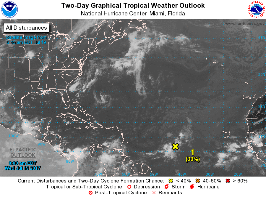
With Tropical Storm Don weakening into an open wave, we only have one area in the Atlantic Basin that needs watching. An area of low pressure is located halfway in between the Lesser Antilles and the Cabo Verde Islands. Some gradual development is expected for the next day or two, then conditions become unfavorable after that. It has a low chance of becoming a tropical cyclone within the next 5 days.
Today In Weather History
July 19, 2006 – The first of two severe thunderstorms hits the St. Louis area, causing the largest power outage in the city’s history with over 570,000 people losing electricity.
WeatherBrains
Don’t forget you can listen to our weekly 90 minute netcast anytime on the web, or on iTunes. This is the show all about weather featuring many familiar voices, including our meteorologists here at ABC 33/40. you can watch it live here on Monday nights at 8:30PM CDT.
Category: Alabama's Weather, ALL POSTS
About the Author (Author Profile)
Scott Martin is an operational meteorologist, professional graphic artist, musician, husband, and father. Not only is Scott a member of the National Weather Association, but he is also the Central Alabama Chapter of the NWA president. Scott is also the co-founder of Racecast Weather, which provides forecasts for many racing series across the USA. He also supplies forecasts for the BassMaster Elite Series events including the BassMaster Classic.Subscribe
If you enjoyed this article, subscribe to receive more just like it.


