

Hazy, Hot, Humid, Heat Advisory
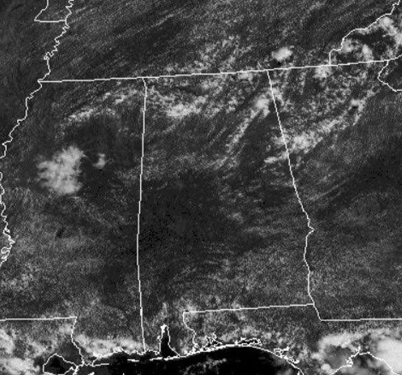
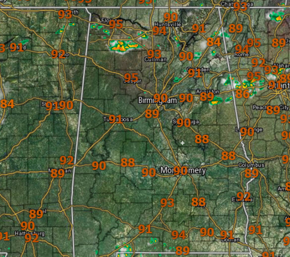
Another mainly sunny and hot afternoon across North/Central Alabama; temperatures well into the 90s and with the downright muggy conditions, those heat indices are heading over 100° in many spots.
Like yesterday, very little heat relief out there, but we are starting to see our daily storms develop and these will persist the rest of the afternoon and into the evening hours.
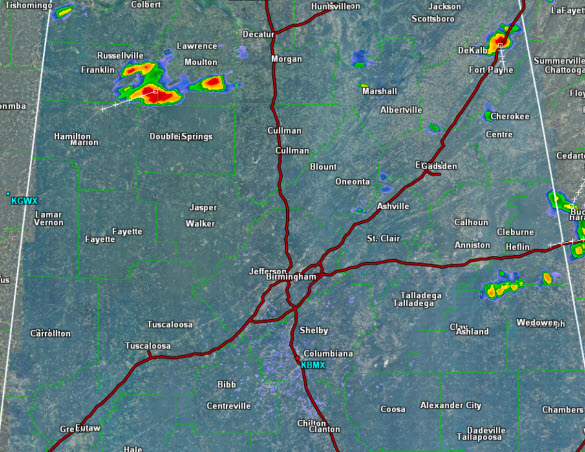
Once again, with an abundance of instability, storms will certainly pack a punch with gusty winds, small hail, torrential rainfall, and frequent and very dangerous lightning. Please, if you hear thunder, head indoors, because if you can hear thunder, you can be struck by lightning, and lightning tends to be the most dangerous threat from summertime convection. Storms will gradually wind down after sunset and you can expect a partly cloudy and very muggy night with lows in the mid 70s.
ANOTHER HEAT ADVISORY: Remains in effect through 9PM this evening as temperatures will range from 93 to 96 degrees this afternoon. Combined with the humidity, this puts the Heat Indices into the 105 to 107 degree range for a few hours this afternoon. Heat related illnesses may be possible for those outdoors in unshaded areas without proper precautions taken.
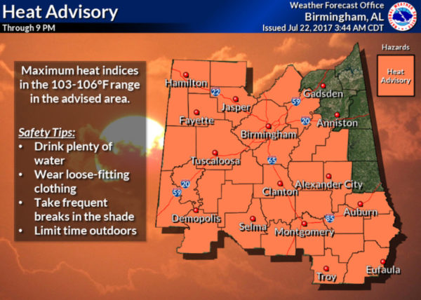
The advisory includes the cities: Hamilton, Sulligent, Vernon, Fayette, Double Springs, Jasper, Oneonta, Carrollton, Tuscaloosa, Birmingham, Hoover, Columbiana, Pelham, Alabaster, Pell City, Moody, Talladega, Sylacauga, Ashland, Livingston, Eutaw, Greensboro, Moundville, Marion, Centreville, Clanton, Rockford, Alexander City, Dadeville, Demopolis, Linden, Selma, Prattville, Fort Deposit, Hayneville, Wetumpka, Tallassee, Montgomery, Tuskegee, Union Springs, Auburn, Opelika, Phenix City, Troy, and Eufaula.
TOMORROW: More of the same for our Sunday, the day should start off dry, but we can’t completely rule out morning shower, but we are expecting a higher coverage of rain and storms in general. This will keep us slightly cooler as highs should be around the 90° mark. Like today, storms will be random and scattered, and no way to know exactly when and where they pop up in advance and will be strong at times.
DEMOPOLIS NOAA WEATHER RADIO IS OFF THE AIR: The Demopolis NOAA Weather Radio transmitter, broadcasting on a frequency of 162.475 MHz, is off the air. We are working with technicians to get it back up and running as soon as possible. In the meantime, please refer to local media and commercial radio for the latest severe weather information. Backup NOAA Weather Radio transmitters are:
Selma, broadcasting on a frequency of 162.450 MHz, and
Tuscaloosa, broadcasting on a frequency of 162.400 MHz.
Keep in mind that not all backup transmitters will tone for your specific county, so please stay weather aware during the outage.
Category: Alabama's Weather, ALL POSTS
About the Author (Author Profile)
Macon, Georgia Television Chief Meteorologist, Birmingham native, and long time Contributor on AlabamaWX. Stormchaser. I did not choose Weather, it chose Me. College Football Fanatic. @Ryan_StinnetSubscribe
If you enjoyed this article, subscribe to receive more just like it.


