

Heat and Humidity, Scattered Showers/Storms
Click image to enlarge.
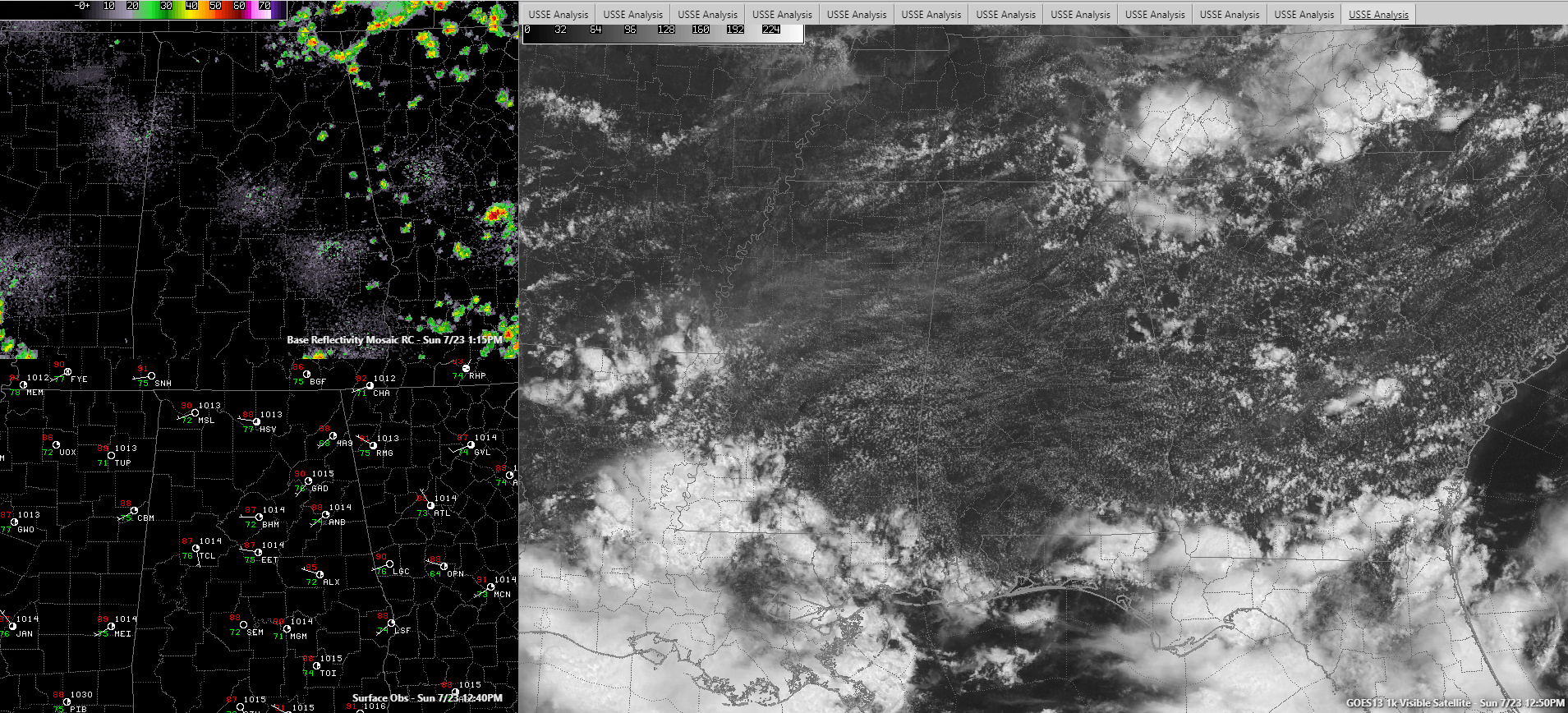
A hot July Sunday afternoon is in progress across North and Central Alabama. Showers were beginning to develop over the northeastern quarter of Alabama, where instability levels and elevations are higher. An outflow boundary was clearly evident on visible satellite over Northwest Alabama. This boundary will push southeastward through the afternoon, hopefully triggering some cooling showers and storms. There is another one behind that one over southern Tennessee. It will also push into Alabama this afternoon.
Temperatures are running a degree or two cooler than those of yesterday, thanks to some early morning low-level clouds and fog. Highs will still top out in the lower and middle 90s unless storms get in the way.
Any heavy rainfall will be brief since wind shear is about as light as it gets and storms will collapse nearly as fast as they go up. Damaging winds don’t look like they will be a problem today, despite more dry air aloft today than yesterday.
HEAT ADVISORY IN EFFECT: Temperatures in the lower and middle 90s this afternoon along with high humidity will produce heat index values between 103 and 106F. This can result in heat illness for people playing or working in unshaded environments without proper cooling.
ANY RELIEF IN SIGHT? Actually, there is. The past couple of days, Alabama has mostly been influenced by a broad upper low in the Gulf of Mexico. The westerlies have been to the north like they usually are in summer. But a decent upper-level trough is swinging into the Midwest, and this trough will help to carve out a deeper longwave trough over the next couple of days. Today should feature scattered showers and storms, aided by outflow boundaries arriving from the north.
BY TOMORROW, TUESDAY: More scattered showers and storms are in store for North and Central Alabama as the trough digs more deeply over the East and a cold front stalls out over North and Northeast Alabama. Neither day will be a washout, but rain chances should be roughly around one out of two. Average rainfall amounts will be around one-half to one inch.
Category: Alabama's Weather, ALL POSTS
About the Author (Author Profile)
Bill Murray is the President of The Weather Factory. He is the site's official weather historian and a weekend forecaster. He also anchors the site's severe weather coverage. Bill Murray is the proud holder of National Weather Association Digital Seal #0001 @wxhistorianSubscribe
If you enjoyed this article, subscribe to receive more just like it.


