

Storms Blowing Up Over Eastern Jefferson County
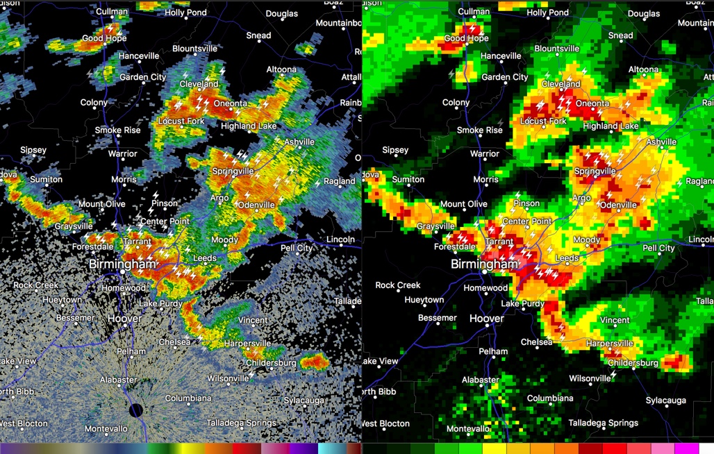
Left side: reflectivity Right side: composite reflectivity
The storms over eastern Jefferson County are intensifying right now, with tops of the thunderstorms over 50,000 feet.
Heavy rain is falling from near the Airport to Irondale and Grants Mill Road down to Highway 119.
There is a tremendous amount of precipitation currently being held aloft over northeastern Jefferson County which could produce strong downburst winds when the storms collapse. Lots of torrential rain and lightning as well.
An areal flood advisory was issued for parts of St. Clair County, where rainfall has been heavy.
Other strong storms are over northern Walker, Blount and Cleburne Counties.
Be alert if you are driving in thunderstorm areas and be inside when lightning is happening near you.
Category: Alabama's Weather, ALL POSTS
About the Author (Author Profile)
Bill Murray is the President of The Weather Factory. He is the site's official weather historian and a weekend forecaster. He also anchors the site's severe weather coverage. Bill Murray is the proud holder of National Weather Association Digital Seal #0001 @wxhistorianSubscribe
If you enjoyed this article, subscribe to receive more just like it.


