

Flash Flood Watches Issued For Parts of Central and North Alabama for Friday
Heavy rain is possible on Friday across Alabama and with recent heavy rain, flooding is a possibility.
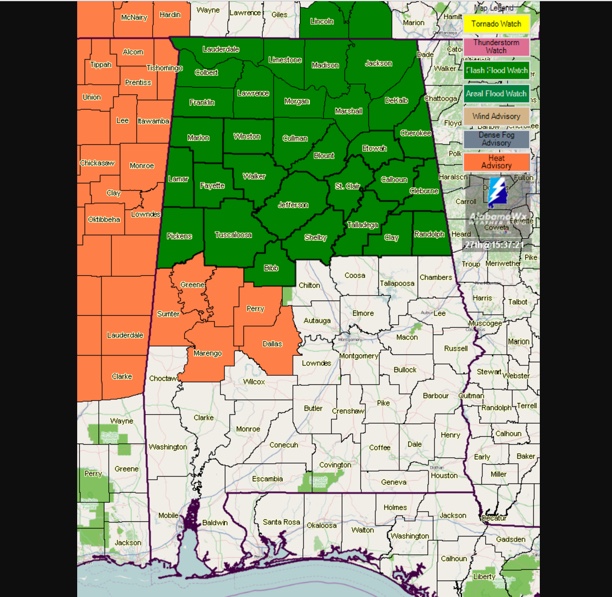
Consequently, the National Weather Service has issued flash flood watches for North and Central Alabama.
The one from the NWS Birmingham goes into effect at 10 a.m. on Friday for Bibb, Blount, Calhoun, Cherokee, Clay, Cleburne, Etowah, Fayette, Jefferson, Lamar, Marion, Pickens, Randolph, Shelby, St. Clair, Talladega, Tuscaloosa, Walker and Winston Counties. It is in effect until midnight Friday night.
The one from the NWS Huntsville goes into effect at 9 a.m. on Friday for Colbert, Cullman, De Kalb, Franklin, Jackson, Lauderdale, Lawrence, Limestone, Madison, Marshall and Morgan Counties. It is in effect until 9 p.m. Friday evening.
At least two rounds of showers and storms are expected to migrate southward across Alabama ahead of a decent cold front.
Severe weather is also a possibility with damaging winds the main threat.
Category: Alabama's Weather, ALL POSTS
About the Author (Author Profile)
Bill Murray is the President of The Weather Factory. He is the site's official weather historian and a weekend forecaster. He also anchors the site's severe weather coverage. Bill Murray is the proud holder of National Weather Association Digital Seal #0001 @wxhistorianSubscribe
If you enjoyed this article, subscribe to receive more just like it.


