

A Marginal Risk For Severe Weather In North/Central Alabama Today
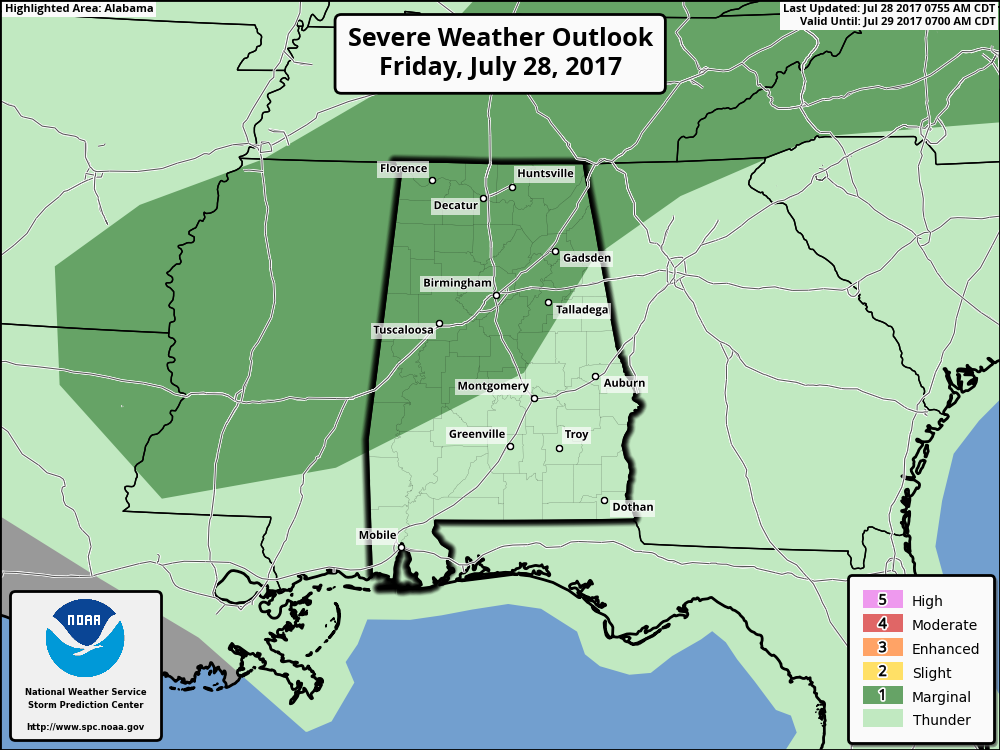
The Storm Prediction Center updated their Day 1 Severe Weather Outlook for today and they have reintroduced a marginal risk for severe storms for nearly all of North/Central Alabama.
We will have even more thunderstorm development out ahead of a surface cold front approaching from the north. Strong to a few isolated severe storms are possible in the marginal risk area throughout the day and into the evening hours. If any storms go severe, the main threat will be from damaging thunderstorm winds of 60 MPH or greater.
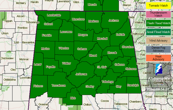
A Flash Flood Watch is in effect for much of North/Central Alabama through this evening. Pockets of hevier rainfall are possible with today’s event where totals of 1-2 inches could fall. With our already saturated soil situation, this could easily lead to ponding and flash flooding. As we’ve seen earlier this week, flooding can happen rather quickly.
Category: Alabama's Weather, ALL POSTS
About the Author (Author Profile)
Scott Martin is an operational meteorologist, professional graphic artist, musician, husband, and father. Not only is Scott a member of the National Weather Association, but he is also the Central Alabama Chapter of the NWA president. Scott is also the co-founder of Racecast Weather, which provides forecasts for many racing series across the USA. He also supplies forecasts for the BassMaster Elite Series events including the BassMaster Classic.Subscribe
If you enjoyed this article, subscribe to receive more just like it.


