

Showers & Storms Continue At Midday, Marginal Risk Expands
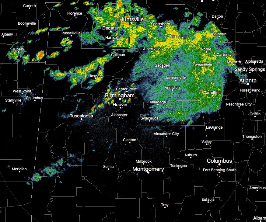
Radar Check As We Approach The Noon Hour
Most of the rain activity at this time is currently located mainly east of I-65 and north of I-20, but we do have some showers approaching the Birmingham Metropolitan Area and more developing in the northwestern parts of the state as well.
A Flash Flood Warning continues in effect for portions of Madison, Lauderdale, Limestone, Morgan, and Lawrence counties until 3:00 PM this afternoon.
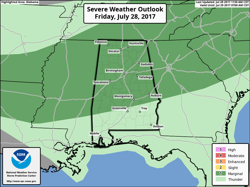
The Storm Prediction Center has expanded the Marginal Risk for severe storms to include nearly all of North/Central Alabama throughout the rest of today and into the early morning hours on Saturday. The main risk will be from wet microburst winds of 60 MPH or more.
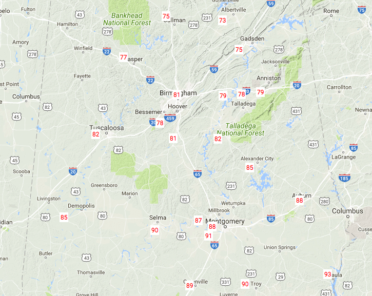
Temperatures Across Central Alabama
Where there is cloud cover and rain-cooled air, temperatures are being held back, but the sunshine is keeping the southern parts of Central Alabama rather hot at this point. Temperatures range from the middle 70s in the northern parts to the lower 90s to the south. The cool spot is currently Cullman at 75 degrees, with Eufaula as the warm spot at 93 degrees.
For The Rest Of Today
We’ll continue to have an increased risk of numerous showers and thunderstorms throughout Central Alabama for the rest of the afternoon and evening hours. At this point, the Storm Prediction Center continues to have much of the area in a marginal risk for severe storms, with the main risk coming from damaging thunderstorm downburst winds of 60 MPH or greater. A flash flooding potential is there today as well, so please use common sense if you see flood waters covering roadways… turn around, don’t drown. Afternoon highs will be in the mid to upper 80s for the northern half of the area, with upper 80s to the mid-90s to the south. Rain chances will be greatest north of a line from Tuscaloosa to Alexander City during the day, but shifting southward slowly as the day progresses, and will continue into the late night. Overnight lows will be in the lower to mid-70s.
The Central Alabama Weekend
Saturday will feature much drier air moving into the northern parts of Central Alabama, and the latest data suggest that locations north of a line from Tuscaloosa to Anniston will remain dry. Clouds will be on the decrease, and so will the dewpoints. South of that line, showers and storms will be likely, especially the farther south you go. Afternoon highs will be in the mid to upper 80s throughout the area.
Sunday could start off rather cool for late summer in Central Alabama… Early morning lows could start off in the upper 50s to the lower 60s in a few locations. Skies will be clear, and afternoon highs will be in the upper 80s to near 90 degrees. With much drier air in place, those highs will feel not as oppressive.
Beach Forecast
For a detailed look at the weather from Fort Morgan over to Panama City Beach, click here to see the AlabamaWx Beach Forecast Center page.
The Beach Forecast is partially underwritten by the support of Brett/Robinson Vacation Rentals in Gulf Shores and Orange Beach. Click here to see Brett/Robinson’s Own Your Summer specials now!
Tropical Outlook
A tropical wave located out in the central Atlantic Ocean has shown some signs of dissipating since yesterday. Environmental conditions will be less favorable for tropical cyclone development throughout the next several days and only has a 20% chance for development within the next 5 days.
On This Day In Weather History
1819 – A small but intense hurricane passed over Bay Saint Louis, MS. The hurricane was considered the worst in fifty years. Few houses were left standing either at Bay Saint Louis or at Pass Christian, and much of the Mississippi coast was desolate following the storm. A U.S. cutter was lost along with its thirty-nine crew members. The storm struck the same area that was hit 150 years later by Hurricane Camille.
WeatherBrains
Check out the show at www.WeatherBrains.com. You can also subscribe on iTunes. You can watch the show live at live.bigbrainsmedia.com on Monday nights starting at 8:30 PM CDT. You will be able to see the show on the James Spann 24×7 weather channel on cable or directly over the air on the dot 2 feed.
Category: Alabama's Weather, ALL POSTS
About the Author (Author Profile)
Scott Martin is an operational meteorologist, professional graphic artist, musician, husband, and father. Not only is Scott a member of the National Weather Association, but he is also the Central Alabama Chapter of the NWA president. Scott is also the co-founder of Racecast Weather, which provides forecasts for many racing series across the USA. He also supplies forecasts for the BassMaster Elite Series events including the BassMaster Classic.Subscribe
If you enjoyed this article, subscribe to receive more just like it.


