

Drier Air Arriving Slowly
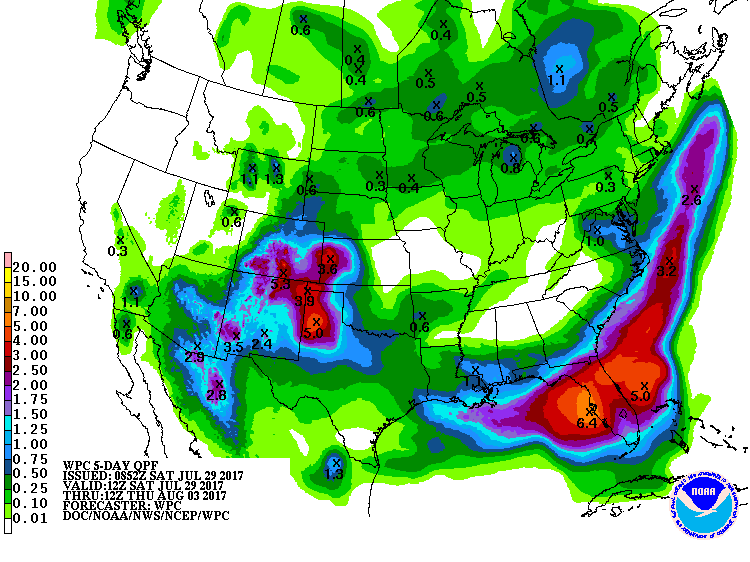
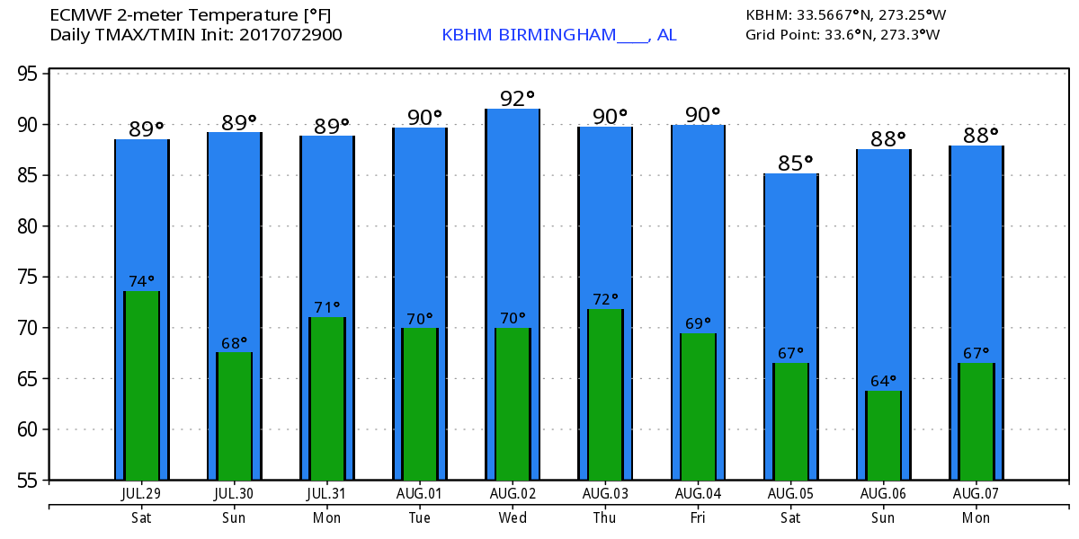
The cold front that was poised to move into Alabama yesterday has reached the Interstate 20 corridor this morning, however, the drier air seen with much lower dew points was lagging behind the front and was still located across northern Middle Tennessee. Dew points were in the middle and lower 60s from Nashville northward. Rain was confined to the southern portion of Alabama and along the Gulf coast. Dew points should be slowly falling today as the drier air makes its way slowly into Central Alabama from the north. You should be able to feel a difference by late afternoon or very early evening. Highs today will be in the upper 80s.
The troughiness along the East Coast will remain in place for the next several days keeping the eastern half of the country out of any excessive heat. The trough will slowly weaken over the next five days. But the important thing to note is that the troughiness remains over the eastern half of the country. Traveling short waves moving along the US-Canadian border will continue maintain the trough position over the eastern US. This essentially keeps us dry through the latter part of the week.
A strong impulse in the Friday/Saturday time frame will help to reinforce the trough and sharpen it up a bit. This impulse will drag a front down into the Ohio and Tennessee River valleys on Friday and Saturday. This along with gradual moisture increase by the latter part of the week will require the mention of scattered showers once again. But it does look like we should remain dry through mid-week. Temperatures will remain at and slightly below the 30-year averages for late July and early August. Our average high in Birmingham should be around 91 and our highs should stay in the 87 to 90 range for the week ahead. Those temperatures along with the lowered humidity should make it feel fairly nice, warm but not overly oppressive.
All is quiet across the Atlantic basin, and tropical storm formation is not expected over the next several days. The eastern North Pacific was busier with Irwin and Hilary though neither was a threat to land.
Shower chances are pretty high today for the beach areas of Alabama and Northwest Florida. It should be dry Sunday and Monday with only small chances of showers returning by Tuesday and into the latter half of the week ahead. You can expect to see highs in the middle and upper 80s. Click here to see the AlabamaWx Beach Forecast Center page. The Beach Forecast is partially underwritten by the support of Brett/Robinson Vacation Rentals in Gulf Shores and Orange Beach. Click here to see Brett/Robinson’s Own Your Summer specials now!
Don’t forget you can listen to our weekly 90 minute netcast anytime on the web, or on iTunes. This is the show all about weather featuring many familiar voices, including our meteorologists here at ABC 33/40.
Looking out into voodoo country, the GFS maintains the eastern US trough through about the 12th of August when it builds the upper ridge across the southern tier of the US once again. This pattern would mean our heat levels go up as we get into the middle of August pretty much as we would expect to see.
I’ll have the next Weather Xtreme Video posted here on Sunday morning around 7 am or so. Be sure to check back often for updates on Alabama weather. Have a great day and Godspeed.
-Brian-
Category: Alabama's Weather, ALL POSTS
About the Author (Author Profile)
Brian Peters is one of the television meteorologists at ABC3340 in Birmingham and a retired NWS Warning Coordination Meteorologist. He handles the weekend Weather Xtreme Videos and forecast discussion and is the Webmaster for the popular WeatherBrains podcast.Subscribe
If you enjoyed this article, subscribe to receive more just like it.


