

Strong Storms Out There Tonight With Flooding Issues
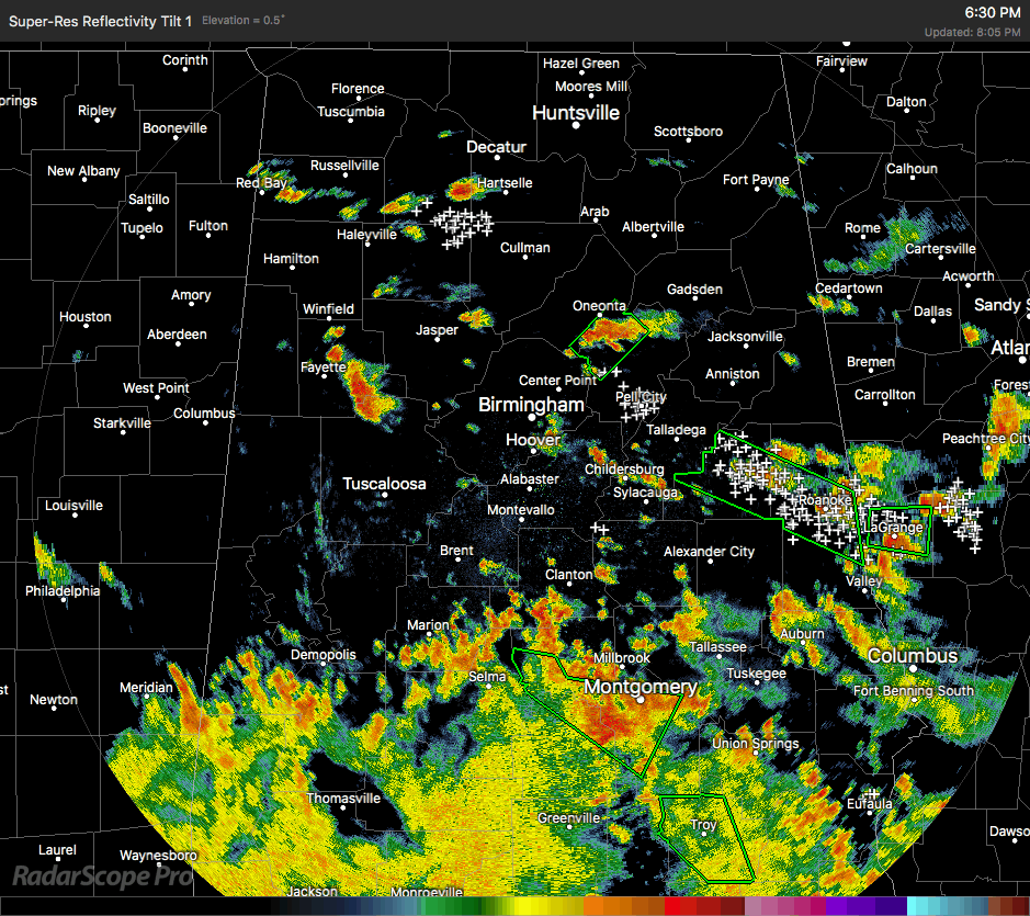
We have multiple storms out there as we have passed the top of the 8 o’clock hour in Central Alabama, some of which are causing some flood issues. The strongest storm on the radar is currently located over parts of Winston and Lawrence counties slowly moving to the east. I would not be surprised if an areal flood advisory will be issued on this storm within the next few minutes unless it starts to dissipate.
Heavy rain continues to fall on parts of Blount and St. Clair counties where a Flash Flood Warning is currently in effect until 8:45 PM. We’ll have to see if that will be extended or allowed to expire.
Another large storm continues to dump copious amounts of rain over parts of Clay, Randolph, and Chambers counties. A Flash Flood Warning is in effect for this area as well until 11:00 PM.
These storms should start to dissipate within the next hour or so and should be mostly done with by midnight-2:00 AM time frame on Friday morning. All of these storms are slow movers and will put down heavy amounts of rainfall until they dissipate. A few more advisories or warnings may be needed.
Category: Alabama's Weather, ALL POSTS
About the Author (Author Profile)
Scott Martin is an operational meteorologist, professional graphic artist, musician, husband, and father. Not only is Scott a member of the National Weather Association, but he is also the Central Alabama Chapter of the NWA president. Scott is also the co-founder of Racecast Weather, which provides forecasts for many racing series across the USA. He also supplies forecasts for the BassMaster Elite Series events including the BassMaster Classic.Subscribe
If you enjoyed this article, subscribe to receive more just like it.


