

Hot And Dry In Central Alabama At The Midday Hour
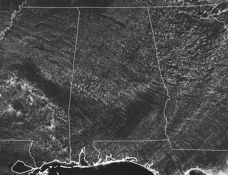
Not a drop can be found on the radar as we are approaching the 1 o’clock hour in the afternoon in Central Alabama. Looking at the skies, we have a mix of sun and clouds at this point. Current temperature readings show that we are ranging throughout the middle 80s to the lower 90s in the area. Birmingham is currently at 88 degrees, while the warm spots are Eufaula and Montgomery at 91 degrees.
WEATHER FOR THE REMAINDER OF THE DAY
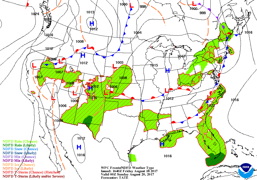
With drier air approaching Central Alabama today, will have a small risk for isolated afternoon and evening showers or thunderstorms. Most everyone in the area will remain dry, and the odds for any one location getting any rain today is around 1-in-5. Skies will be partly cloudy and afternoon highs will be in the upper 80s to the lower 90s. Skies will be mostly clear for the evening and overnight hours, and any rain that is out there will have diminished by sunset. Overnight lows will be in the upper 60s to the middle 70s.
TOMORROW’S WEATHER
A cold front will begin to move through Central Alabama tomorrow morning, and this will bring drier air to the area. There will be a slight risk of isolated showers and storms for the southern half of the area, but those chances will diminish as the front continues to move south. Afternoon highs will be in the lower to middle 90s.
BEACH FORECAST
For a detailed look at the weather from Fort Morgan over to Panama City Beach, click here to see the AlabamaWx Beach Forecast Center page. The Beach Forecast is partially underwritten by the support of Brett/Robinson Vacation Rentals in Gulf Shores and Orange Beach. Click here to see Brett/Robinson’s Hot Deals now!
ACTIVE TROPICS
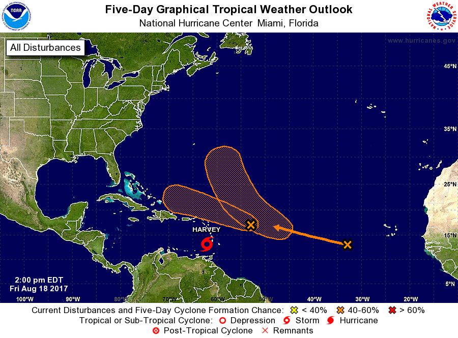
Tropical Storm Harvey is chugging along westward at 21 MPH in the Eastern Caribbean Sea and is forecast to make landfall as a tropical storm in Belize on Tuesday afternoon after brushing the Honduras coastline on Monday.
Invest 92L is racing its way into less favorable conditions, and the odds of it becoming a depression/storm are dropping. It’s moving to the west-northwest at 20 MPH, and the chances of it forming into a storm/depression within the next 5 days are down to 60%.
The third disturbance has a while to go before it becomes a threat to any landmass. It is forecast to gradually strengthen and become a little better organized but only has a 40% chance of developing into a depression or storm within the next 5 days.
Stay up-to-date with the latest posts in the Tropical Weather category on the AlabamaWx Weather Blog home page.
WEATHERBRAINS
Check out the show at www.WeatherBrains.com. You can also subscribe on iTunes. You can watch the show live at live.bigbrainsmedia.com on Monday nights starting at 8:30 PM CDT. You will be able to see the show on the James Spann 24×7 weather channel on cable or directly over the air on the dot 2 feed.
Category: Alabama's Weather, ALL POSTS
About the Author (Author Profile)
Scott Martin is an operational meteorologist, professional graphic artist, musician, husband, and father. Not only is Scott a member of the National Weather Association, but he is also the Central Alabama Chapter of the NWA president. Scott is also the co-founder of Racecast Weather, which provides forecasts for many racing series across the USA. He also supplies forecasts for the BassMaster Elite Series events including the BassMaster Classic.Subscribe
If you enjoyed this article, subscribe to receive more just like it.


