

Blanketed By A Cumulus Cloud Deck At Midday, But Showers Are Expected Later Today
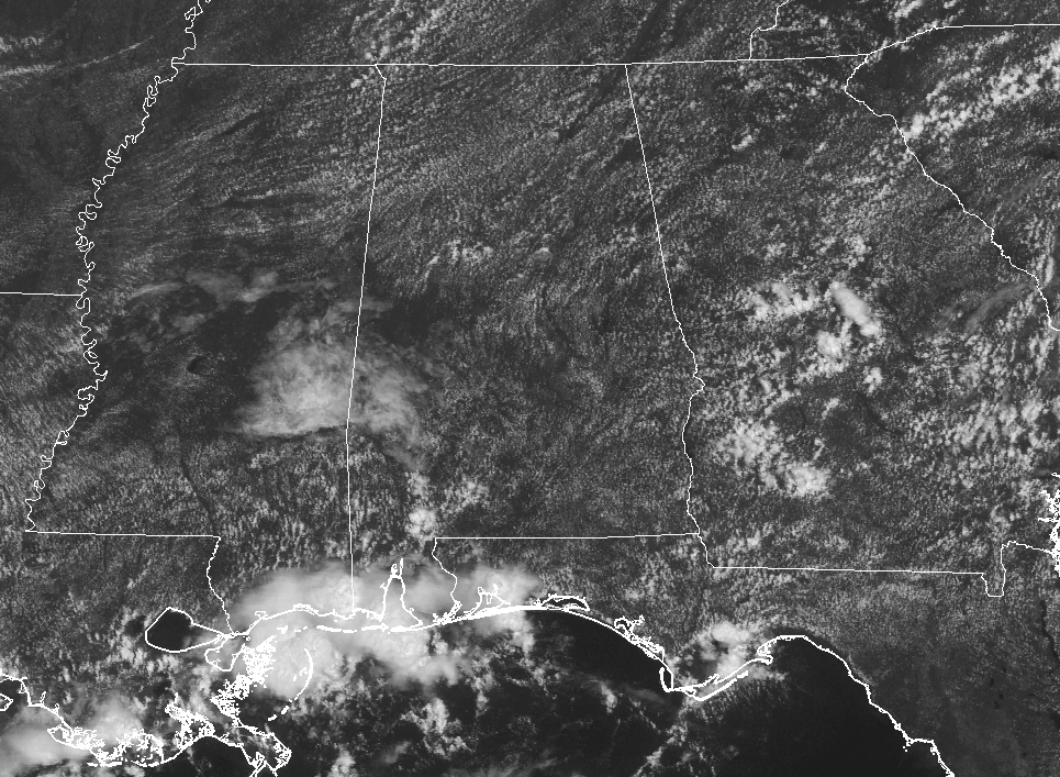
At 11:50 AM, we have a field of cumulus clouds over nearly all at Central Alabama, but no rainfall under those clouds at this point. The nearest showers in the state are located in the extreme southwestern parts of the state affecting places such as Monroeville, Bayou La Batre, and Dauphin Island.
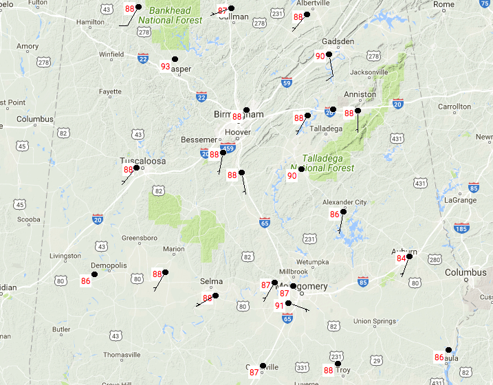
Temperatures across Central Alabama are ranging in the mid-80s to the low-90s, with Montgomery topping out as the warm spot at 91 degrees. Birmingham is currently at 88 degrees.
A Few Scattered Storms Possible This Afternoon and Evening
We’ll have scattered showers and thunderstorms form during the afternoon hours, but we’ll have a boundary pushing in giving us an extra increase in activity later this evening and into tonight, especially as we enter into the pre-dawn hours of Wednesday. Afternoon highs will top out in the low to mid-90s, with lows in the low to mid-70s.
Wednesday’s Weather
The surface front will be approaching from the north and this will bring an increased risk for scattered to numerous showers and thunderstorms throughout the daytime and into the night time hours. Severe weather is not likely at this point, but a few storms could be strong with winds up to 40 MPH. Drier air will start to move in from the north during the late night and overnight hours, but rain chances will continue for the southern half of the area. Afternoon highs will be in the mid-80s to the low-90s from north to south.
Taking A Peek At The Tropics
The rebirth of Harvey is likely and could possibly become a category one hurricane before moving onto the southeastern Texas coast on Friday. It is forecast to move to the northeast and bring plenty of rain to Louisiana and Mississippi, and even to Alabama by Sunday.
Invest 92L is close to the Bahamas and will probably meander around the Florida Peninsula for a few days before ultimately being forced out to sea by a deep trough that will form over the eastern U.S.
Stay up-to-date with the latest posts in the Tropical Weather category on the AlabamaWx Weather Blog home page. Click here to see the latest on the Tropical Weather.
Got Beach Plans?
For a detailed look at the weather from Fort Morgan over to Panama City Beach, click here to see the AlabamaWx Beach Forecast Center page.
The Beach Forecast is partially underwritten by the support of Brett/Robinson Vacation Rentals in Gulf Shores and Orange Beach. Click here to see Brett/Robinson’s Hot Deals now!
Advertise With Us!
Now is the time to set your marketing campaign on AlabamaWX. The site has enjoyed a 71% jump in page views this year! The website has already enjoyed 10,157,915 page views this year. We can customize a creative, flexible and affordable package that will suit your organization’s needs. Contact Bill Murray at (205) 687-0782.
E-Forecast
Get the AlabamaWx seven-day forecast delivered directly to your inbox by email twice daily. It is the most detailed weather forecast available in Central Alabama. Click here to subscribe. It’s free!
WeatherBrains
On last night’s show, the panel entertained Craig Fugate, former Director of FEMA. Check out the show at www.WeatherBrains.com. You can also subscribe on iTunes. You can watch the show live at live.bigbrainsmedia.com on Monday nights starting at 8:30 PM CDT. You will be able to see the show on the James Spann 24×7 weather channel on cable or directly over the air on the dot 2 feed.
Category: Alabama's Weather, ALL POSTS
About the Author (Author Profile)
Scott Martin is an operational meteorologist, professional graphic artist, musician, husband, and father. Not only is Scott a member of the National Weather Association, but he is also the Central Alabama Chapter of the NWA president. Scott is also the co-founder of Racecast Weather, which provides forecasts for many racing series across the USA. He also supplies forecasts for the BassMaster Elite Series events including the BassMaster Classic.Subscribe
If you enjoyed this article, subscribe to receive more just like it.


