

Notes on Nate As We Approach 10 p.m.
We have been busy with severe weather here in Central Alabama so we haven’t had as much time to follow the progress of Nate.
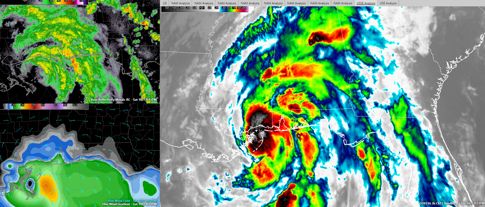
The center of Hurricane Nate is 40 miles south of Gulfport MS as this hour.
Movement is to the N at 20 mph This motion will bring the center ashore on the Mississippi Coast near Gulfport around midnight
Top winds are 85 mph. The Air Force Plane recently found flight level winds of 92 mph. So this means sustained winds are probably around 80 mph.
Fortunately, the steady intensification we observed last night and this morning leveled off during the day.
Still, winds and surge are having a big impact along the Mississippi and Alabama coasts. The surge at Pascagoula was recently reported to be 3.2 feet with about 40 roads across southern Jackson County covered by surge.
Tornadoes continue to be a big problem. There are currently two tornado warnings in effect for Baldwin County.
The strongest winds will affect the Mississippi coast especially from Biloxi to Pascagoula.
Winds recently gusted to 42 knots (48 mph) at the Pensacola Naval Air Station. Winds at Jack Edwards Airport in Gulf Shores are gusting to 35 mph. At the Mobile Regional Airport, winds are gusting to 35 mph.
Water levels are running 2.5 feet above normal at Dauphin Island and 2.6 feet above normal at the Alabama State Docks in Mobile. The surge will increase dramatically to the east of the center once it crosses the coastline.
Moderate to occasionally heavy rain is falling across much of North Central Alabama with the main rain shield now moving into Southwest Alabama. At least one more wave of rain will move across Central Alabama after midnight before a lull sets in. Then the main rain shield will arrive in South Central Alabama by 3 a.m. It will move northeast through the morning hours, affecting the Tuscaloosa/Birmingham areas between 9 a.m. and 3 p.m. and Northeast Alabama during the afternoon.
About the Author (Author Profile)
Bill Murray is the President of The Weather Factory. He is the site's official weather historian and a weekend forecaster. He also anchors the site's severe weather coverage. Bill Murray is the proud holder of National Weather Association Digital Seal #0001 @wxhistorianSubscribe
If you enjoyed this article, subscribe to receive more just like it.


