

Latest On Hurricane Nate As We Approach 3:00 AM
As of the last update from the NHC at 1:00 AM, maximum sustained winds were around 85 MPH. Some weakening has occurred, but we’ll know the latest on wind strength at 4:00 AM.
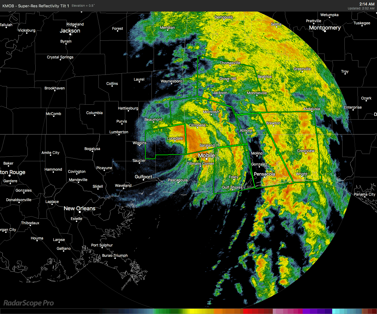
Wind gusts in South Alabama are really starting to pick up as the center of Nate continues to push inland. The center is currently moving in a northeasterly motion, now over Lucedale, Mississippi and west of Mobile at the moment. The Alabama Gulf Coast should be seeing the strongest winds at this point.
Several stations in Mobile have reported wind gusts up over 60 MPH, including a 66 MPH wind gust at Mobile Regional Airport.
Flash flood warnings continue in effect for Baldwin, Conecuh, Covington, Escambia, and Monroe Counties.
At this point there are no tornado warnings in effect along the coast or immediately inland.
At this point, only a few reports of damage or power outages have come in. A carport was removed from a home due to winds, along with windows blown out in a single residence in Waynesboro, Mississippi.
About the Author (Author Profile)
Scott Martin is an operational meteorologist, professional graphic artist, musician, husband, and father. Not only is Scott a member of the National Weather Association, but he is also the Central Alabama Chapter of the NWA president. Scott is also the co-founder of Racecast Weather, which provides forecasts for many racing series across the USA. He also supplies forecasts for the BassMaster Elite Series events including the BassMaster Classic.Subscribe
If you enjoyed this article, subscribe to receive more just like it.


