

Much of Central Alabama In A Marginal Risk For Severe Storms On Saturday
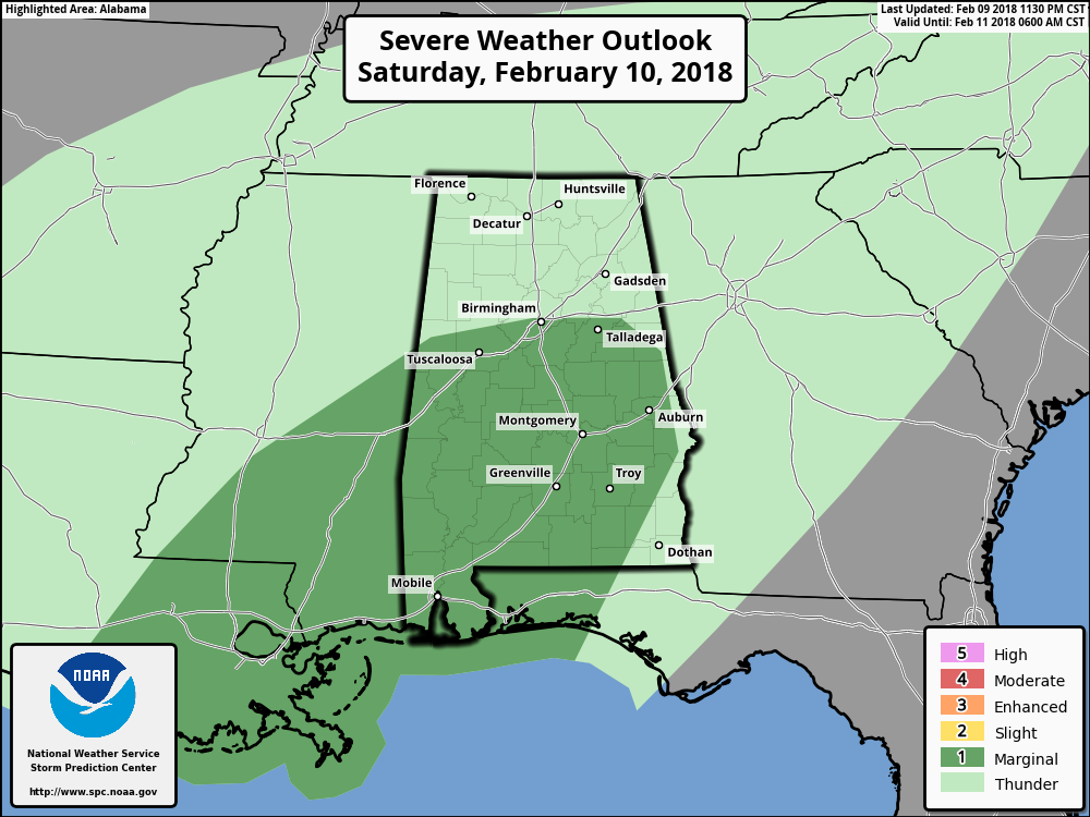
The Storm Prediction Center has nearly all of Central Alabama south of a line from Reform to Birmingham to Wedowee in a Marginal Risk for severe storms on its day one outlook (6 AM Sat. – 6 AM Sun.). All modes of severe weather will be possible in the risk area… isolated damaging wind gusts up to 60 MPH, marginally severe hail, and a few isolated tornadoes.
With Central Alabama being in a very moist and warm airmass, the atmosphere will be marginally supportive of supercells with a low-end threat for damaging winds and an isolated tornado or two. Marginally severe hail is possible but will be limited by modest mid-level lapse rates.
Convective development will be likely during the late morning through the mid-afternoon hours as surface-based instability values will be in the 500-750 J/kg range, and shear values will be high enough to support rotating updrafts. Dewpoints will be reaching the lower to mid-60s by the mid-afternoon hours as well.
Category: ALL POSTS, Severe Weather
About the Author (Author Profile)
Scott Martin is an operational meteorologist, professional graphic artist, musician, husband, and father. Not only is Scott a member of the National Weather Association, but he is also the Central Alabama Chapter of the NWA president. Scott is also the co-founder of Racecast Weather, which provides forecasts for many racing series across the USA. He also supplies forecasts for the BassMaster Elite Series events including the BassMaster Classic.Subscribe
If you enjoyed this article, subscribe to receive more just like it.


