

Stormy Later Today
The sky was mostly cloudy for the northern two-thirds of Alabama this morning with temperatures quite mild with most of the state in the 60s. Keep in mind our 30-year average low for late February is 39 degrees. There were a few showers on radar this morning across the western sections of the state, but the main show will come tonight as an upper trough swings by and a surface front moves into Central Alabama.
SPC has a small chunk of the northwestern corner of Alabama in an enhanced area while the slight risk for severe storms covers about the northwestern quadrant of the state.
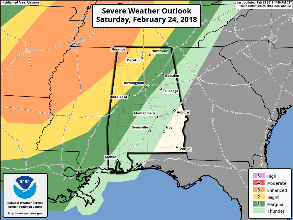
Storms are expected to develop later today in the ARK-LA-TEX area and move eastward as the strong short wave over the Four Corners Area accelerates rapidly northeastward with a strong surface low developing in the vicinity of Northeast Oklahoma. CAPE values should be in the 700 to 900 range while storm relative helicity values will be in the 300 to 500 range. The upper ridge will help to keep much of the dynamics to our north as the overall system weakens coming into Alabama. Still, there is definitely a risk for severe weather tonight into early Sunday morning, so be sure to have a way to receive weather warnings especially while sleeping.
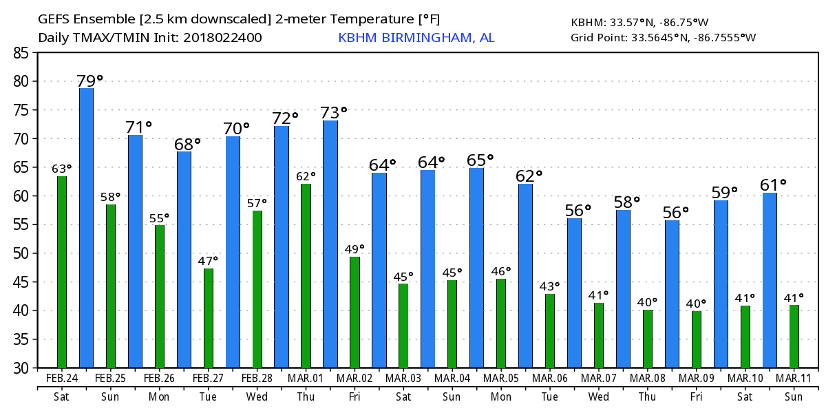
The front pushes into the Southeast US but stalls out across Central Alabama Sunday evening as it comes parallel to the upper flow. A second short wave trough will move across the Mississippi River on Monday bringing an end to the rain. Highs Sunday and Monday will drop back from the unusual warmth we’ve seen with highs in the 60s.
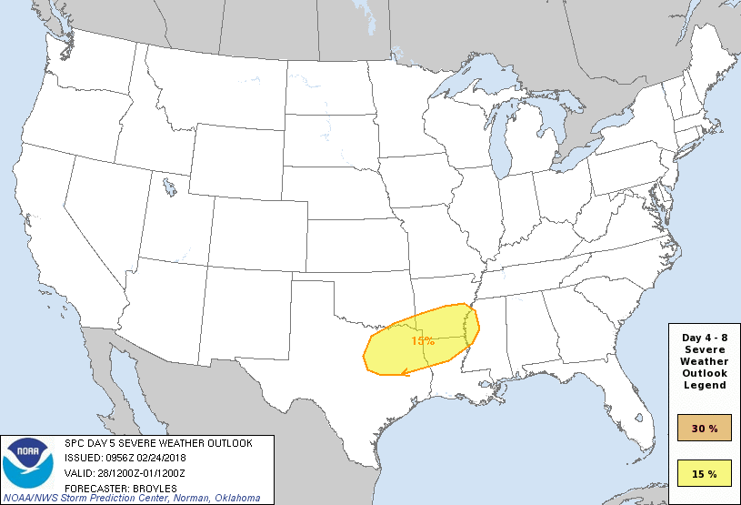
Tuesday should be dry for Central Alabama, but another short wave digs into the Four Corners Area on Tuesday and rapidly ejects northeastward on Wednesday. This brings the front back north as a warm front and introduces another chance for severe storms Wednesday into early Thursday with a surface low developing in Oklahoma and rapidly intensifying and moving to the vicinity of Chicago on Thursday morning. Hence another potential for severe storms in the Lower Mississippi River Valley on Day 5.
The rain moves out on Thursday as an upper ridge develops and moves across the Central US. Friday and Saturday should be dry with high temperatures around 60.
Look for some big changes once we head into voodoo country. The GFS is developing a deep trough once again along the East Coast of the US. This pattern is strangely suggestive of more chilly weather for the eastern half of the country, so I hope the coats have not been stored away just yet.
Beach Forecast: Click here to see the AlabamaWx Beach Forecast Center page.
WeatherBrains: Don’t forget you can listen to our weekly 90 minute netcast anytime on the web, or on iTunes. This is the show all about weather featuring many familiar voices, including our meteorologists here at ABC 33/40.
Be sure to check back often for updates on this weather situation. I expect to have the next Weather Xtreme Video posted here around 7 am Sunday. Be safe and Gosdpeed.
-Brian-
Category: Alabama's Weather, ALL POSTS, Weather Xtreme Videos
About the Author (Author Profile)
Brian Peters is one of the television meteorologists at ABC3340 in Birmingham and a retired NWS Warning Coordination Meteorologist. He handles the weekend Weather Xtreme Videos and forecast discussion and is the Webmaster for the popular WeatherBrains podcast.Subscribe
If you enjoyed this article, subscribe to receive more just like it.


