

Looking Wet into Monday
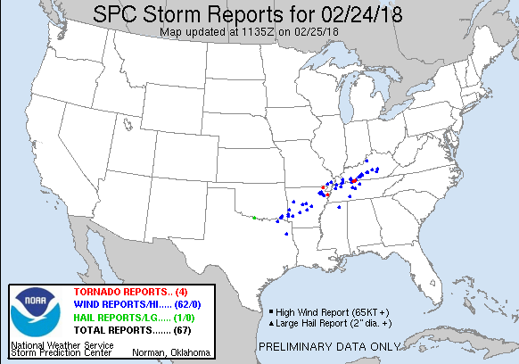
Unfortunately numerous severe storms along with flash flooding occurred over the Mid-South area last night with the storm reports from SPC indicating at least two fatalities, the first of 2018, I believe. Here’s the SPC storm report graphic as of about 5:30 am.
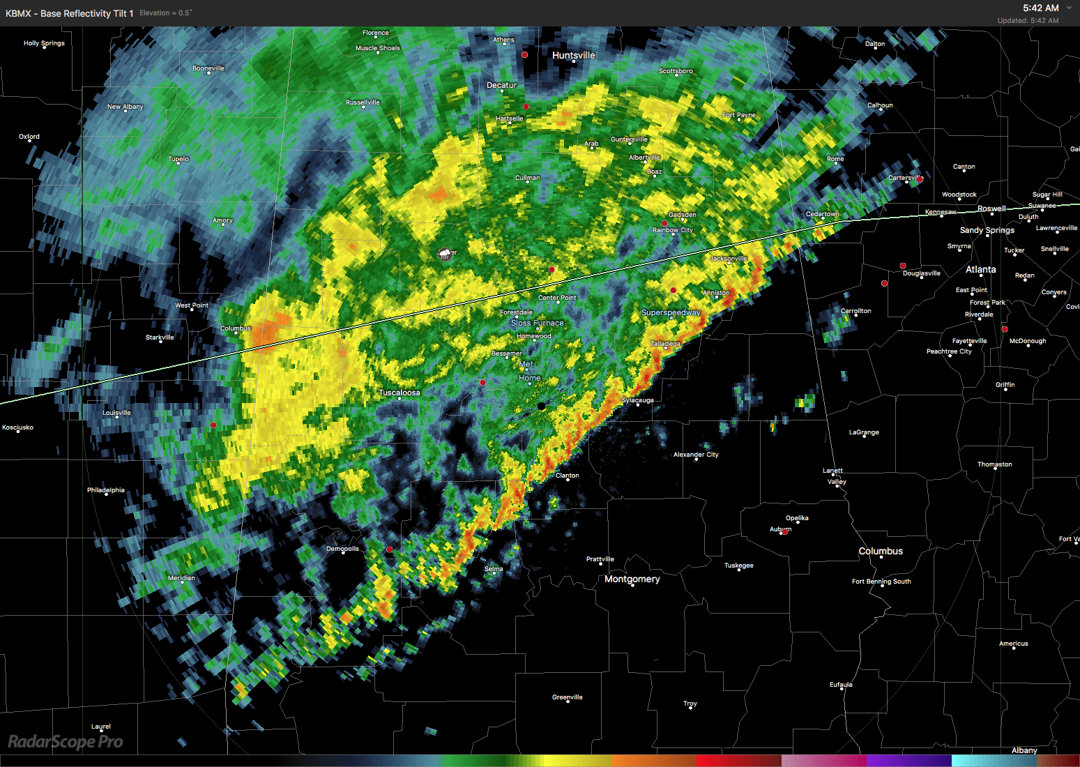
The radar image taken at 5:42 am showed the line of heavier showers had reached across much of Central Alabama stretching from just east of Jacksonville to south of Demopolis.
So it is going to remain pretty wet across Central Alabama for your Sunday with the temperatures likely to remain in the middle and upper 50s today. We will probably see a brief lull in the rain during the late morning into early afternoon hours. The reasons for all the rain is the front which had moved into Central Alabama which has become parallel to the upper flow which means it is not going to make much further progress southward. A strong trough over eastern New Mexico will move fairly quickly eastward tonight and early Monday, and this should be just the push we need to move the front and the rain out of Central Alabama by Monday afternoon.
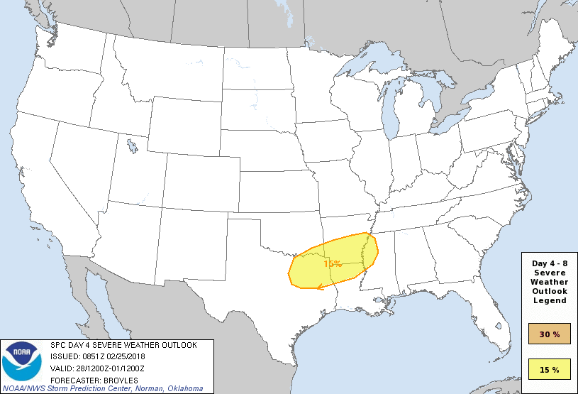
An strong upper ridge builds across the eastern half of the country on Tuesday, so we should be dry and reasonably mild with highs in the lower 70s. But the front which pushed through and out of the area on Monday comes back northward as a warm front late Tuesday and into early Wednesday morning. This spells another round of wet weather for us. It appears that the greatest threat for severe weather will remain west of Alabama with a marginal risk for severe storms over East Texas on Day 3 and moving a little eastward on Day 4.
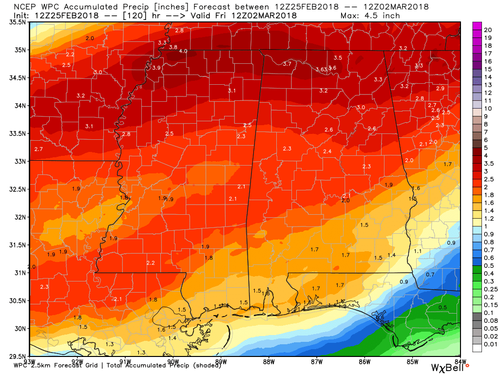
Rainfall for the Southeast US is going to be fairly heavy over the next five days through Friday morning with the rain today and Monday along with the Wednesday/Thursday event. Widespread 2 inch amounts are expected across the northern two-thirds of Alabama with amounts of 3 to 3.5 inches possible across the northern third of the state.
Another strong trough moves from eastern New Mexico on Wednesday across the Mississippi River Valley on Thursday which should bring an end to the rain and storms across Central Alabama by Thursday afternoon. Wednesday will be warm with highs in the lower half of the 70s turning cooler for Thursday with highs in the 60s.
The GFS builds in the upper ridge on Friday and maintains it across the eastern third of the country through Saturday and Sunday with high temperatures in the 60s.
Looking into voodoo country, the GFS is still advertising a pattern shift with the development of a deep trough across the eastern third of the US by Tuesday, March 6th. There will be some changes to the overall trough around the 9th of March as several strong ridges and troughs move through the overall flow. But the GFS holds onto the notion of an eastern US trough again by March 11th. The idea of this fairly deep trough suggests some chillier weather for the eastern US as we move into March.
Beach Forecast: Click here to see the AlabamaWx Beach Forecast Center page.
WeatherBrains: Don’t forget you can listen to our weekly 90 minute netcast anytime on the web, or on iTunes. This is the show all about weather featuring many familiar voices, including our meteorologists here at ABC 33/40.
Category: Alabama's Weather, ALL POSTS, Weather Xtreme Videos
About the Author (Author Profile)
Brian Peters is one of the television meteorologists at ABC3340 in Birmingham and a retired NWS Warning Coordination Meteorologist. He handles the weekend Weather Xtreme Videos and forecast discussion and is the Webmaster for the popular WeatherBrains podcast.Subscribe
If you enjoyed this article, subscribe to receive more just like it.


