

Wind Advisory In Effect For All Of Central Alabama From 11:00 AM Until 10:00 PM
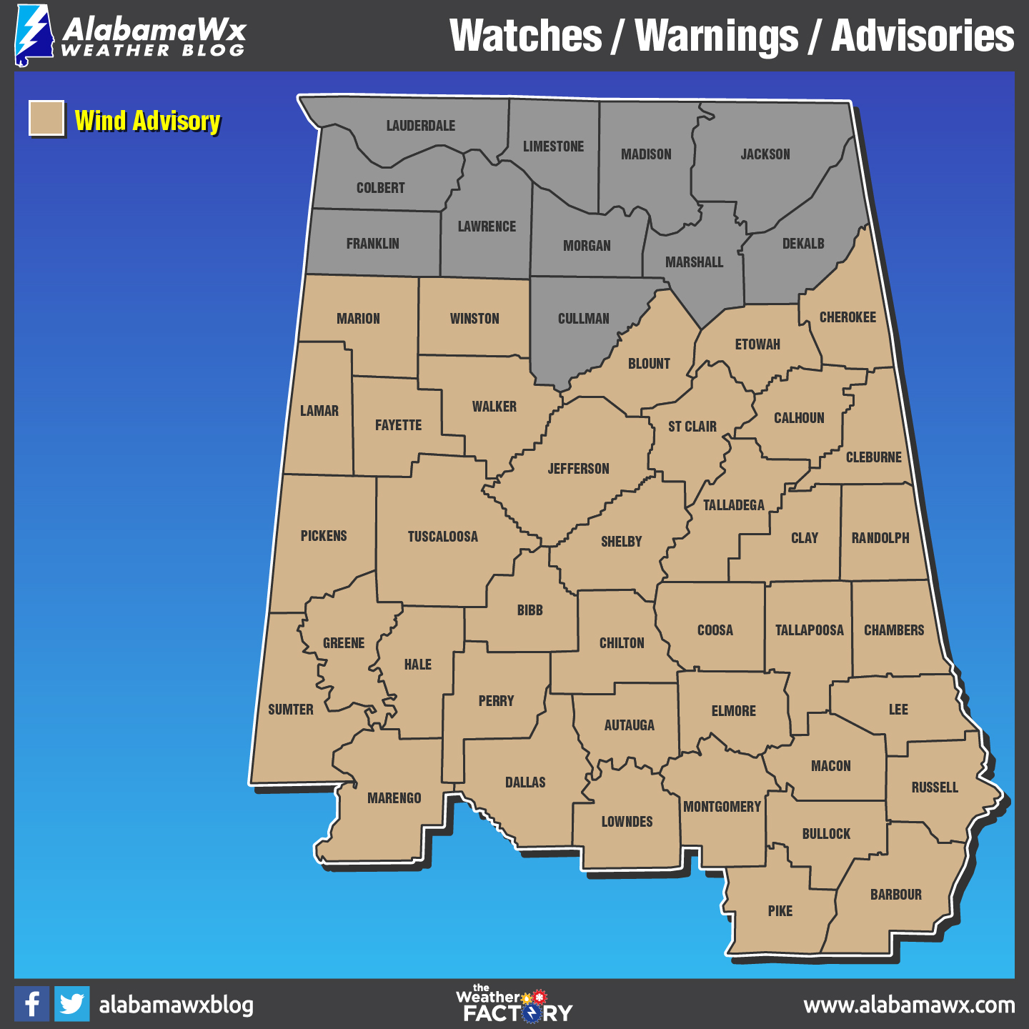
The National Weather Service in Birmingham has issued a Wind Advisory, which is in effect from 11:00 AM to 10:00 PM CDT this evening.
This advisory includes Autauga, Barbour, Bibb, Blount, Bullock, Calhoun, Chambers, Cherokee, Chilton, Clay, Cleburne, Coosa, Dallas, Elmore, Etowah, Fayette, Greene, Hale, Jefferson, Lamar, Lee, Lowndes, Macon, Marengo, Marion, Montgomery, Perry, Pickens, Pike, Randolph, Russell, Shelby, St. Clair, Sumter, Talladega, Tallapoosa, Tuscaloosa, Walker, and Winston counties.
Winds of 15 to 25 mph will be possible with gusts up to 35 mph at times.
Impacts of these strong winds could cause difficult driving, downed trees or larger limbs. Be especially cautious in areas where damage occurred on Monday as these winds could result in loose debris or damaged limbs to fall.
A Wind Advisory means that wind gusts of 35 mph are expected. Winds this strong can make driving difficult… especially for high profile vehicles. Use extra caution.
Category: Alabama's Weather, ALL POSTS
About the Author (Author Profile)
Scott Martin is an operational meteorologist, professional graphic artist, musician, husband, and father. Not only is Scott a member of the National Weather Association, but he is also the Central Alabama Chapter of the NWA president. Scott is also the co-founder of Racecast Weather, which provides forecasts for many racing series across the USA. He also supplies forecasts for the BassMaster Elite Series events including the BassMaster Classic.Subscribe
If you enjoyed this article, subscribe to receive more just like it.


