Severe weather update – 315 pm
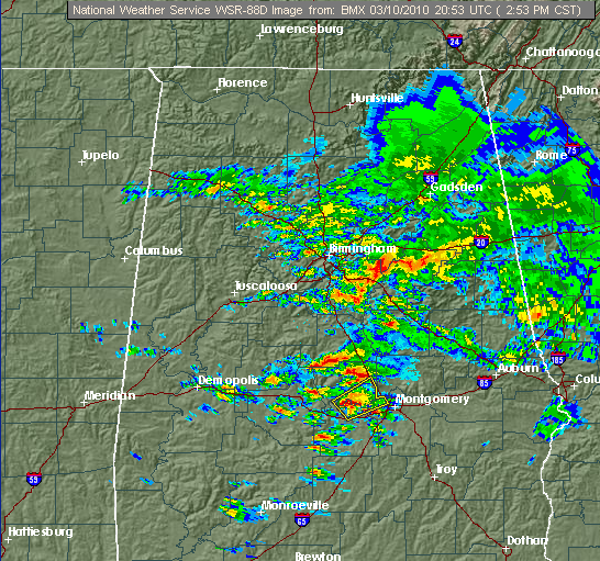
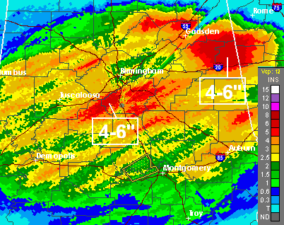
Thunderstorms continue to form in central and eastern Alabama, and radar shows that rainfall amounts since last night have been heavy. Flooding has been reported in numerous locations (see James’ post below), so be very careful driving home from work today. Lower your speed when driving in rain, and don’t drive across a road covered by water…it may be deeper than you think and can wash your car away if you cross it.
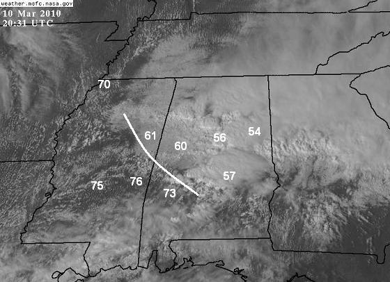
A tornado watch is in effect for parts of west Alabama, from Tuscaloosa to Montgomery and westward. On satellite, you can see the thunderstorms in central and east Alabama, with sunshine to the west. Temperatures are in the mid 70s in SW Alabama and most of Mississippi, where the sun has been out.
Severe thunderstorms are expected to develop in the warm, unstable air over MS and western AL anytime. The boundary between the warm and cold temperatures set up by the cloud cover and rain may cause a higher threat of storm rotation along it. It remains to be seen how quickly clouds will move out of central Alabama…if they wait until 5 pm, little sunshine will get through. Still, the warm air to the SW will move into west Alabama this evening, and isolated tornadoes are possible, especially given the boundary drawn in the satellite picture.
Category: Uncategorized


