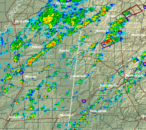
Severe weather analysis – 142 pm
SCROLL DOWN TO SEE LIVE PICTURE OF WALL CLOUD OVER TENNESSEE RIVER AT DECATUR
Very complex and difficult-to-forecast weather situation over Alabama this afternoon. A strong cold front is moving through MS, and out ahead of it sunshine has now pushed temperatures into the lower and mid 80s, with dewpoints near 70. A gravity wave moving SE apparently initiated the weak line of storms that is now east of BHM, and the storms we have been most concerned about today are in eastern MS and northern AL (dangerous storm near Moulton, may approach Decatur/Huntsville area if it holds together).
The storms out ahead of the front are the most dangerous because they are out by themselves, and can produce tornadoes more efficiently than the line of storms along the front that will come in later. One thing that may be holding storms back a little south of Cullman (BHM, TCL, ANB) is a “cap”, or weak temperature inversion at 750 mb (see BMX balloon data below).
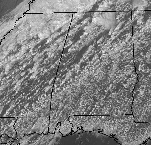
Some air parcels trying to rise and generate a thunderstorm will not be able to get through this warm inversion (they will be cooler than their surroundings and sink). However, if the sun keeps shining (satellite picture below shows it will), and with dewpoints being so high that condensation adds a lot of heat to rising air parcels, it may eventually get warm enough for more parcels to break through that cap over central Alabama, and once the cap breaks (if it does), any storms that form will become severe quickly. The wind shear is highest over north Alabama, so the highest tornado potential is there, but we can’t rule out a tornadic storm in central AL either.
Once the front comes in late afternoon/evening, the forcing due to the front will erode the cap through adiabatic cooling, but by then the tornado threat with any given storm will be lower.
Stay close to a source of weather information as this situation develops this afternoon, and have a plan for what you’ll do in the event of a tornado warning, at work, at home, in schools, wherever.
Category: Uncategorized


