Late Night Forecast Thoughts…
Everyone wants to know if we are going to have a monster snow Wednesday and Thursday. That idea has been on the table since it was a feature of a few GFS and European model runs this week. While the models have backed off from this solution over the past several runs, this has been the winter of the unexpected. We will actually deal with a minor winter threat tomorrow night with the main even coming Wednesday night and Thursday followed by some cold conditions for late in the week and the weekend. How cold? How much snow? Let’s see what we can tell…
TONIGHT/MONDAY: Clouds will thicken this evening and a few showers may arrive by midnight. Dewpoints are in the upper 20s already, so cooling by evaporation will not be a problem tonight. Temperatures will drop into the lower 40s before skies cloud over, and this should keep the precipitation liquid through much of the overnight hours. The approaching disturbance will cool the mid levels of the atmosphere, setting the stage for the precipitation to mix with or briefly change over to snow by late in the day Monday. In any case, temperatures will be in the lower and middle 40s on Monday, preventing any accumulation issues. A brisk westerly wind will kick in by afternoon. As skies start to clear Monday night, lows will fall back into the upper 20s.
WEDNESDAY NIGHT
Precipitation is expected to begin before midnight across North and Central Alabama Wednesday night. It looks like it will be snow over the north, with a rain/snow mix over Central Alabama. Rain will likely change to or be all snow all the way down to the I-20 corridor Wednesday night. Lows will drop to near freezing in the I-20 corridor, with colder readings to the north and warmer conditions to the south. Thursday will feature colder conditions
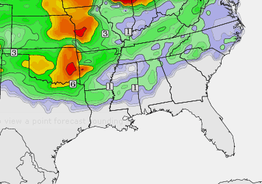
ACCUMULATIONS: It’s still too early to try to be specific about snow accumulations for Wednesday night and Thursday. Recent model runs have not shown the signs of a huge accumulating snow, with the best moisture south of the colder temperature profiles. But the idea of there being a few hours of light snow in areas north of I-20 is a good possibility. This is what the accumulated snow chart looks like from the evening GFS run. This looks like a very plausible solution to me.
TURN TO COLDER: Thursday will feature colder conditions with a brisk northwesterly wind and temperatures rising only a few degrees at best into the middle 30s. Indeed, temperatures may remain steady during the morning hours before falling by afternoon. Lows will be in the teens by Friday morning, and should remain in the 30s during the day. Saturday will be slightly warmer. Sunday looks a lot like Saturday.
Category: Alabama's Weather, Winter Weather


