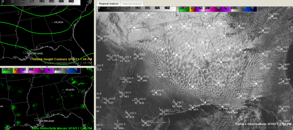
Clouds Hang Tough
Clouds have been hanging tough across Alabama on this Sunday. If you look at a visible satellite image across the state, you might think you are looking down at a cauliflower patch. The stratocumulus clouds are really thick, thanks to colder air aloft flowing in on northwesterly winds, making the airmass slightly unstable. No unstable enough for showers, but not far from it. It appears that the clouds will be slow to break up, meaning mostly cloudy conditions for the rest of the afternoon. A few peeks of sun will try to work in from the west as the strong spring sun tries to eat at the cloud deck. But any heating tends to just add to the weak instability and clouds will fill back in.
The clouds are limiting temperatures across the area. Readings had barely made it into the 60s by lunchtime, and that is where they will stay for the remainder of the afternoon. In fact, the 1 p.m. reading at Birmingham fell back to 59F.
TONIGHT THROUGH MONDAY: A strong upper level disturbance will wheel around the big upper low to our north. This disturbance will possibly bring some light rain to Alabama overnight, and we definitely could see a few patches of light rain tomorrow, especially during the morning. Overnight lows will drop into the upper 40s. Skies will begin to clear during the afternoon. Areas that see sun earlier may see readings in the 60s, cloudier spots could be relegated to the 50s.
Category: Alabama's Weather


