Big Rain Event Ahead
**No afternoon Weather Xtreme Video today… having to make up school visits cancelled Monday + extra duties eating into the production schedule again today**
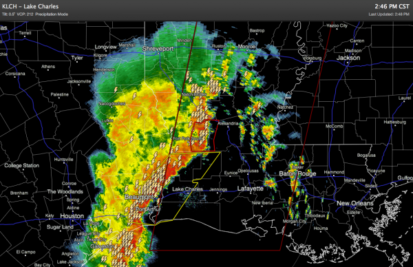
HERE IT COMES AGAIN: While today has been a delightful spring-like day for Alabama, we watch with interest the big mass of rain and storms to the west…
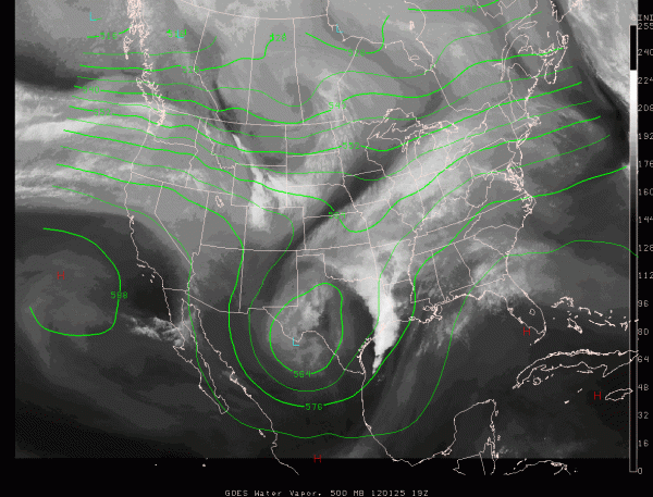
Below is a look at the big upper low over West Texas responsible for the foul weather…
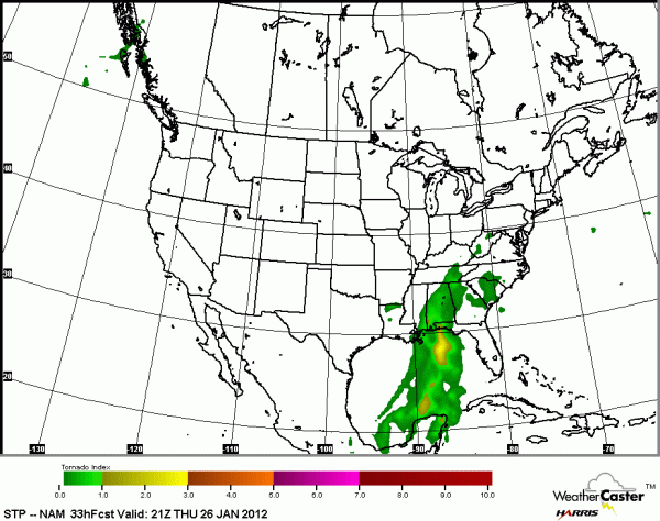
Rain and storms will become widespread across Alabama tomorrow as the upper low approaches. Not much change in the overall thinking… below is the forecast STP from the NAM at 3:00 p.m. tomorrow…
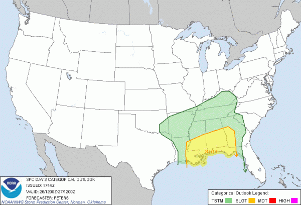
And, the day two convective outlook from SPC…
No doubt the best chance of severe weather in Alabama will across the southern half of the state, and even there it is a somewhat marginal threat. The best instability will be pretty close to the Gulf Coast; a tornado or two is certainly possible over South Alabama, but the main threat seems to be from damaging straight line winds along a squall line that should form tomorrow night.
For the northern counties of Alabama, we always have to watch the radar closely with systems like this; you know the deal… when it comes to thunderstorms, expect the unexpected. But, the severe weather risk looks pretty minimal for places like Birmingham Tuscaloosa, Anniston, and Gadsden. The potential issue will be heavy rain and the threat of flooding. The NWS in Huntsville has a flash flood watch in place for their county warning area (the Tennessee Valley). The heaviest and most widespread rain will come from noon to midnight.
HOW MUCH RAIN: The 12Z NAM is printing 1.44″ for Birmingham… while the GFS is drier with 0.76″. If rain amounts stay under two inches, that should prevent major flash flooding issues. We will forecast rain amounts of 1 to 2 inches, with isolated amounts to 3 inches over the Tennessee Valley.
FRIDAY AND THE WEEKEND: Getting much better model agreement now. The rain ends late tomorrow night, and the sky becomes mostly sunny on Friday. The weather will be cooler with a high between 57 and 60 degrees. The weekend looks cool and dry; the high Saturday will be around 60, but Sunday will be cooler with a high in the mid 50s. Lows will get down into the mid 30s early Sunday, and by daybreak Monday we should be at or below freezing.
NEXT WEEK AND BEYOND: For now much of next week looks rather benign; a weak system could bring a few showers by Wednesday or Thursday, but model agreement is not good. See the morning Weather Xtreme video for more details and long range ideas.
WEATHER BRAINS: Don’t forget you can listen to our weekly 90 minute netcast anytime on the web, or on iTunes. This is the show all about weather featuring many familiar voices, including our meteorologists here at ABC 33/40.
CONNECT: You can find me on all of the major social networks…
I had a great time today visiting the kids at Kingwood Christian in Alabaster, and Bluff Park Elementary in Hoover… be looking for them on the Pepsi KIDCAM at 5:00 and 6:00 on ABC 33/40 News! The next Weather Xtreme video will be posted by 7:00 a.m. tomorrow…
Category: Alabama's Weather


